ISS063-E-51537
| NASA Photo ID | ISS063-E-51537 |
| Focal Length | 28mm |
| Date taken | 2020.07.20 |
| Time taken | 15:07:42 GMT |
Resolutions offered for this image:
5011 x 3341 pixels 720 x 480 pixels 5568 x 3712 pixels 640 x 427 pixels
5011 x 3341 pixels 720 x 480 pixels 5568 x 3712 pixels 640 x 427 pixels
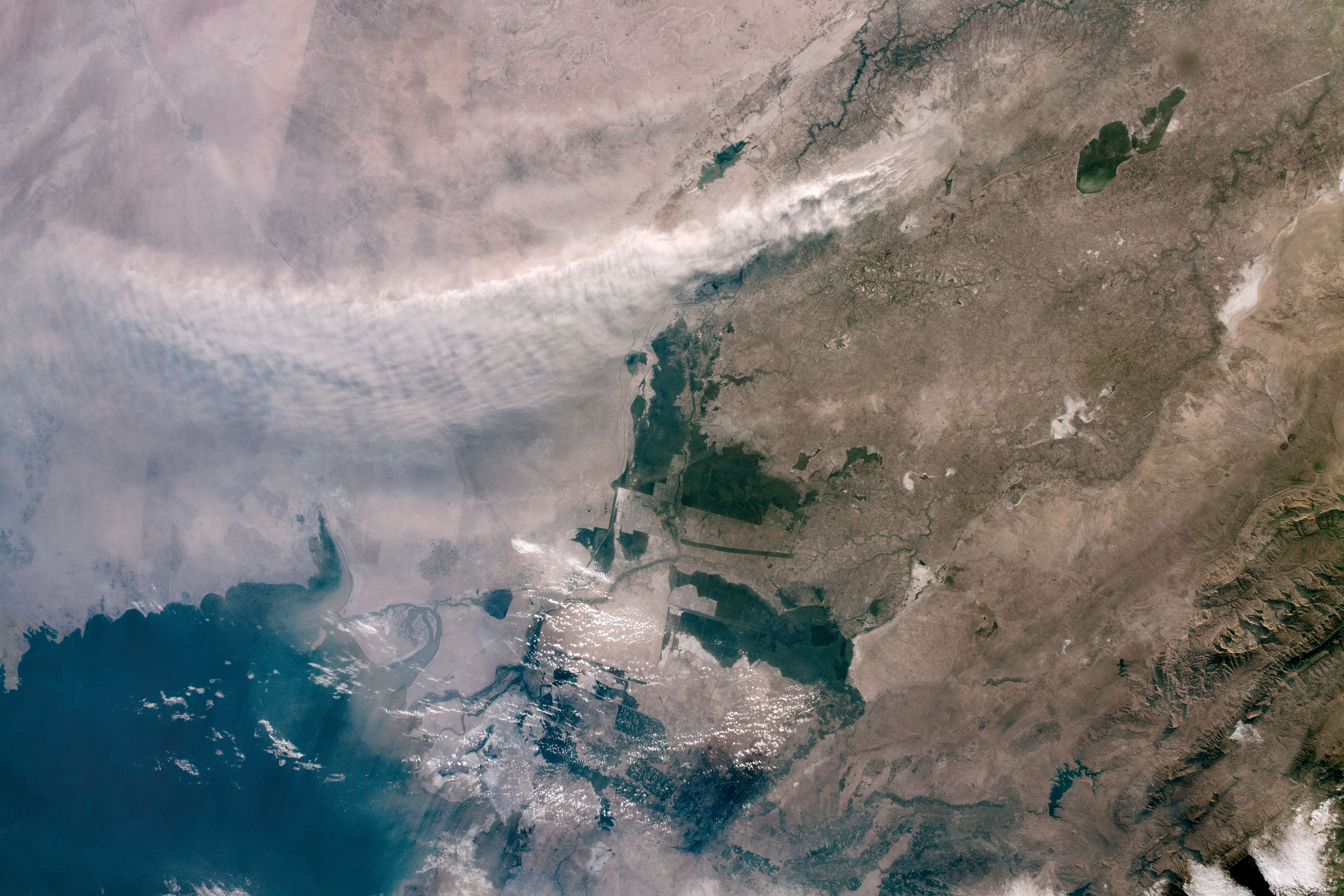
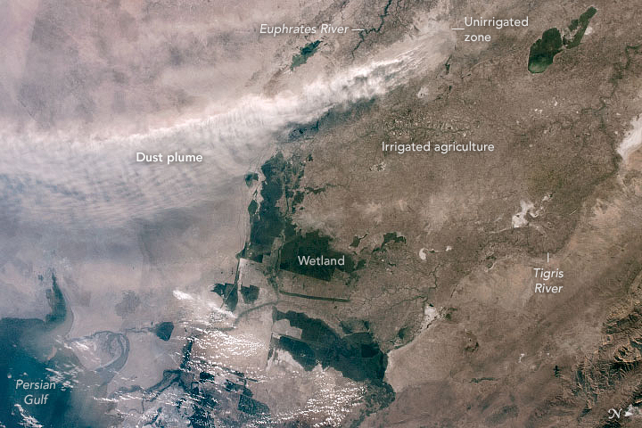
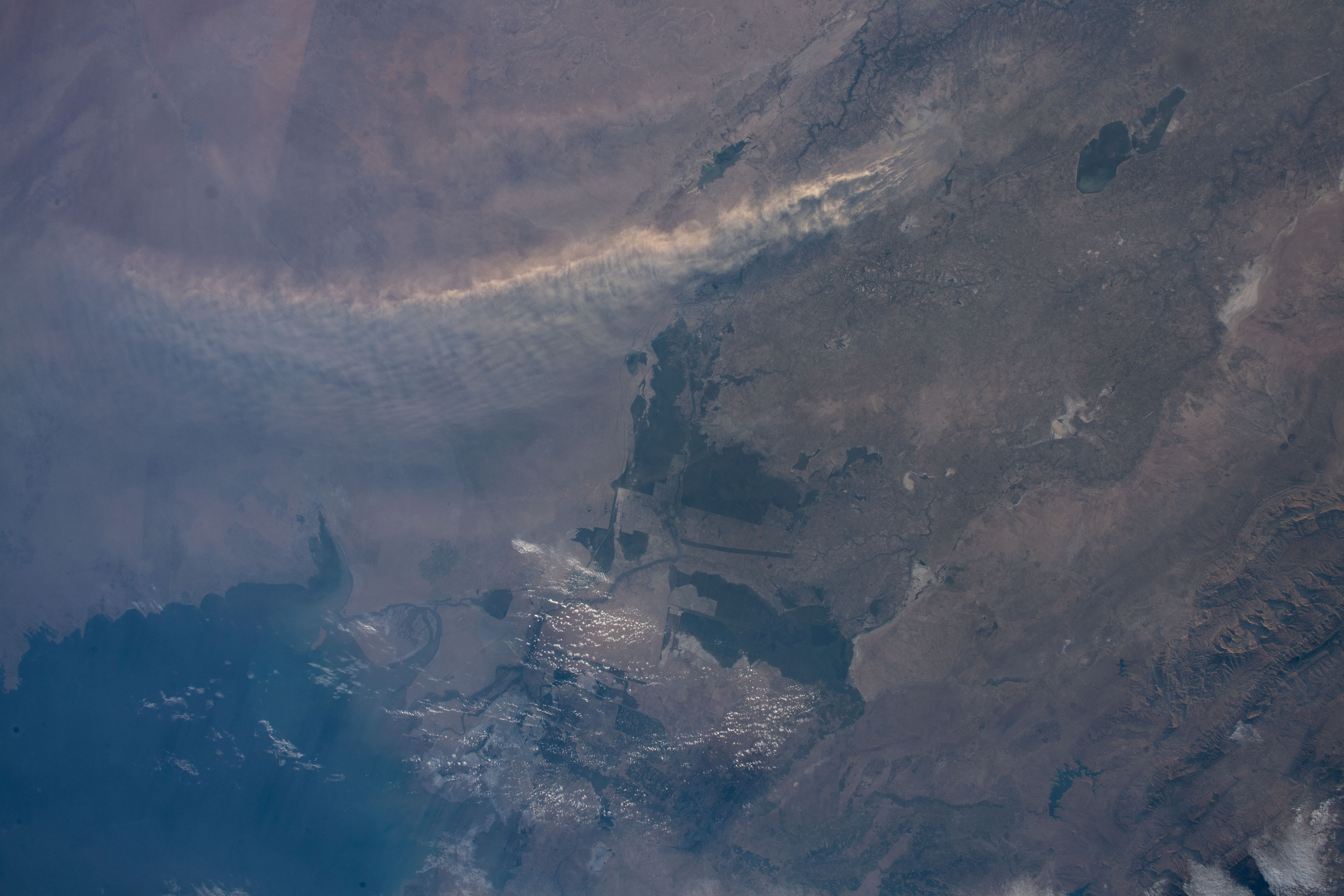


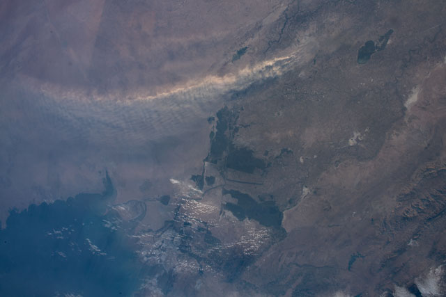
Spacecraft nadir point: 28.5° N, 42.5° E
Photo center point:
Photo center point by machine learning:
Photo center point:
Photo center point by machine learning:
Nadir to Photo Center:
Spacecraft Altitude: 224 nautical miles (415km)
Country or Geographic Name: | |
Features: | |
| Features Found Using Machine Learning: | |
Cloud Cover Percentage: | 2 (1-10)% |
Sun Elevation Angle: | 11° |
Sun Azimuth: | 287° |
Camera: | NIKON D5 S/N: 3502550 |
Focal Length: | 28mm |
Camera Tilt: | |
Format: | |
Film Exposure: | |
| Additional Information | |
| Width | Height | Annotated | Cropped | Purpose | Links |
|---|---|---|---|---|---|
| 5011 pixels | 3341 pixels | No | No | NASA's Earth Observatory web site | Download Image |
| 720 pixels | 480 pixels | Yes | Yes | NASA's Earth Observatory web site | Download Image |
| 5568 pixels | 3712 pixels | No | No | Download Image | |
| 640 pixels | 427 pixels | No | No | Download Image |
Download Packaged File
Download a Google Earth KML for this Image
View photo footprint information
Download a GeoTIFF for this photo
Image Caption: none
