ISS062-E-39375
| NASA Photo ID | ISS062-E-39375 |
| Focal Length | 400mm |
| Date taken | 2020.02.19 |
| Time taken | 13:13:10 GMT |
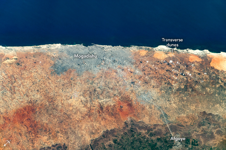
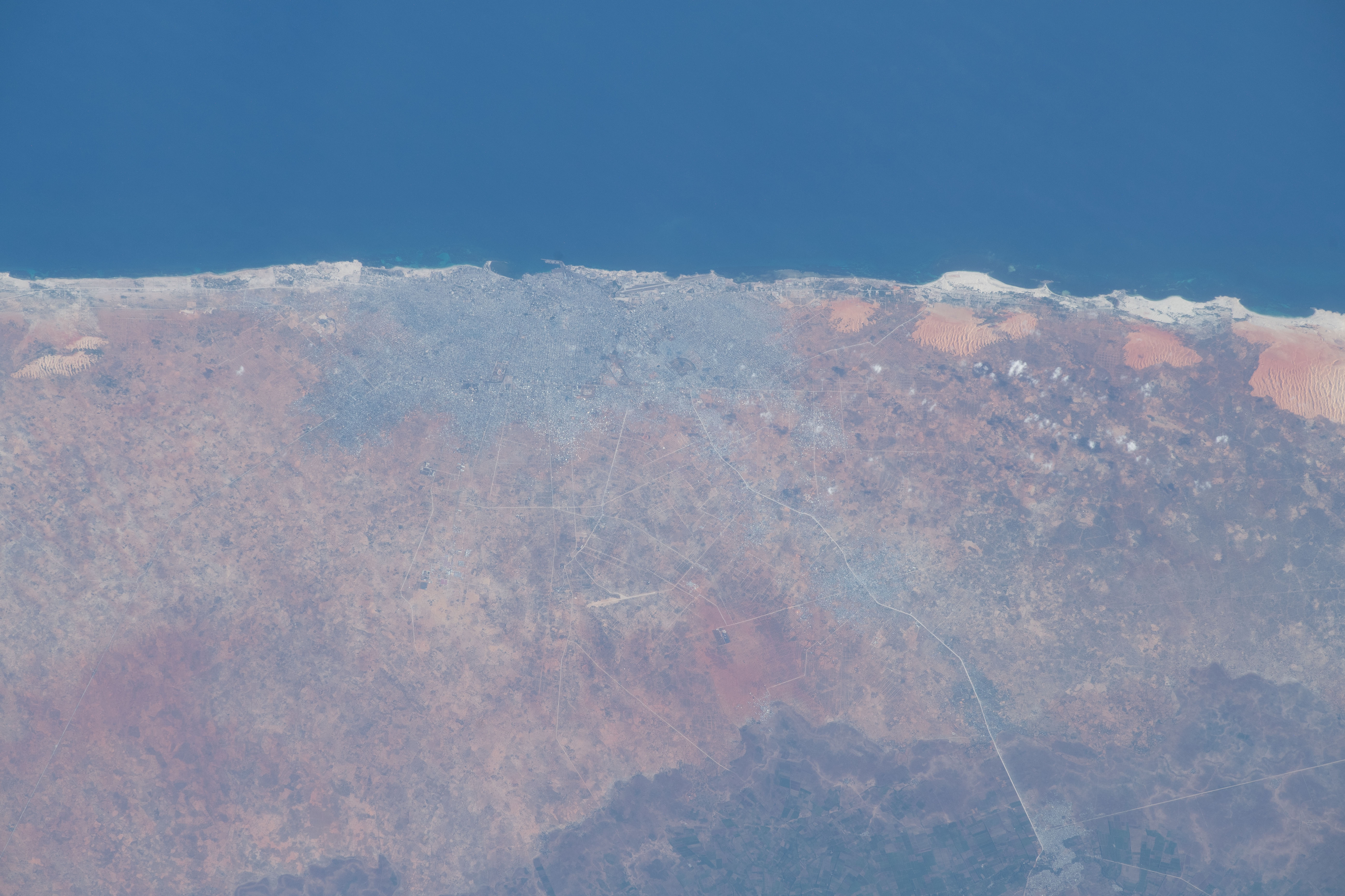

Photo center point: 2.1° N, 45.3° E
Photo center point by machine learning: 2.07° N, 45.28° E

Country or Geographic Name: | SOMALIA |
Features: | MOGADISHU |
| Features Found Using Machine Learning: | |
Cloud Cover Percentage: | 10 (1-10)% |
Sun Elevation Angle: | 30° |
Sun Azimuth: | 253° |
Camera: | Nikon D5 Electronic Still Camera |
Focal Length: | 400mm |
Camera Tilt: | 51 degrees |
Format: | 5568E: 5568 x 3712 pixel CMOS sensor, 35.9 x 23.9 mm, total pixels: 21.33 million, Nikon FX format |
Film Exposure: | |
| Additional Information | |
| Width | Height | Annotated | Cropped | Purpose | Links |
|---|---|---|---|---|---|
| 720 pixels | 480 pixels | Yes | Yes | NASA's Earth Observatory web site | Download Image |
| 5568 pixels | 3712 pixels | No | No | Download Image | |
| 640 pixels | 427 pixels | No | No | Download Image |
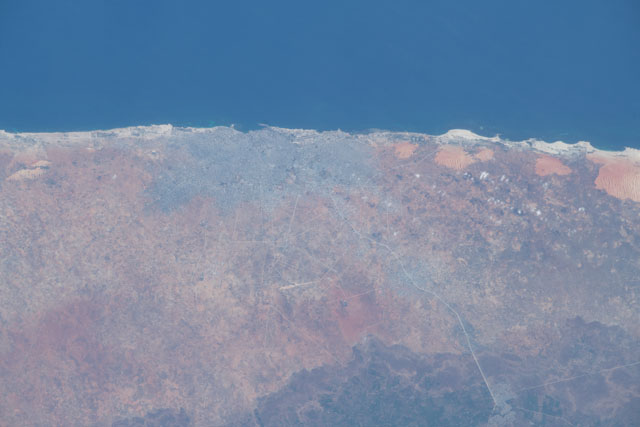
As the International Space Station (ISS) was passing over the Horn of Africa, an astronaut shot this photograph of Somalia's capital city, Mogadishu. This historic port on the coast of the Indian Ocean is home to more than 2 million people.
Just inland from the coast, sand dunes flank the urban area. Prevailing winds from the east-northeast shape the dunes into ridges perpendicular to the wind direction. Geologists call these "transverse dunes." The red and orange colors in the dune fields are due to natural chemical and weathering processes (//www.dst.uniroma1.it/geologicaromana/Volumi/VOL%2031/GR_31_249_263_Angelucci%20et%20al.pdf) that left behind traces of iron in the sandy minerals. These dunes stand in contrast to the lightly-colored, calcium carbonate-rich sands near the shore.
Further inland, rectangular agricultural fields are visible near the town of Afgoye. A small segment of the vital Shebelle River is visible running through the farmland and town. The Shebelle starts in Ethiopia's highlands and trends south towards the Jubba River (far outside this photo to the right).
