ISS062-E-112947

| NASA Photo ID | ISS062-E-112947 |
| Focal Length | 16mm |
| Date taken | 2020.03.23 |
| Time taken | 22:30:19 GMT |
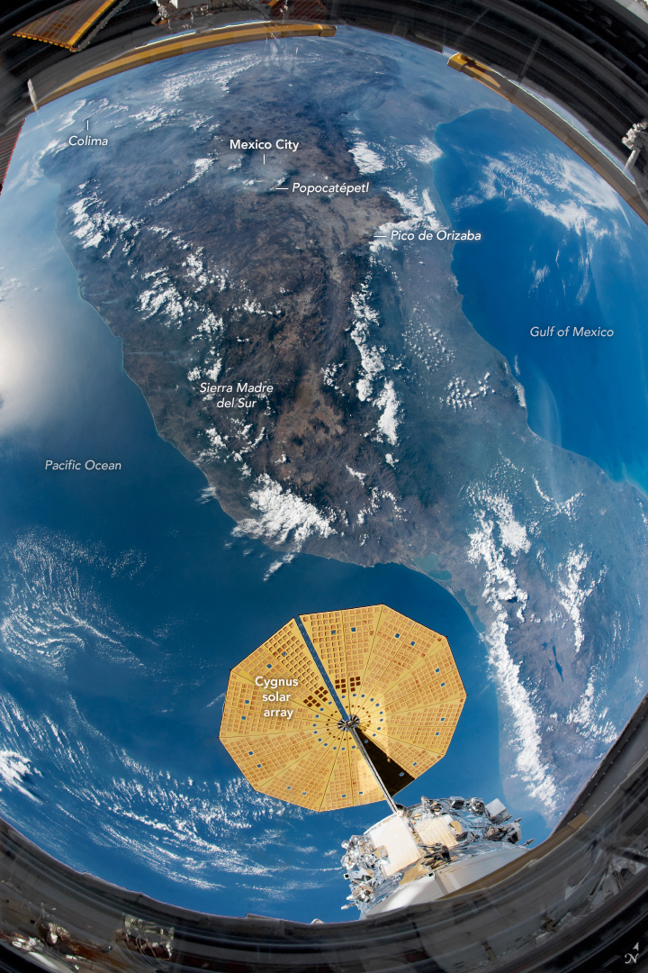
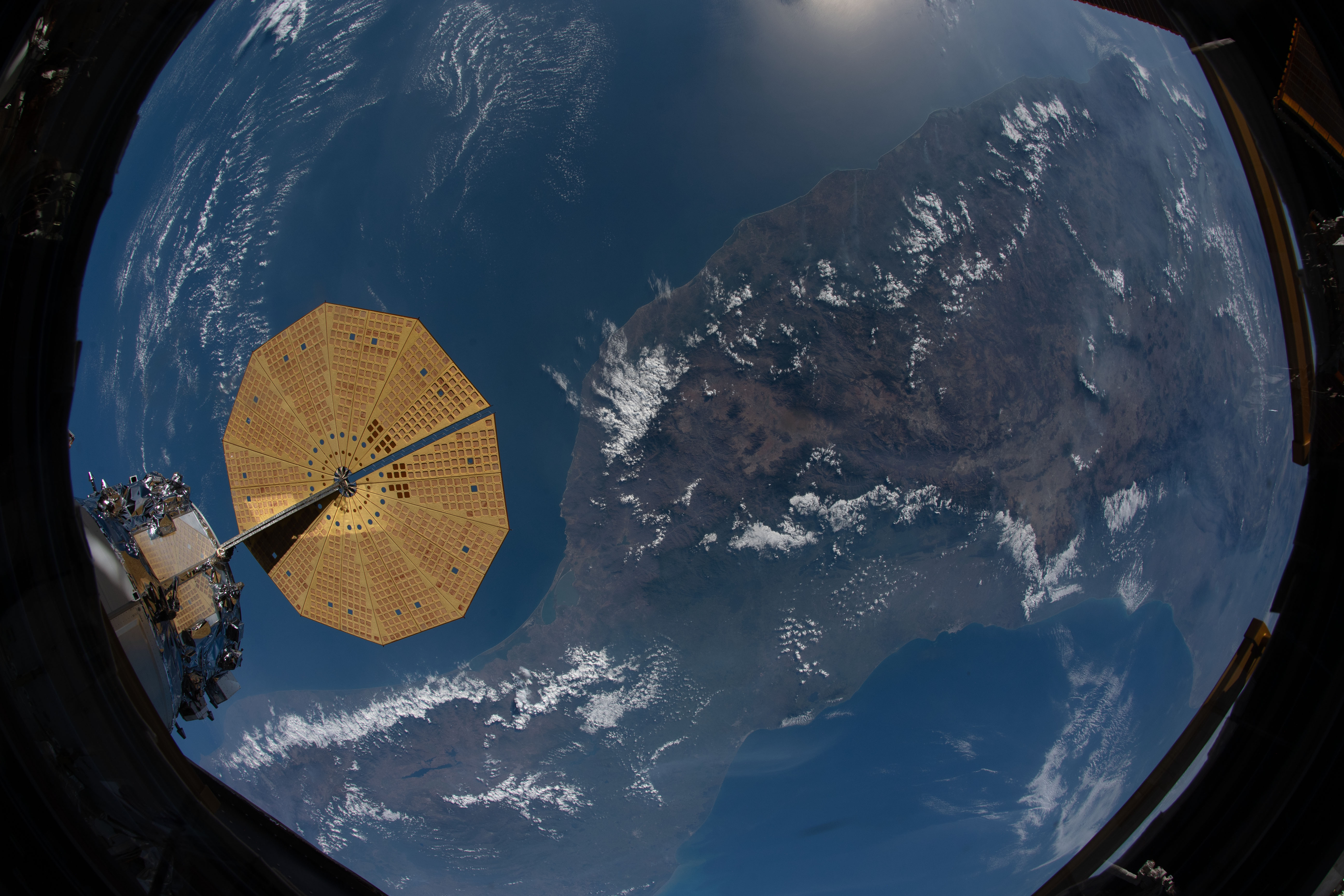
Photo center point: 16.5° N, 96.5° W
Photo center point by machine learning:
Country or Geographic Name: | MEXICO |
Features: | COLIMA VOLCANO, MEXICO CITY, POPOCATEPETL VOLCANO, PICO DE ORIZABA VOLCANO, SIERRA MADRE DEL SUR, GULF OF MEXICO, PACIFIC OCEAN |
| Features Found Using Machine Learning: | PAN- |
Cloud Cover Percentage: | 25 (11-25)% |
Sun Elevation Angle: | 33° |
Sun Azimuth: | 264° |
Camera: | Nikon D5 Electronic Still Camera |
Focal Length: | 16mm |
Camera Tilt: | High Oblique |
Format: | 5568E: 5568 x 3712 pixel CMOS sensor, 35.9 x 23.9 mm, total pixels: 21.33 million, Nikon FX format |
Film Exposure: | |
| Additional Information | |
| Width | Height | Annotated | Cropped | Purpose | Links |
|---|---|---|---|---|---|
| 720 pixels | 1080 pixels | Yes | No | NASA's Earth Observatory web site | Download Image |
| 5568 pixels | 3712 pixels | No | No | Download Image | |
| 640 pixels | 427 pixels | No | No | Download Image |
An astronaut onboard the International Space Station (ISS) took this photograph using a short camera lens, capturing almost all of Mexico in one shot. The wide field of view is framed by the center window of the ISS Cupola module and includes a solar array of the Northrop Grumman Cygnus cargo spacecraft.
This view encompasses most of Mexico's mountain ranges and long coastlines, though details like individual cities and volcanoes are not readily distinguishable. Active volcanoes like Popocatepetl, Colima, and Pico de Orizaba are nestled throughout the Sierra Madre del Sur mountains. Mexico City, which is regularly rattled by earthquakes, sits at the foot of Popocatepetl.
Different climate zones are broadly visible in the image. On the southern coast facing the Gulf of Mexico, the climate is tropical and wet. Forests and coastal plains appear with a slight green tone. Looking inland, clouds tend to form around the mountains and often shroud tall volcanic peaks. The lighter toned tan-brown terrain of the interior is mostly desert country that stretches north across the U.S.-Mexico border.
