ISS062-E-102588
| NASA Photo ID | ISS062-E-102588 |
| Focal Length | 200mm |
| Date taken | 2020.03.18 |
| Time taken | 20:24:12 GMT |
3936 x 2669 pixels 720 x 480 pixels 5568 x 3712 pixels 640 x 427 pixels
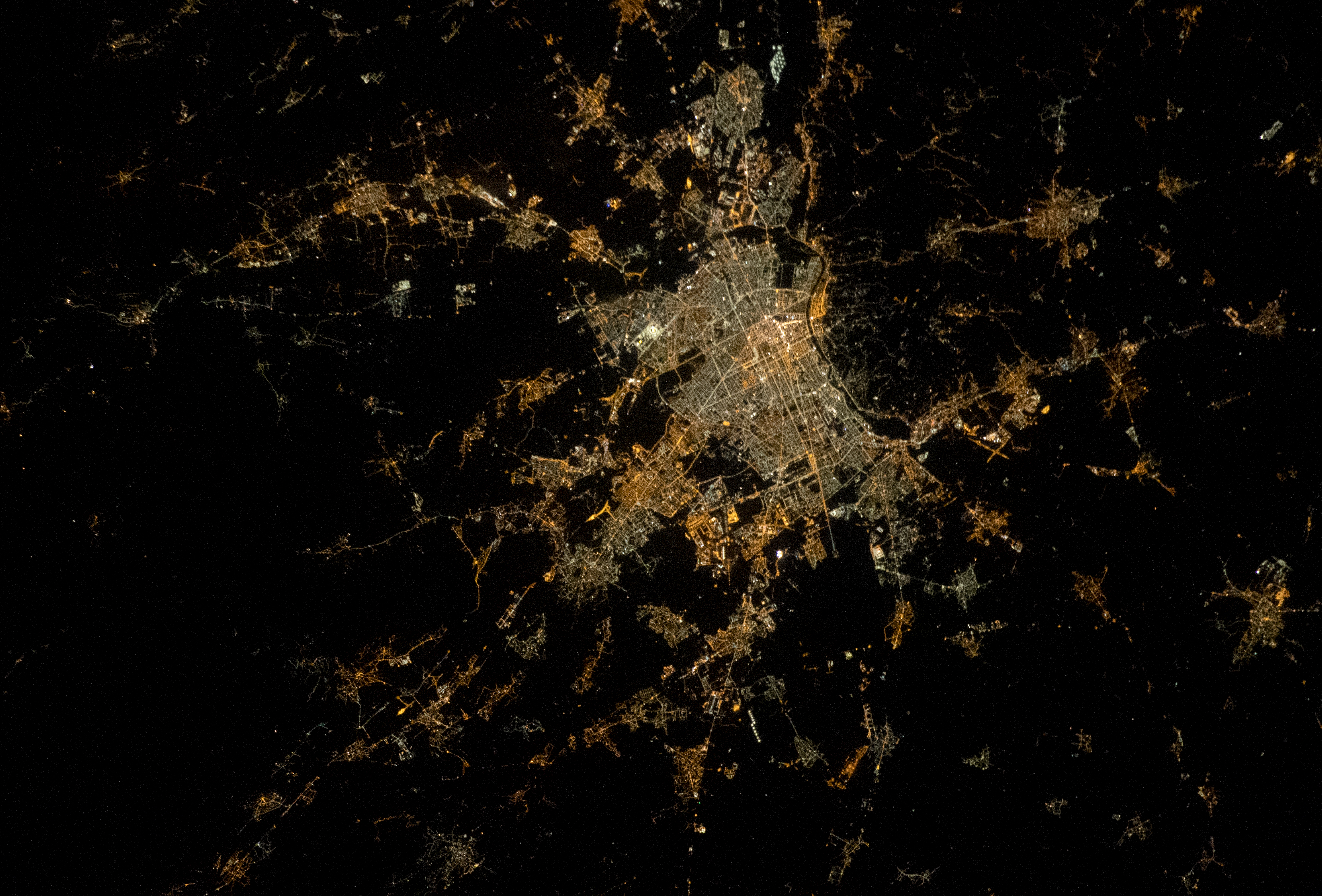
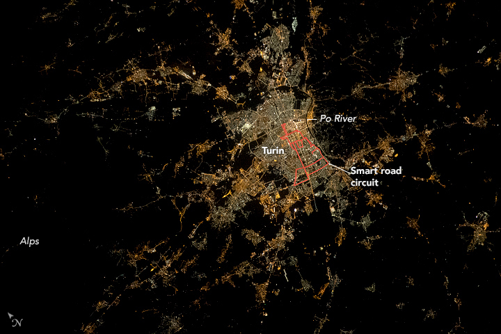

Photo center point: 45.2° N, 7.6° E
Photo center point by machine learning: 45.21° N, 7.58° E

Country or Geographic Name: | ITALY |
Features: | TURIN |
| Features Found Using Machine Learning: | |
Cloud Cover Percentage: | 10 (1-10)% |
Sun Elevation Angle: | -28° |
Sun Azimuth: | 303° |
Camera: | Nikon D5 Electronic Still Camera |
Focal Length: | 200mm |
Camera Tilt: | 15 degrees |
Format: | 5568E: 5568 x 3712 pixel CMOS sensor, 35.9 x 23.9 mm, total pixels: 21.33 million, Nikon FX format |
Film Exposure: | |
| Additional Information | |
| Width | Height | Annotated | Cropped | Purpose | Links |
|---|---|---|---|---|---|
| 3936 pixels | 2669 pixels | No | Yes | NASA's Earth Observatory web site | Download Image |
| 720 pixels | 480 pixels | Yes | Yes | Download Image | |
| 5568 pixels | 3712 pixels | No | No | Download Image | |
| 640 pixels | 427 pixels | No | No | Download Image |
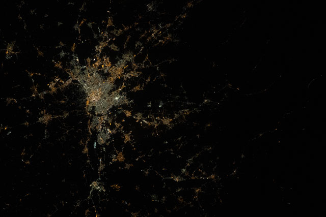
An astronaut onboard the International Space Station (ISS) took this nighttime photograph of the city of Turin in northwestern Italy, home to many Italian car companies and automotive manufacturing plants. Through Italy's 2018 Smart Road Decree, Turin was chosen as a test site for autonomous driving vehicles. The smart road circuit map for self-driving cars has been traced onto the photo below (resolution approximately 15 meters per pixel) using image editing software and GIS techniques.
Astronaut photographs of cities at night can be clear enough to discern specific features like roads and buildings, as well as dark spaces such as farmland, bodies of water, and mountains. Strings of lights trace the roads that connect Turin's city center to the mountain valleys of the Italian Alps. Small pockets of light indicate the presence of towns. An outline of the Po River follows the eastern border of Turin as it begins its route from the Alps toward Italy's agricultural heartland.

