ISS062-E-44966

| NASA Photo ID | ISS062-E-44966 |
| Focal Length | 50mm |
| Date taken | 2020.02.21 |
| Time taken | 17:34:08 GMT |
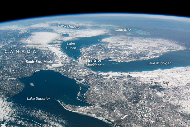
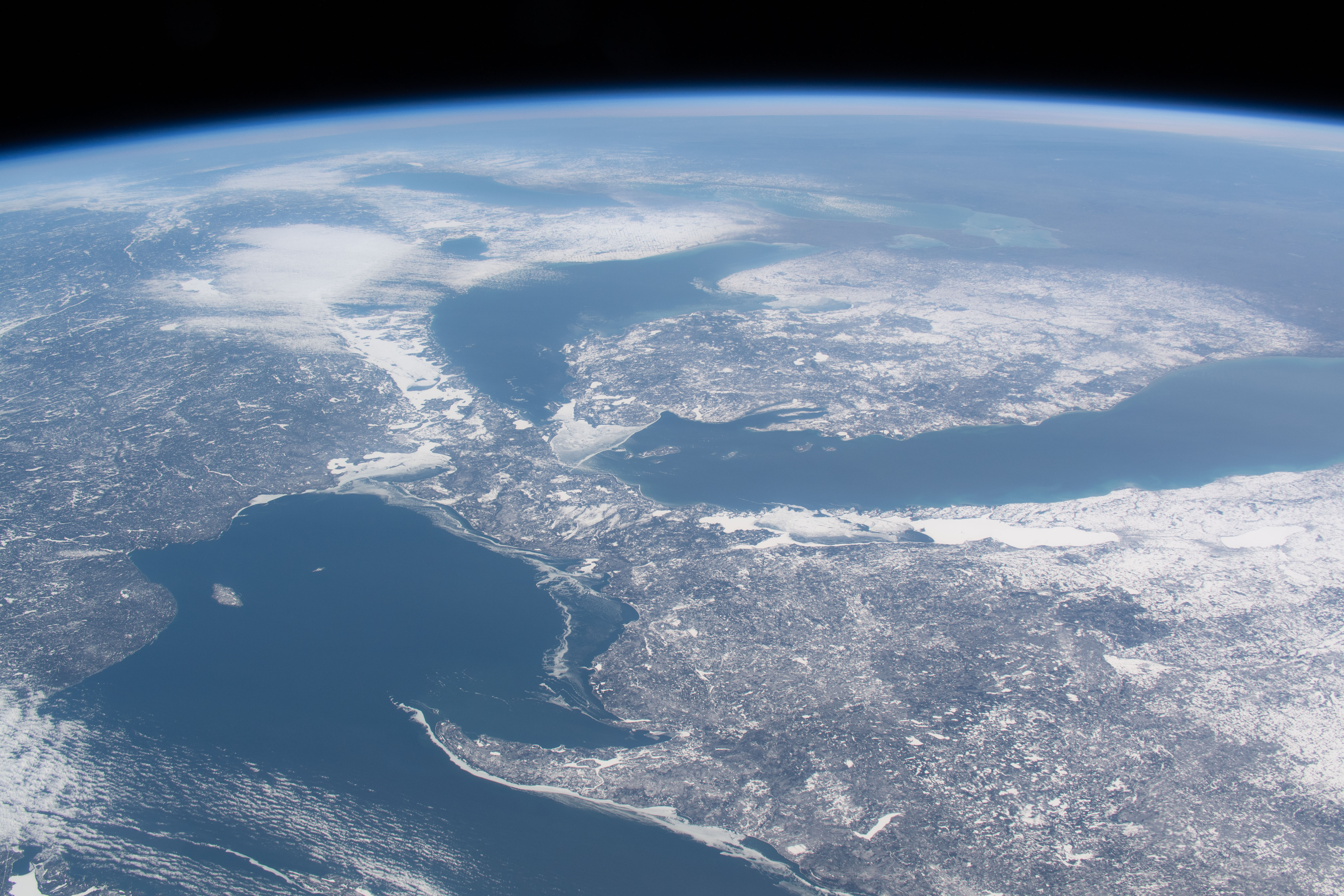

Photo center point: 45.5° N, 85.0° W
Photo center point by machine learning:
Country or Geographic Name: | USA-MICHIGAN |
Features: | GREAT LAKES, CANADA, LAKE SUPERIOR, LAKE HURON, LAKE ERIE, LAKE ONTARIO, KEWEENAW PENINSULA, STRAITS OF MACKINAC, GREEN BAY, SAULT STE. MARIE |
| Features Found Using Machine Learning: | PAN- |
Cloud Cover Percentage: | 10 (1-10)% |
Sun Elevation Angle: | 28° |
Sun Azimuth: | 161° |
Camera: | Nikon D5 Electronic Still Camera |
Focal Length: | 50mm |
Camera Tilt: | High Oblique |
Format: | 5568E: 5568 x 3712 pixel CMOS sensor, 35.9 x 23.9 mm, total pixels: 21.33 million, Nikon FX format |
Film Exposure: | |
| Additional Information | |
| Width | Height | Annotated | Cropped | Purpose | Links |
|---|---|---|---|---|---|
| 720 pixels | 480 pixels | Yes | No | NASA's Earth Observatory web site | Download Image |
| 5568 pixels | 3712 pixels | No | No | Download Image | |
| 640 pixels | 427 pixels | No | No | Download Image |
An astronaut aboard the International Space Station (ISS) took this oblique photograph of the Great Lakes in late winter. The international border between Canada and the United States snakes down the middle of lakes Superior, Huron, Erie, and Ontario. The spike of land jutting into Lake Superior is the Keweenaw Peninsula, the northern tip of Michigan's Upper Peninsula (which you can also see here).
From late February to early March in most years, the winter cold freezes much of the surface area of the lakes. However, almost no ice is visible on any of the lakes in this view from February 21, 2020, except for a small accumulation around the Straits of Mackinac. The 22 percent ice cover at that point was significantly lower than the long-term average of 55 percent, and one of the lowest percentages on record.
Small towns are difficult to see under snow, but you can make out Green Bay, Wisconsin, and Sault Ste. Marie, Ontario. Lake-effect snow appears "downwind" of Lake Michigan (on the lower peninsula of Michigan) and downwind of Lake Huron in Ontario.
