ISS061-E-6914
| NASA Photo ID | ISS061-E-6914 |
| Focal Length | 240mm |
| Date taken | 2019.10.18 |
| Time taken | 04:57:21 GMT |
720 x 480 pixels 720 x 480 pixels 720 x 480 pixels 5568 x 3712 pixels 640 x 427 pixels

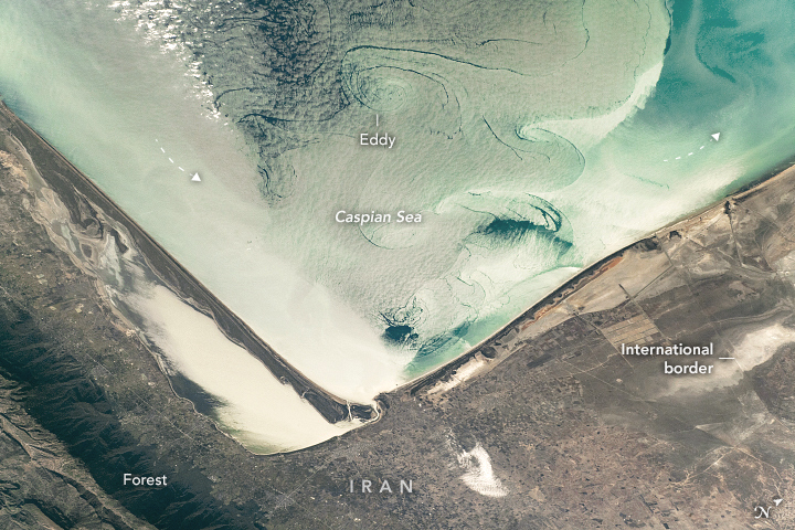

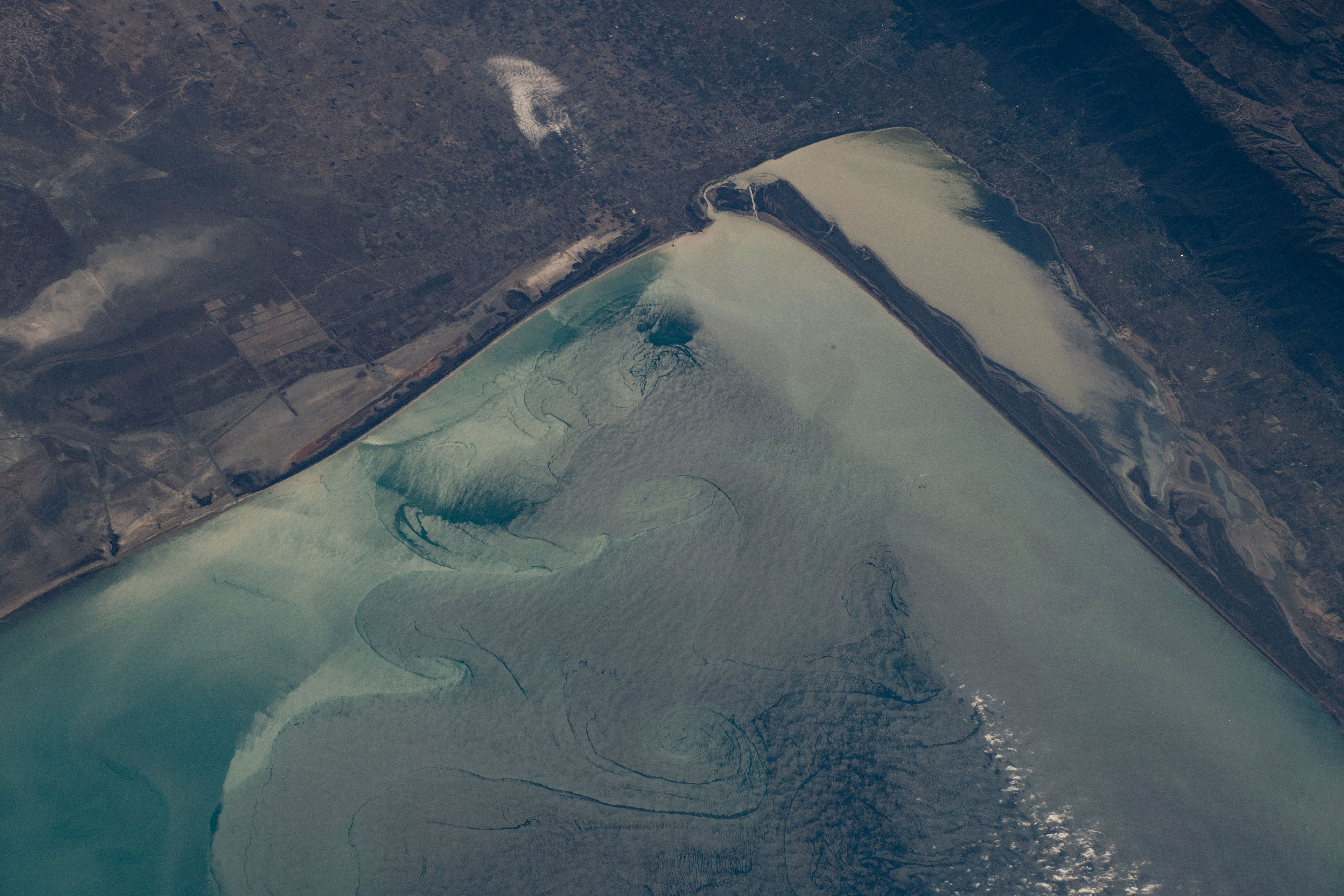


Photo center point: 37.0° N, 53.8° E
Photo center point by machine learning:
Country or Geographic Name: | IRAN |
Features: | CASPIAN SEA, MIAN KALEH, BANDAR GAZ |
| Features Found Using Machine Learning: | |
Cloud Cover Percentage: | 10 (1-10)% |
Sun Elevation Angle: | 21° |
Sun Azimuth: | 121° |
Camera: | Nikon D5 Electronic Still Camera |
Focal Length: | 240mm |
Camera Tilt: | High Oblique |
Format: | 5568E: 5568 x 3712 pixel CMOS sensor, 35.9 x 23.9 mm, total pixels: 21.33 million, Nikon FX format |
Film Exposure: | |
| Additional Information | |
| Width | Height | Annotated | Cropped | Purpose | Links |
|---|---|---|---|---|---|
| 720 pixels | 480 pixels | Yes | No | Download Image | |
| 720 pixels | 480 pixels | Yes | No | Download Image | |
| 720 pixels | 480 pixels | Yes | Yes | Download Image | |
| 5568 pixels | 3712 pixels | No | No | Download Image | |
| 640 pixels | 427 pixels | No | No | Download Image |
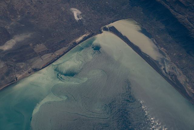
An astronaut aboard the International Space Station (ISS) took this photograph highlighting the water surface in the southeast corner of the Caspian Sea. The tight angle of the coastline, close to the point where Iran and Turkmenistan meet, is a readily recognizable landmark for ISS crews. The region has a generally arid climate, but thick forests blanket the rain-catching slopes of the Elburz Mountains that fringe the sea.
The image shows patterns of swirls on the sea surface as revealed by reflected sunlight, or sunglint. This circulation has been studied through both remote sensing and in situ techniques-in this case floating drifters that take direct measurements in the water column as their movements are tracked by GPS.
Thanks to such data, scientists now know that the water in this corner of the Caspian Sea circulates slowly in a counterclockwise direction, making a broad current pattern termed a gyre. This flow appears to astronauts as a complicated pattern of smaller eddies or swirls; they are larger where the water is deeper (top center) and much smaller near the shoreline, where the water is shallower.
