ISS061-E-52673
| NASA Photo ID | ISS061-E-52673 |
| Focal Length | 500mm |
| Date taken | 2019.11.21 |
| Time taken | 18:01:30 GMT |
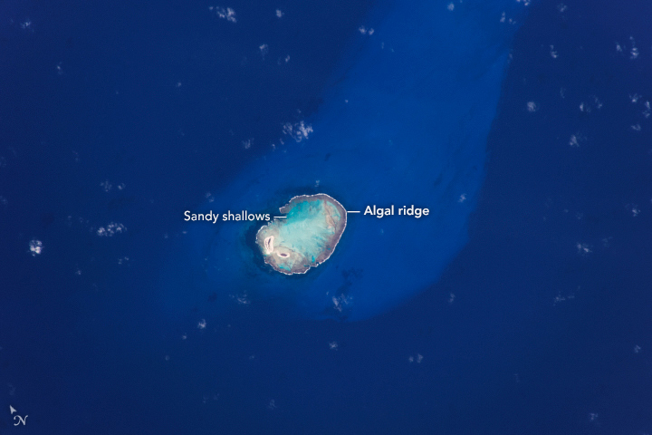
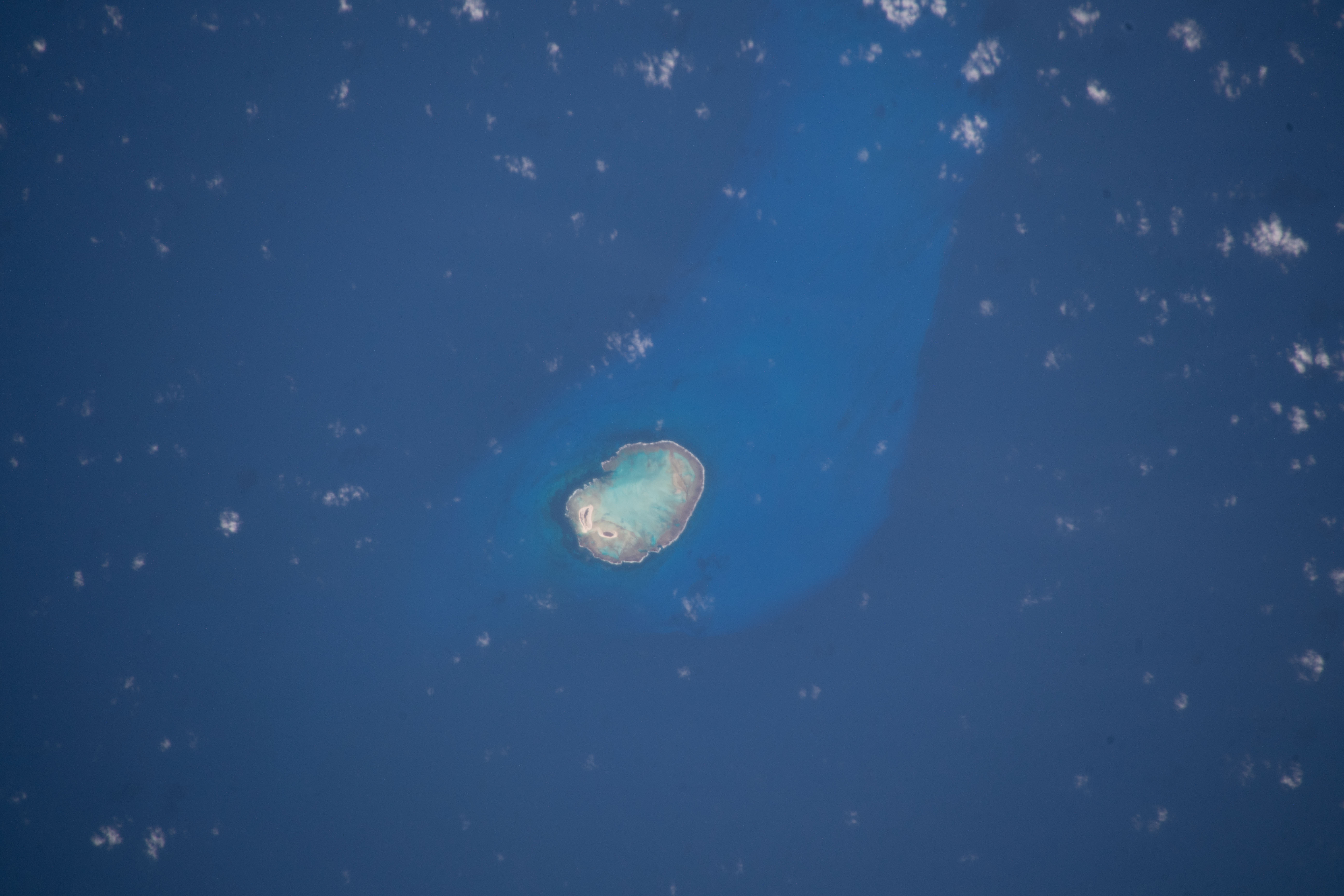


Photo center point: 3.9° S, 33.8° W
Photo center point by machine learning:
Country or Geographic Name: | BRAZIL |
Features: | ROCAS ATOLL |
| Features Found Using Machine Learning: | |
Cloud Cover Percentage: | 10 (1-10)% |
Sun Elevation Angle: | 30° |
Sun Azimuth: | 250° |
Camera: | Nikon D5 Electronic Still Camera |
Focal Length: | 500mm |
Camera Tilt: | 13 degrees |
Format: | 5568E: 5568 x 3712 pixel CMOS sensor, 35.9 x 23.9 mm, total pixels: 21.33 million, Nikon FX format |
Film Exposure: | |
| Additional Information | |
| Width | Height | Annotated | Cropped | Purpose | Links |
|---|---|---|---|---|---|
| 720 pixels | 480 pixels | Yes | Yes | NASA's Earth Observatory web site | Download Image |
| 5568 pixels | 3712 pixels | No | No | Download Image | |
| 640 pixels | 427 pixels | No | No | Download Image |
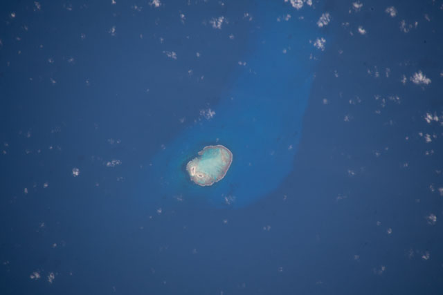
This photograph, taken by an astronaut onboard the International Space Station (ISS), shows the only atoll in the South Atlantic Ocean. Rocas Atoll (//sigep.cprm.gov.br/sitio033/sitio033english.htm) is part of the Fernando de Noronha archipelago, located approximately 260 kilometers (160 miles) off the northeastern coast of Brazil. This image clearly captures the defining boundary between the outer algal ridge, the open ocean, and the sandy bottom closer to the atoll's center.
An atoll is usually a circular or oval-shaped reef structure with a lagoon in the center. These structures typically form around a volcanic island that has subsided while the coral continues to grow upward. These reef structures are self-contained environments that create ideal conditions for a diverse habitat. Coral reefs are considered among the most diverse ecosystems in the world.
In 1978, Rocas Atoll was named a national biological reserve due to the large populations of migratory and resident seabirds. As the first marine reserve to be established in Brazil, it is the strictest type of protected area, specifically focused on the conservation of biodiversity such that no recreational activity or resource exploitation is permitted.
