ISS061-E-4546

| NASA Photo ID | ISS061-E-4546 |
| Focal Length | 65mm |
| Date taken | 2019.10.08 |
| Time taken | 19:03:45 GMT |
720 x 480 pixels 720 x 600 pixels 5568 x 3712 pixels 640 x 427 pixels
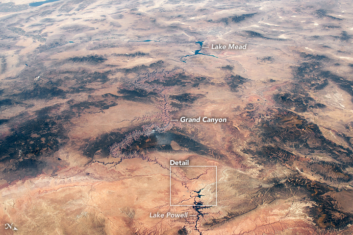

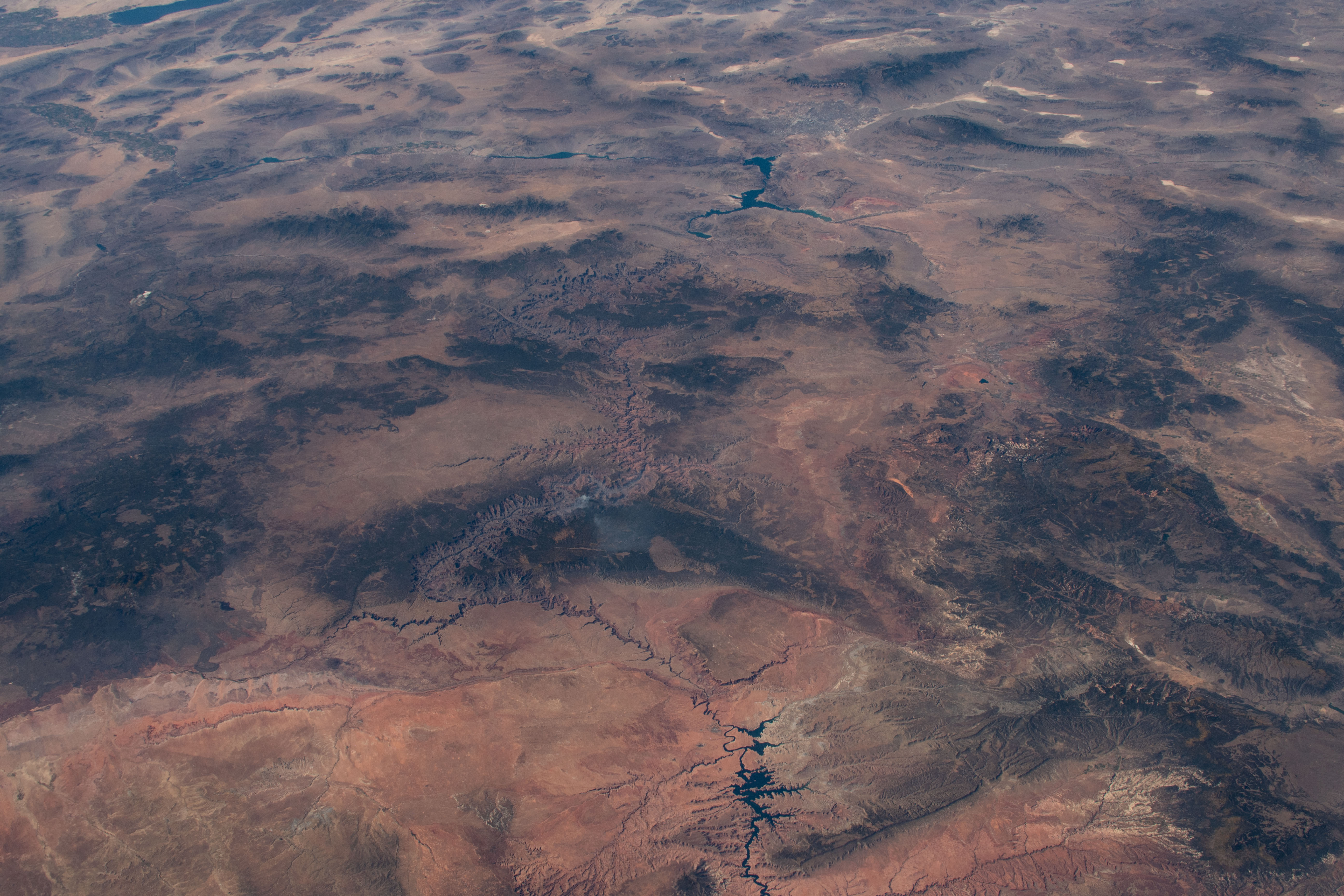


Photo center point: 36.5° N, 113.0° W
Photo center point by machine learning:
Country or Geographic Name: | USA-ARIZONA |
Features: | GRAND CANYON, HORSESHOE BEND, LAKE POWELL |
| Features Found Using Machine Learning: | |
Cloud Cover Percentage: | 10 (1-10)% |
Sun Elevation Angle: | 47° |
Sun Azimuth: | 180° |
Camera: | Nikon D5 Electronic Still Camera |
Focal Length: | 65mm |
Camera Tilt: | 47 degrees |
Format: | 5568E: 5568 x 3712 pixel CMOS sensor, 35.9 x 23.9 mm, total pixels: 21.33 million, Nikon FX format |
Film Exposure: | |
| Additional Information | |
| Width | Height | Annotated | Cropped | Purpose | Links |
|---|---|---|---|---|---|
| 720 pixels | 480 pixels | Yes | No | NASA's Earth Observatory web site | Download Image |
| 720 pixels | 600 pixels | Yes | Yes | NASA's Earth Observatory web site | Download Image |
| 5568 pixels | 3712 pixels | No | No | Download Image | |
| 640 pixels | 427 pixels | No | No | Download Image |
Ancient geologic features and modern reservoirs share the spotlight in this photo of the Colorado Plateau, taken by an astronaut onboard the International Space Station (ISS).
The western half of the plateau, which spans southeastern Utah and northern Arizona, is dominated by the Colorado River and its tributaries, which collectively drain more than 90 percent of the water on the plateau. According to the U.S. National Park Service, the Colorado River began eroding the plateau about 5 to 6 million years ago, forming many of today's well-known features like the Grand Canyon, Horseshoe Bend, and the characteristic slot canyons of the region.
Horseshoe Bend is a popular and scenic entrenched meander near Page, Arizona - one of the many twists in the Colorado River. The meanders formed as the Colorado Plateau was raised by tectonic forces. As the land rose upward, the river continued to cut its channel downward through the underlying rock layers. That channel cutting formed a tight U-shape (closeup below) in the sandstone to form today's sheer cliff walls.
While natural forces like erosion have been reshaping the landscape for thousands of years, humans have made their mark in the past hundred years. The largest bodies of water in these images are the artificial reservoirs at Lake Powell and Lake Mead, which were formed by the Glen Canyon and Hoover dams, respectively. The lakes are the two largest artificial reservoirs in the United States, providing hydroelectric power and water for about 40 million people and 5.5 million acres of farmland across the U.S. West and Mexico.
