ISS061-E-32065
| NASA Photo ID | ISS061-E-32065 |
| Focal Length | 50mm |
| Date taken | 2019.11.06 |
| Time taken | 14:59:30 GMT |
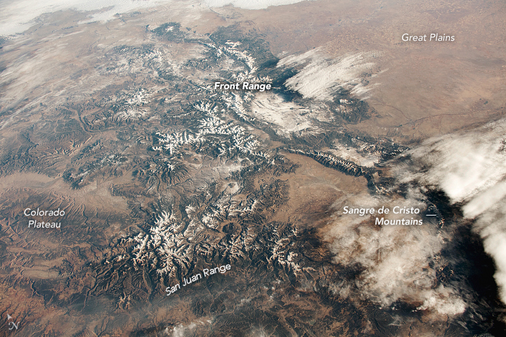
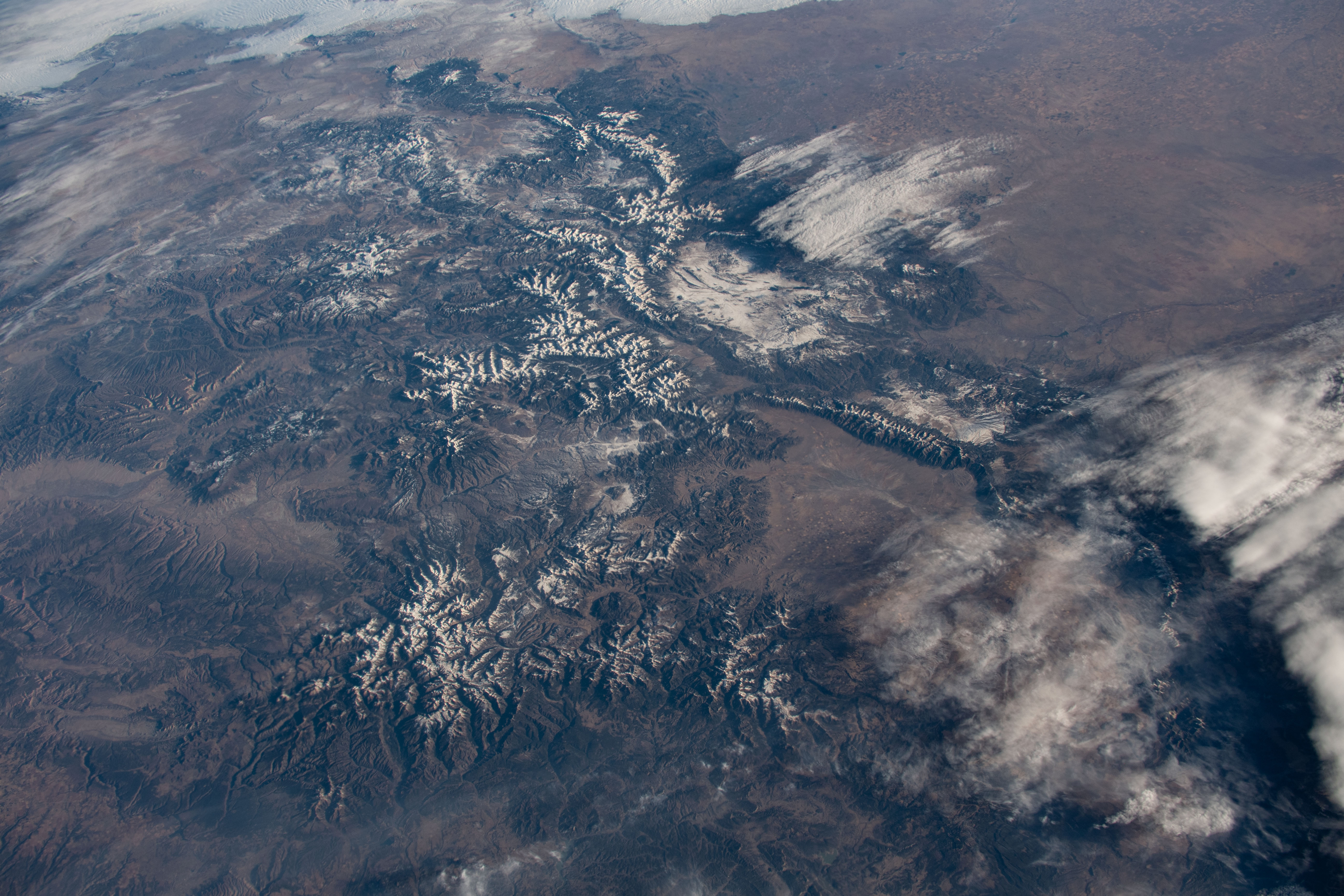

Photo center point: 38.5° N, 106.5° W
Photo center point by machine learning:
Country or Geographic Name: | USA-COLORADO |
Features: | FORT COLLINS, ROCKY MOUNTAINS |
| Features Found Using Machine Learning: | |
Cloud Cover Percentage: | 25 (11-25)% |
Sun Elevation Angle: | 13° |
Sun Azimuth: | 121° |
Camera: | Nikon D5 Electronic Still Camera |
Focal Length: | 50mm |
Camera Tilt: | 50 degrees |
Format: | 5568E: 5568 x 3712 pixel CMOS sensor, 35.9 x 23.9 mm, total pixels: 21.33 million, Nikon FX format |
Film Exposure: | |
| Additional Information | |
| Width | Height | Annotated | Cropped | Purpose | Links |
|---|---|---|---|---|---|
| 720 pixels | 480 pixels | Yes | No | NASA's Earth Observatory web site | Download Image |
| 5568 pixels | 3712 pixels | No | No | Download Image | |
| 640 pixels | 427 pixels | No | No | Download Image |
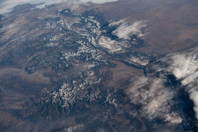
The Colorado segment of the Rocky Mountains is on full display in this photograph taken by an astronaut on board the International Space Station (ISS). Cloud cover stalled on the eastern slope of the mountains, allowing for this image of the entire Front Range, as well as several other ranges - San Juan and Sangre de Christo - that together comprise the Rocky Mountains in Colorado. The Colorado Plateau is readily recognizable due to its flat profile relative to the adjacent mountain ranges.
The snow-capped peaks along the Front Range mark the boundary between the Rockies and the Great Plains to the east. The Front Range is also a section of the Great Divide. Often referred to as The Continental Divide, it is a hydrologic boundary that delineates the direction of water flow between east and west, toward the Atlantic or Pacific oceans.
Nearly fifty years ago, Apollo astronauts visited the San Juan range for geology training. The rocks and terrain of the San Juan Mountains made the area well suited for teaching astronauts to recognize different types of rocks for sampling, and to record their observations for further analysis by scientists back on Earth.
