ISS061-E-152239

| NASA Photo ID | ISS061-E-152239 |
| Focal Length | 140mm |
| Date taken | 2020.02.02 |
| Time taken | 10:15:58 GMT |
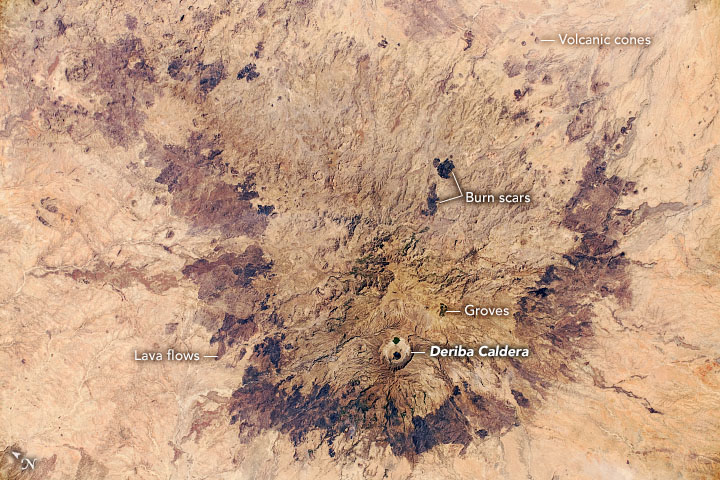
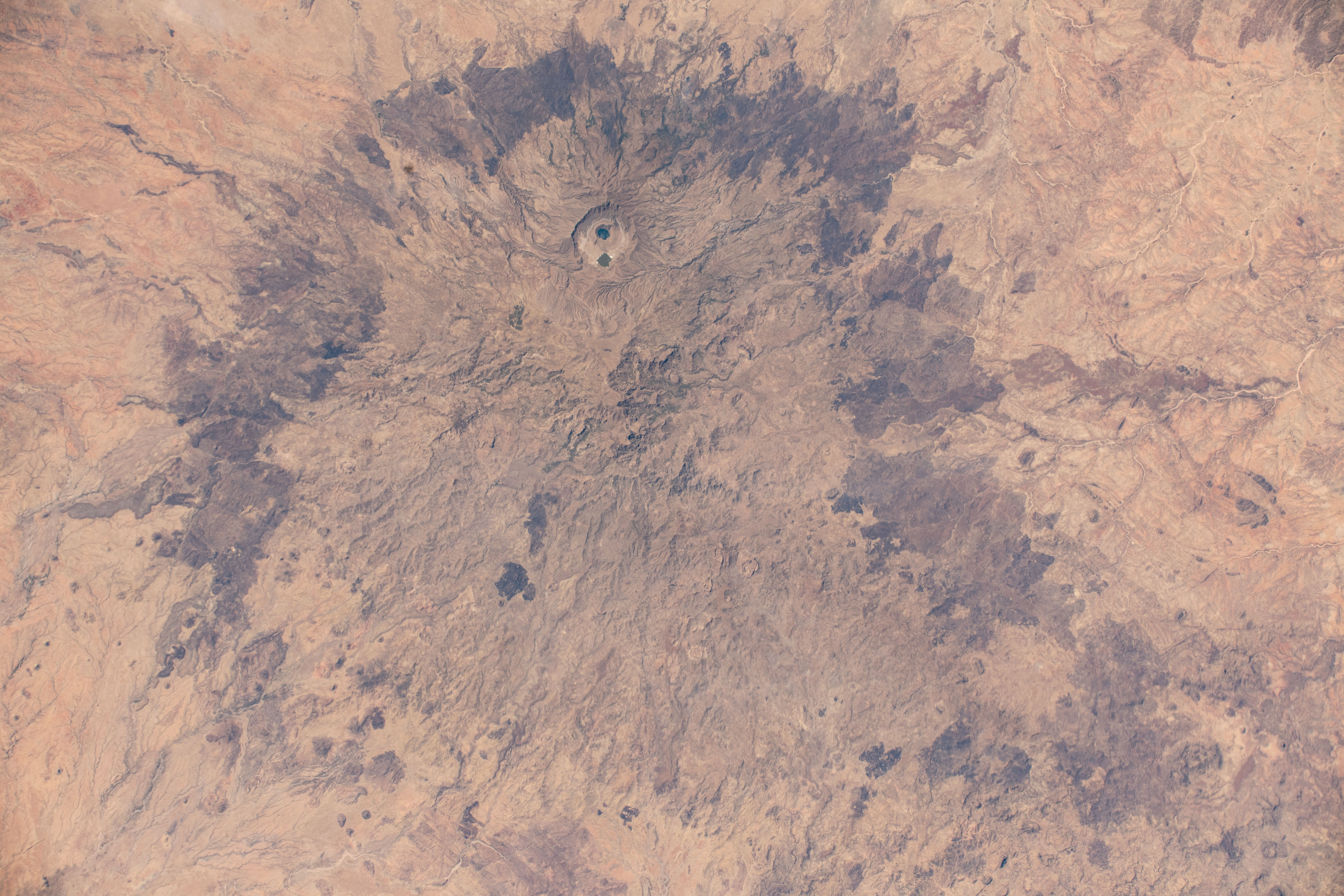


Photo center point: 13.1° N, 24.4° E
Photo center point by machine learning: 13.09° N, 24.37° E

Country or Geographic Name: | SUDAN |
Features: | JEBEL MARRA, MARRAH MOUNTAINS, SAHARA DESERT, MASSIF, LAVA FLOWS, DERIBA CALDERA |
| Features Found Using Machine Learning: | |
Cloud Cover Percentage: | 10 (1-10)% |
Sun Elevation Angle: | 61° |
Sun Azimuth: | 167° |
Camera: | Nikon D5 Electronic Still Camera |
Focal Length: | 140mm |
Camera Tilt: | 30 degrees |
Format: | 5568E: 5568 x 3712 pixel CMOS sensor, 35.9 x 23.9 mm, total pixels: 21.33 million, Nikon FX format |
Film Exposure: | |
| Additional Information | |
| Width | Height | Annotated | Cropped | Purpose | Links |
|---|---|---|---|---|---|
| 720 pixels | 480 pixels | Yes | Yes | NASA's Earth Observatory web site | Download Image |
| 5568 pixels | 3712 pixels | No | No | Download Image | |
| 640 pixels | 427 pixels | No | No | Download Image |
Astronauts aboard the International Space Station (ISS) took this near-vertical photograph of Jebel Marra (also known as the Marrah Mountains) in the eastern Sahara Desert. The almost circular massif in the Darfur region of Sudan is a large cluster of volcanoes and lava flows, with a large central area of volcanic pyroclastic deposits that measures roughly 70 kilometers (40 miles) north to south. Numerous small volcanic cones appear around the margin of the massif.
A collapsed volcano, the Deriba Caldera, is the highest point in Sudan (3042 meters/9,980 feet) and the site of two small lakes. The caldera also drew the interest of astronauts in 2008.
The entire massif rises high enough to have a climate that is cooler and wetter than the surrounding desert. It is thus a center of human population, with numerous small fields and several towns. Seen from space, the evidence of human activity comes in the form of palm groves. The two prominent dark patches at image center are likely fire scars.
