ISS061-E-120687

| NASA Photo ID | ISS061-E-120687 |
| Focal Length | 78mm |
| Date taken | 2020.01.07 |
| Time taken | 09:57:05 GMT |
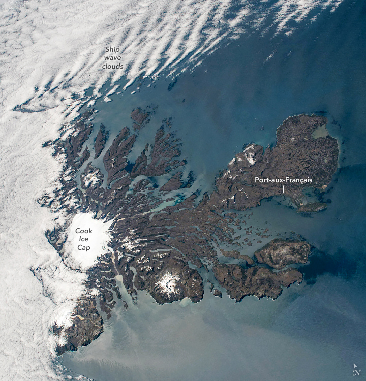
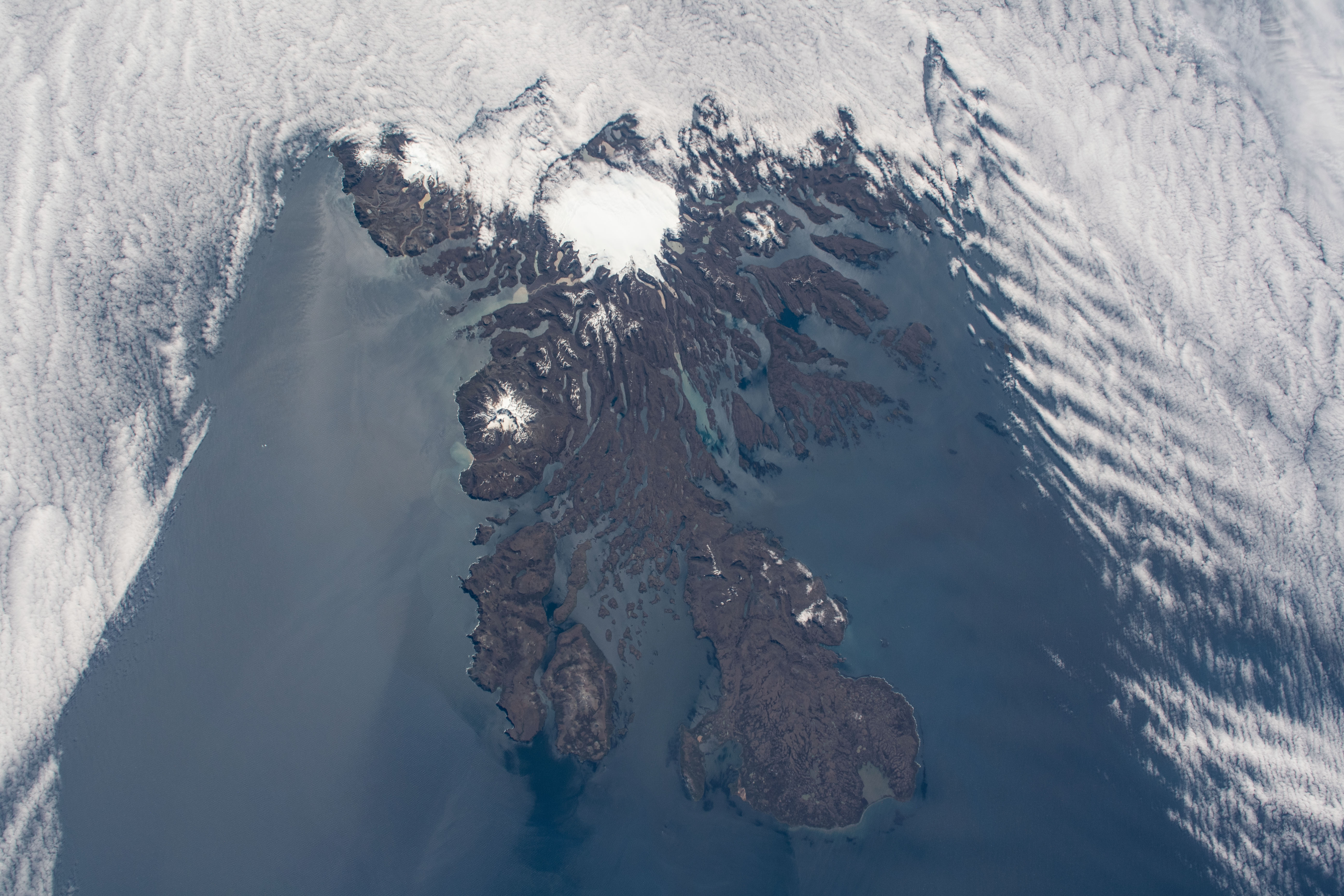


Photo center point: 49.5° S, 70.0° E
Photo center point by machine learning:
Country or Geographic Name: | KERGUELEN ILES |
Features: | SHIP WAVE CLOUDS, SUNGLINT, COOK ICE CAP, PORT-AUX-FRANCIS |
| Features Found Using Machine Learning: | |
Cloud Cover Percentage: | 50 (26-50)% |
Sun Elevation Angle: | 49° |
Sun Azimuth: | 299° |
Camera: | Nikon D5 Electronic Still Camera |
Focal Length: | 78mm |
Camera Tilt: | 27 degrees |
Format: | 5568E: 5568 x 3712 pixel CMOS sensor, 35.9 x 23.9 mm, total pixels: 21.33 million, Nikon FX format |
Film Exposure: | |
| Additional Information | |
| Width | Height | Annotated | Cropped | Purpose | Links |
|---|---|---|---|---|---|
| 720 pixels | 750 pixels | Yes | Yes | NASA's Earth Observatory web site | Download Image |
| 5568 pixels | 3712 pixels | No | No | Download Image | |
| 640 pixels | 427 pixels | No | No | Download Image |
While orbiting over the vast emptiness of the southern Indian Ocean, an astronaut took this photo of the Kerguelen Islands. Westerly winds pushed low-lying clouds up against the western shores. Meanwhile, ship wave clouds ripple away from small yet tall outlying islands. Sunglint reflecting off of the water surface highlights some waves moving toward the southern coastline (bottom left).
Deeply cut valleys and fjords radiate out from the Cook Ice Cap. These scours are the signatures of glaciers that have eroded large masses of rock and shaped the rugged landscape. Many smaller glaciers connected to the Cook Ice Cap feed into lakes or run out to sea.
The Kerguelen Islands are isolated from continents and human populations, being much closer to Antarctica than to Africa and Australia. However, geographic isolation does not mean the islands are unoccupied. Port-aux-Francis is a small settlement that hosts seasonal researchers for studies of local and migratory animals, oceanography, and Earth science.
Related Image
- NASA Earth Observatory (2016, December 28) Kerguelen Islands.
