ISS060-E-81644

| NASA Photo ID | ISS060-E-81644 |
| Focal Length | 16mm |
| Date taken | 2019.09.28 |
| Time taken | 13:00:07 GMT |
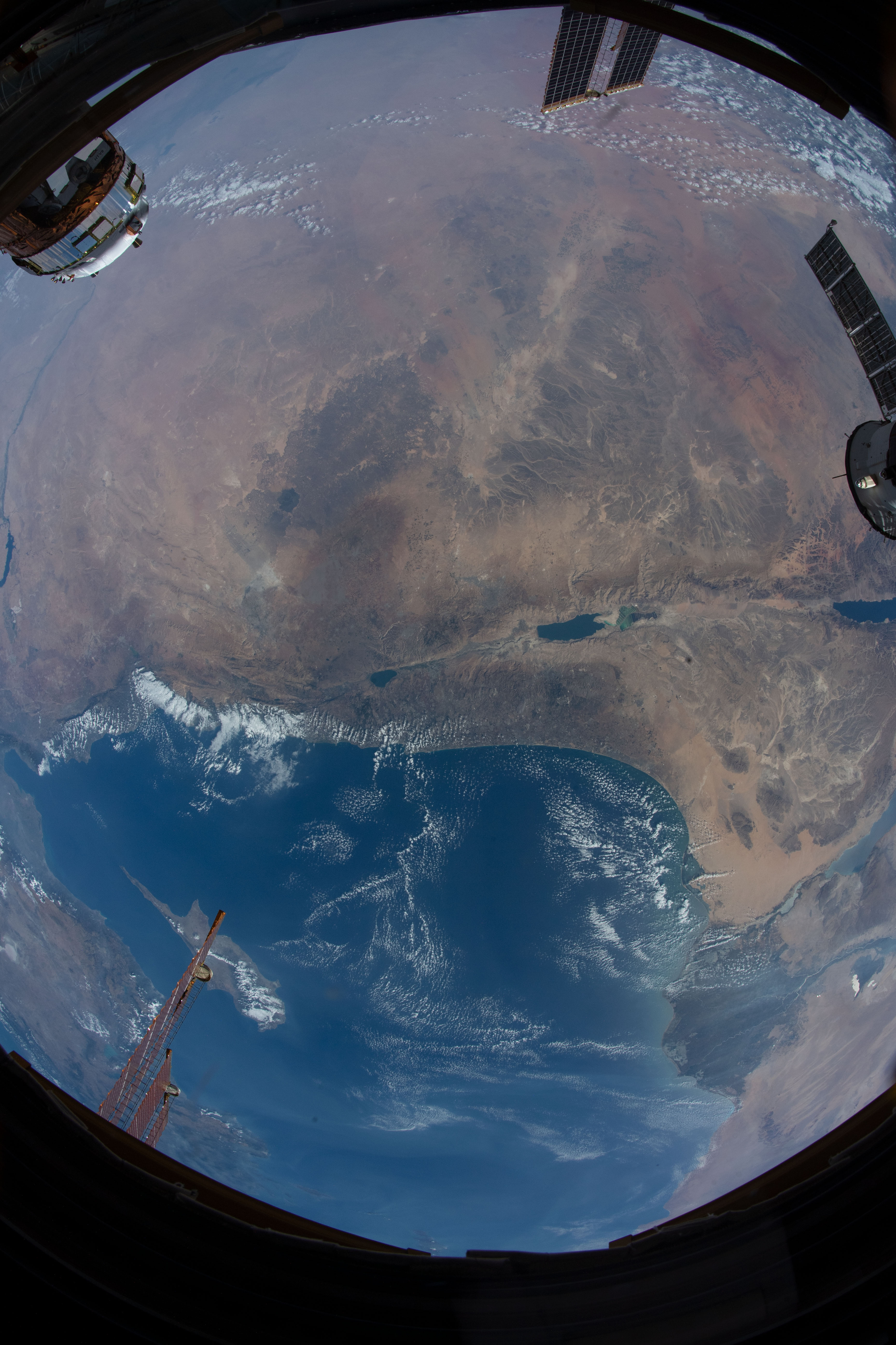

Spacecraft nadir point: 28.5° N, 32.0° E
Photo center point: 32.5° N, 35.5° E
Photo center point by machine learning:
Photo center point: 32.5° N, 35.5° E
Photo center point by machine learning:
Nadir to Photo Center: Northeast
Spacecraft Altitude: 221 nautical miles (409km)
Country or Geographic Name: | ISRAEL |
Features: | NILE RIVER DELTA, CAIRO, WADI RUM, DEAD SEA |
| Features Found Using Machine Learning: | |
Cloud Cover Percentage: | 25 (11-25)% |
Sun Elevation Angle: | 34° |
Sun Azimuth: | 246° |
Camera: | Nikon D5 Electronic Still Camera |
Focal Length: | 16mm |
Camera Tilt: | High Oblique |
Format: | 5568E: 5568 x 3712 pixel CMOS sensor, 35.9 x 23.9 mm, total pixels: 21.33 million, Nikon FX format |
Film Exposure: | |
| Additional Information | |
| Width | Height | Annotated | Cropped | Purpose | Links |
|---|---|---|---|---|---|
| 3712 pixels | 5568 pixels | No | No | Download Image | |
| 427 pixels | 640 pixels | No | No | Download Image |
Download Packaged File
Download a Google Earth KML for this Image
View photo footprint information
Download a GeoTIFF for this photo
Image Caption: none
