ISS060-E-71360
| NASA Photo ID | ISS060-E-71360 |
| Focal Length | 78mm |
| Date taken | 2019.09.16 |
| Time taken | 20:48:07 GMT |
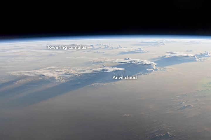
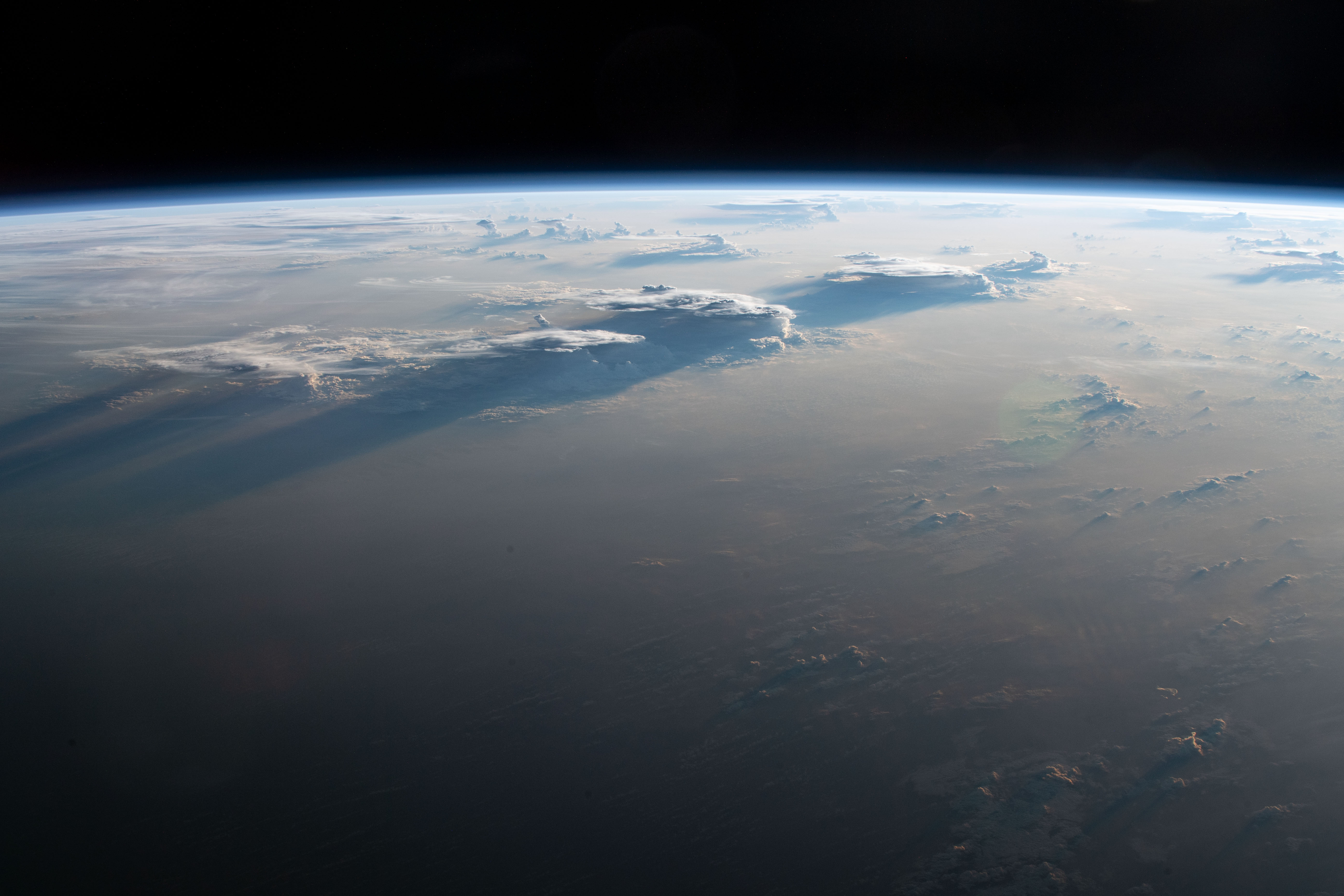
Photo center point:
Photo center point by machine learning:
Country or Geographic Name: | BRAZIL |
Features: | EARTH LIMB, CUMULONIMBUS, ANVIL, STORMS, TERMINATOR |
| Features Found Using Machine Learning: | PAN- |
Cloud Cover Percentage: | 100 (76-100)% |
Sun Elevation Angle: | -4° |
Sun Azimuth: | 273° |
Camera: | Nikon D5 Electronic Still Camera |
Focal Length: | 78mm |
Camera Tilt: | High Oblique |
Format: | 5568E: 5568 x 3712 pixel CMOS sensor, 35.9 x 23.9 mm, total pixels: 21.33 million, Nikon FX format |
Film Exposure: | |
| Additional Information | |
| Width | Height | Annotated | Cropped | Purpose | Links |
|---|---|---|---|---|---|
| 720 pixels | 480 pixels | Yes | Yes | NASA's Earth Observatory web site | Download Image |
| 5568 pixels | 3712 pixels | No | No | Download Image | |
| 640 pixels | 427 pixels | No | No | Download Image |
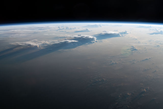
As the International Space Station traveled towards the terminator, an astronaut shot this oblique photograph of a heavily clouded region near the northeastern coast of Brazil. The angle of the setting Sun accentuates the depth and texture of towering cumulonimbus clouds, which in turn cast long shadows on lower clouds and on the ground.
Known to meteorologists as cumulonimbus incus—anvil clouds—they stand out due to their vertical extent and flattened tops. Caused by extreme atmospheric instability and accompanied by thunderstorms, some anvil clouds have overshooting tops that penetrate the stratosphere. When air convection and mixing are just right, the towering cumulus congestus clouds near Earth’s limb (top center of the image) have potential to take on anvil form. With their extreme height and wide tops, the anvil clouds cast the largest shadows, some of which blend into the terminator line in this photo.
