ISS059-E-67912
| NASA Photo ID | ISS059-E-67912 |
| Focal Length | 210mm |
| Date taken | 2019.05.19 |
| Time taken | 22:17:53 GMT |
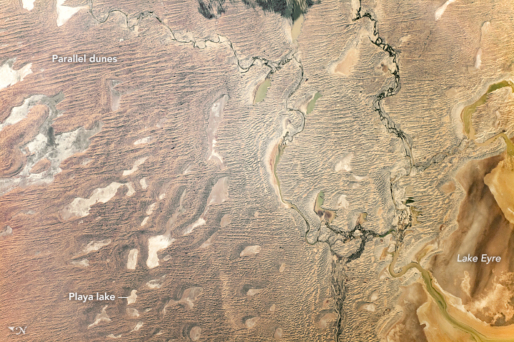
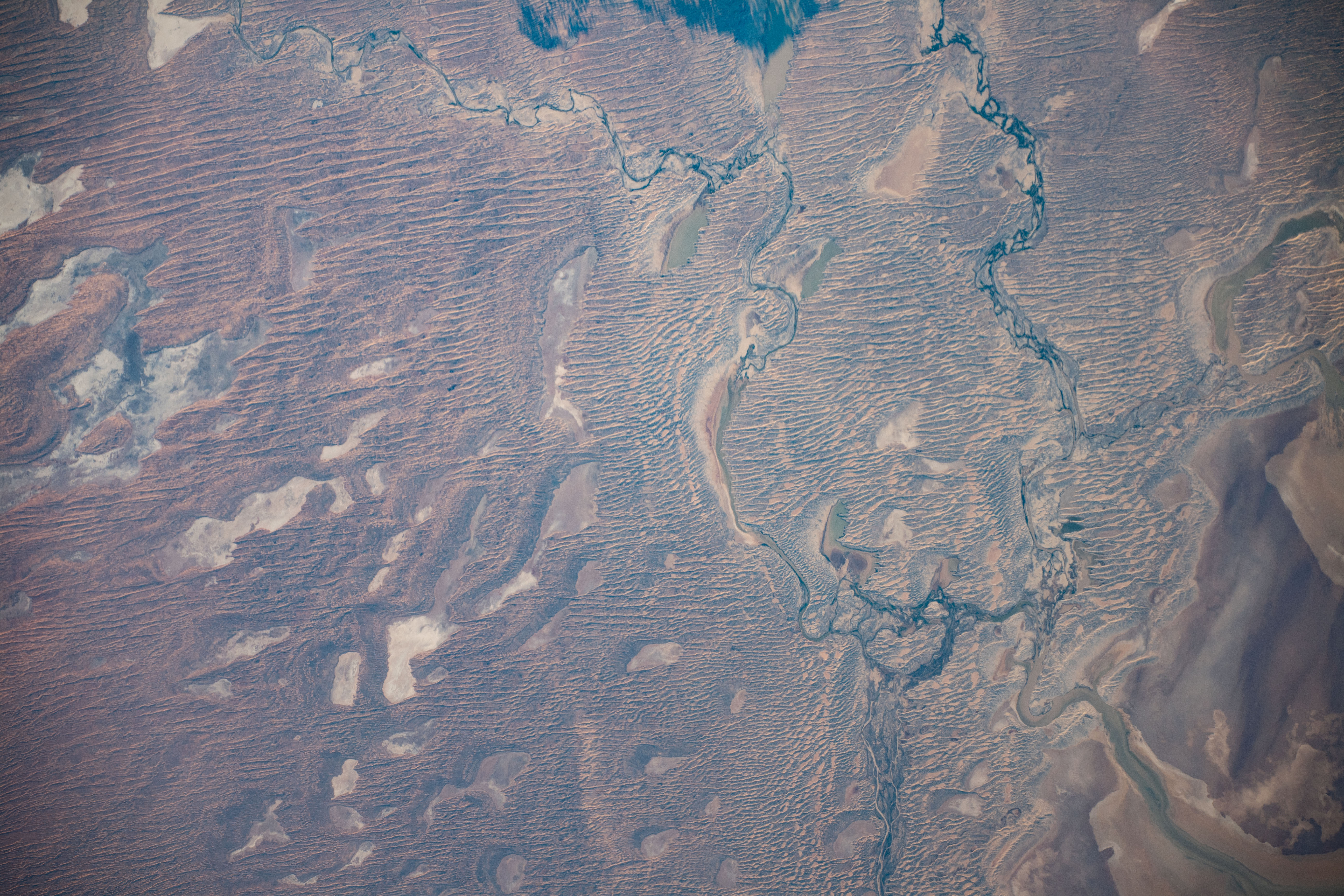

Photo center point: 27.5° S, 137.3° E
Photo center point by machine learning:
Camera: | Nikon D5 Electronic Still Camera |
Focal Length: | 210mm |
Camera Tilt: | 34 degrees |
Format: | 5568E: 5568 x 3712 pixel CMOS sensor, 35.9 x 23.9 mm, total pixels: 21.33 million, Nikon FX format |
Film Exposure: | |
| Additional Information | |
| Width | Height | Annotated | Cropped | Purpose | Links |
|---|---|---|---|---|---|
| 720 pixels | 480 pixels | Yes | No | NASA's Earth Observatory web site | Download Image |
| 5568 pixels | 3712 pixels | No | No | Download Image | |
| 640 pixels | 427 pixels | No | No | Download Image |
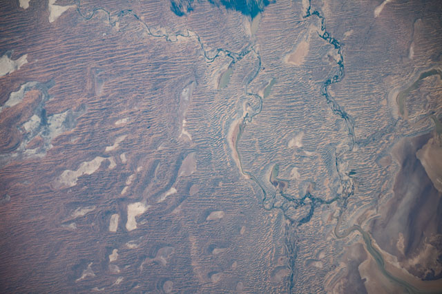
This photograph, taken by an astronaut on the International Space Station, offers a detailed view of parallel, linear dunes in Australia's Simpson Desert. The dunes have formed as a result of wind erosion and sand deposition taking place over thousands of years. Some of the dunes stretch more than 100 kilometers (60 miles) in length.
Lake Eyre - also known as Kati Thanda - Lake Eyre - is Australia's largest salt lake. Some of it is visible in the right corner of the image, along with other playa lakes that stand out from the rippled landscape. Playas are flat, shallow lake beds that occur in arid and semi-arid climate zones. The dry lake beds are lighter in color due to a thin layer of salt deposits that reflect more light.
The Kati Thanda-Lake Eyre basin spans parts of South Australia, Northern Territory, Queensland, and New South Wales. It is part of one of the world's largest internally draining river systems, which means that the rivers in the photo do not drain into the ocean. In this photo, Lake Eyre has a higher volume of water than usual due to flooding that occurred earlier in the year.
