ISS059-E-59836

| NASA Photo ID | ISS059-E-59836 |
| Focal Length | 24mm |
| Date taken | 2019.05.07 |
| Time taken | 06:46:51 GMT |
Cloud masks available for this image:
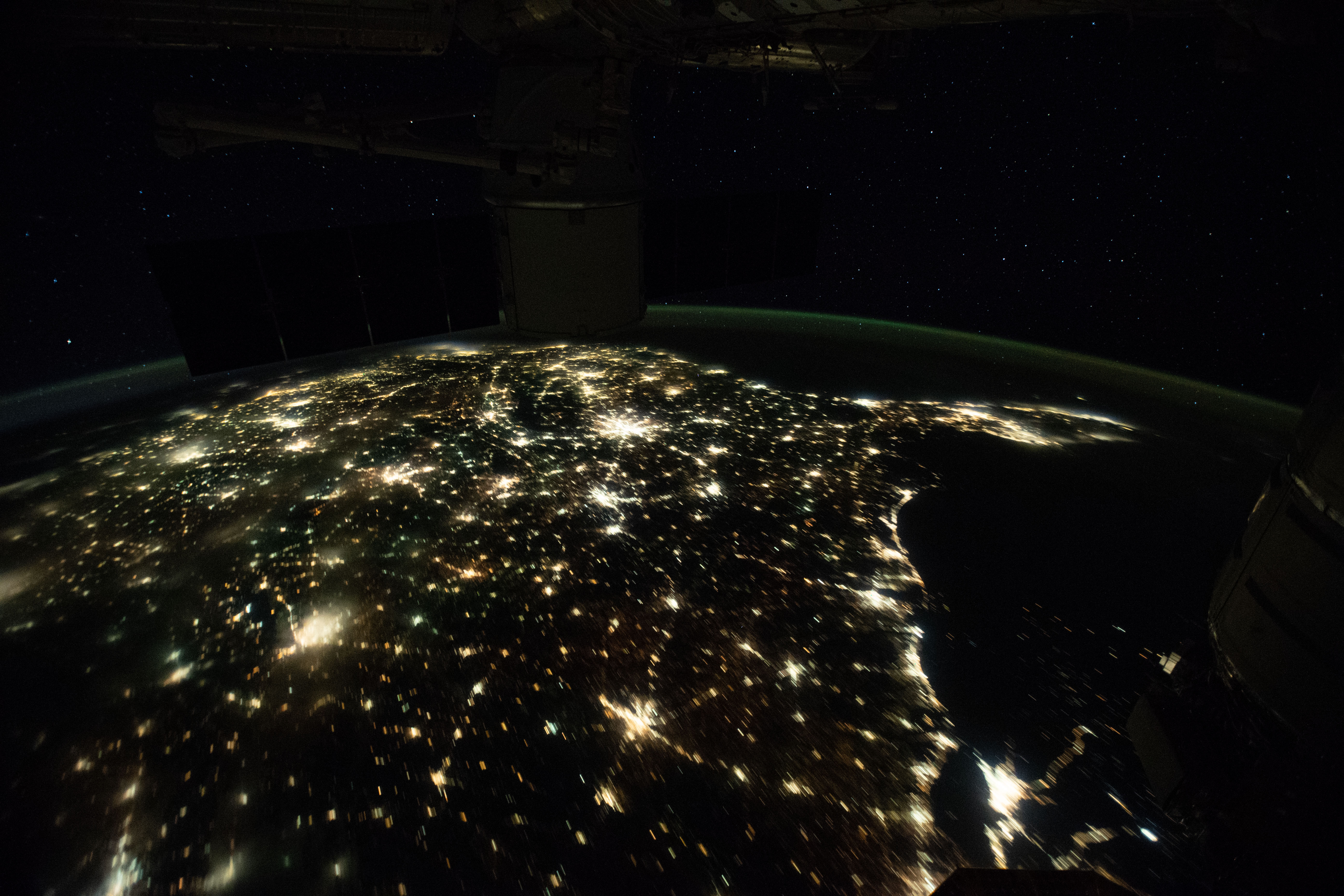
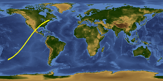
Spacecraft nadir point: 31.1° N, 93.7° W
Photo center point: 32.5° N, 90.0° W
Photo center point by machine learning:
Photo center point: 32.5° N, 90.0° W
Photo center point by machine learning:
Nadir to Photo Center: East
Spacecraft Altitude: 219 nautical miles (406km)
Country or Geographic Name: | USA-MISSISSIPPI |
Features: | LIMB, GULF OF MEXICO, JACKSON |
| Features Found Using Machine Learning: | |
Cloud Cover Percentage: | 10 (1-10)% |
Sun Elevation Angle: | -42° |
Sun Azimuth: | 11° |
Camera: | Nikon D5 Electronic Still Camera |
Focal Length: | 24mm |
Camera Tilt: | 48 degrees |
Format: | 5568E: 5568 x 3712 pixel CMOS sensor, 35.9 x 23.9 mm, total pixels: 21.33 million, Nikon FX format |
Film Exposure: | |
| Additional Information | |
This photo is one of the photos used to create this time-lapse video:
| Width | Height | Annotated | Cropped | Purpose | Links |
|---|---|---|---|---|---|
| 5568 pixels | 3712 pixels | No | No | Download Image | |
| 640 pixels | 427 pixels | No | No | Download Image |
Download Packaged File
Download a Google Earth KML for this Image
View photo footprint information
Download a GeoTIFF for this photo
Image Caption: CATALOGED BY THE UNIVERSITY OF TEXAS AT EL PASO
