ISS059-E-36214

| NASA Photo ID | ISS059-E-36214 |
| Focal Length | 800mm |
| Date taken | 2019.04.27 |
| Time taken | 20:06:03 GMT |
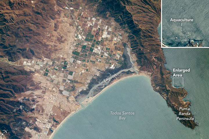
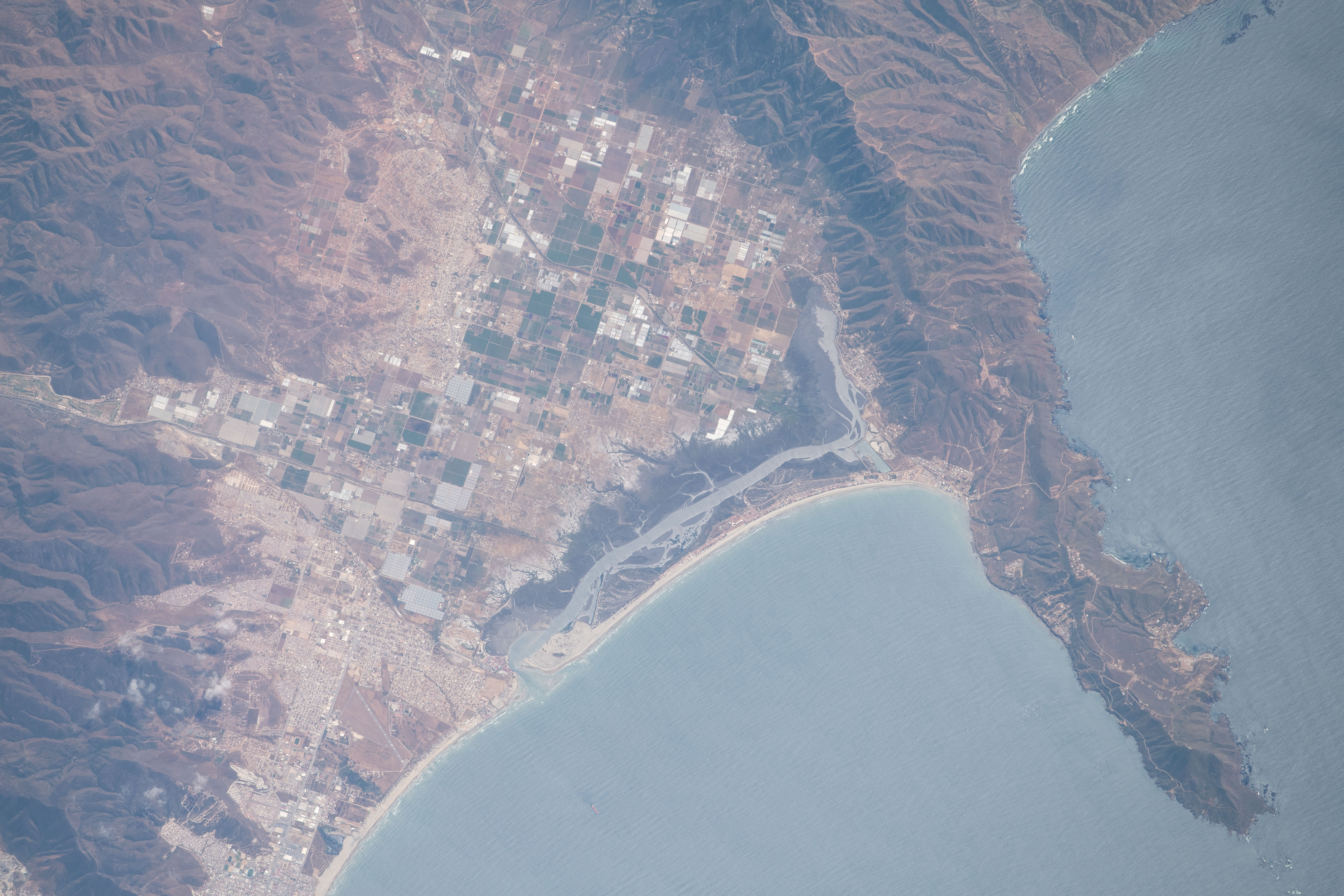

Photo center point: 31.7° N, 116.6° W
Photo center point by machine learning: 31.73° N, 116.62° W

Country or Geographic Name: | MEXICO |
Features: | BAHIA TODOS LOS SANTOS, PENINSULA |
| Features Found Using Machine Learning: | |
Cloud Cover Percentage: | 10 (1-10)% |
Sun Elevation Angle: | 69° |
Sun Azimuth: | 191° |
Camera: | Nikon D5 Electronic Still Camera |
Focal Length: | 800mm |
Camera Tilt: | 42 degrees |
Format: | 5568E: 5568 x 3712 pixel CMOS sensor, 35.9 x 23.9 mm, total pixels: 21.33 million, Nikon FX format |
Film Exposure: | |
| Additional Information | |
| Width | Height | Annotated | Cropped | Purpose | Links |
|---|---|---|---|---|---|
| 720 pixels | 480 pixels | Yes | No | NASA's Earth Observatory web site | Download Image |
| 5568 pixels | 3712 pixels | No | No | Download Image | |
| 640 pixels | 427 pixels | No | No | Download Image |
This photograph, taken by an astronaut onboard the International Space Station, captures a short section of coastline on the west coast of Baja California, Mexico. Small developed areas are interspersed among sections of farmland in a valley bounded by minor mountain ranges. The city of Ensenada, a major port and tourist destination, lies just beyond the bottom left corner of the image.
The fishing industry is an integral part of the economy for this region. Pacific Bluefin tuna is one of the important species locally. A series of fish farming pens also appear along the east side of the peninsula. (The inset image offers a zoomed look at one of the aquaculture facilities.)
Punta Banda Peninsula reaches out to form the southern limit of Todos Santos Bay (All Saints Bay). The temperate conditions that make this region productive for fishing also provide attractive conditions for Pacific gray whales as they migrate south from their feeding grounds to give birth in the protected bays and estuaries of Baja California.
The lagoon (image center) and the bay coastline have been affected by erosion in recent years due to a combination of natural processes, a reduced sediment supply to the bay and, increasingly, urban growth and increased tourism.
