ISS057-E-55414
| NASA Photo ID | ISS057-E-55414 |
| Focal Length | 68mm |
| Date taken | 2018.10.19 |
| Time taken | 22:06:29 GMT |
2768 x 4613 pixels 720 x 973 pixels 2768 x 4928 pixels 359 x 640 pixels
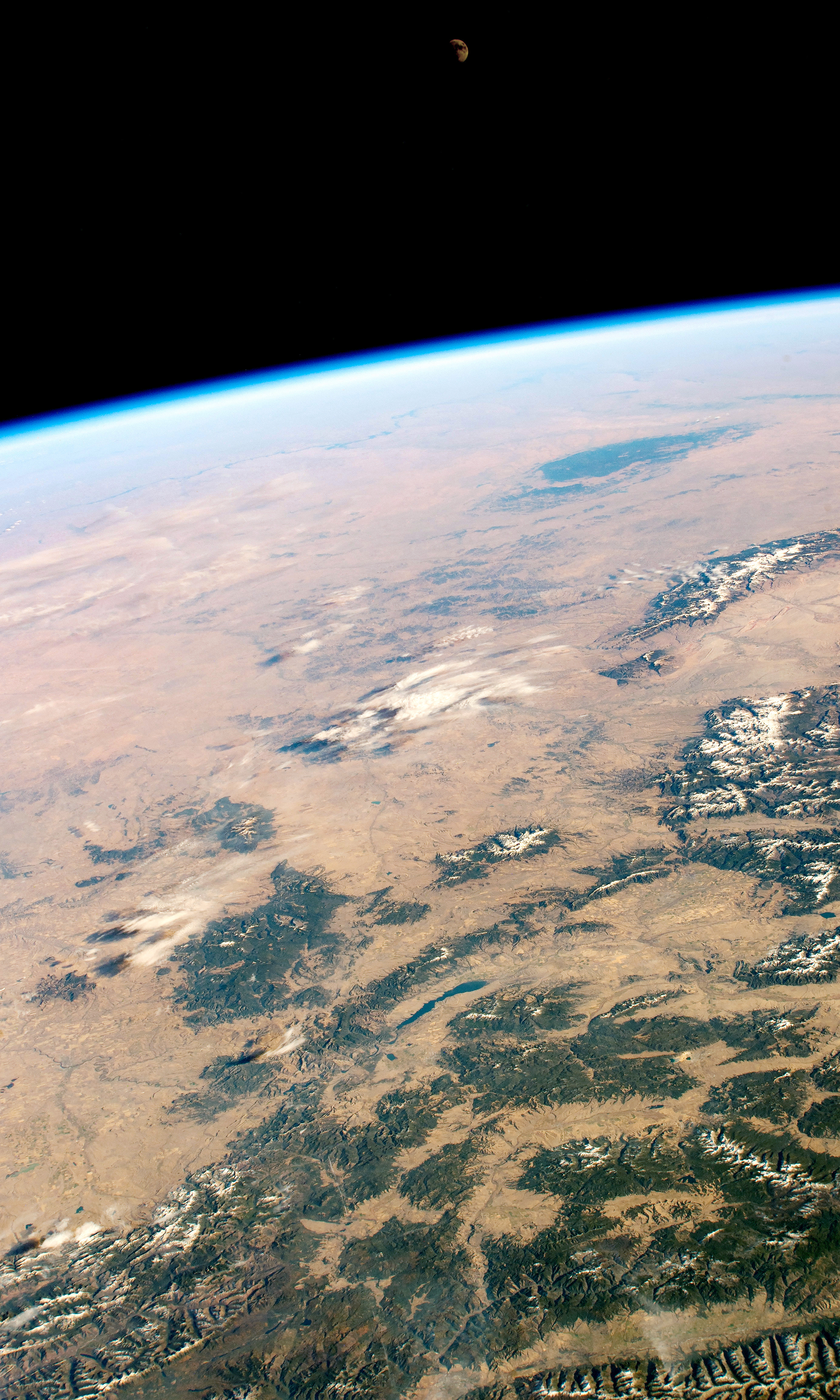
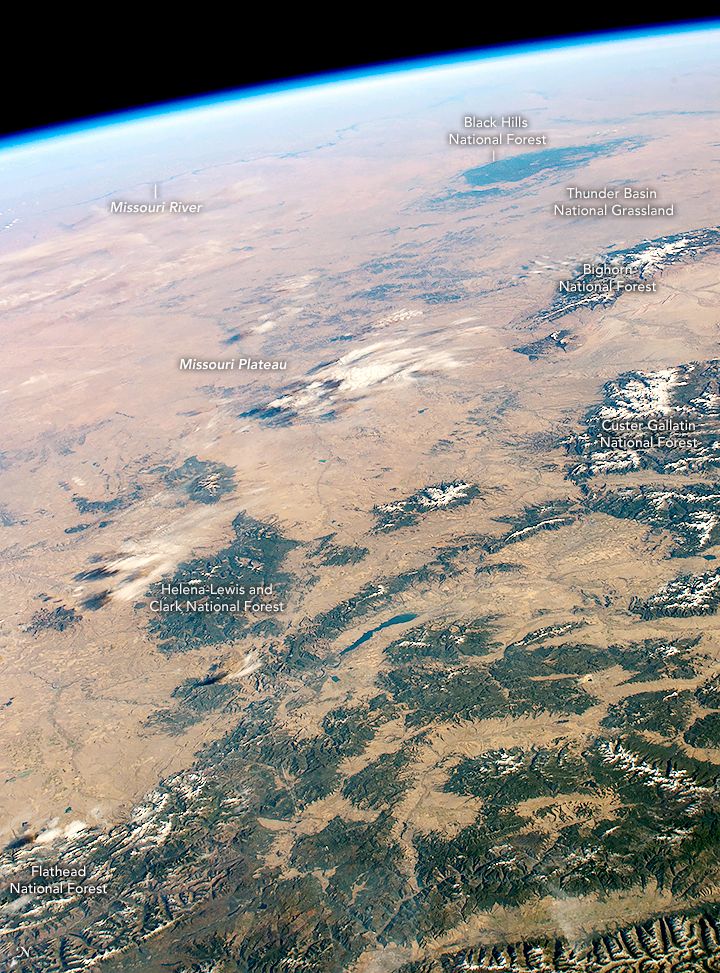


Photo center point: 46.0° N, 109.0° W
Photo center point by machine learning:
Country or Geographic Name: | USA-MONTANA |
Features: | PAN- WYOMING, BLACK HILLS, FLATHEAD FOREST, MISSOULA, MOON |
| Features Found Using Machine Learning: | |
Cloud Cover Percentage: | 10 (1-10)% |
Sun Elevation Angle: | 25° |
Sun Azimuth: | 218° |
Camera: | Nikon D4 Electronic Still Camera |
Focal Length: | 68mm |
Camera Tilt: | High Oblique |
Format: | 4928E: 4928 x 3280 pixel CMOS sensor, 36.0mm x 23.9mm, total pixels: 16.6 million, Nikon FX format |
Film Exposure: | |
| Additional Information | Image acquired by ISS External High Definition Camera |
| Width | Height | Annotated | Cropped | Purpose | Links |
|---|---|---|---|---|---|
| 2768 pixels | 4613 pixels | No | No | NASA's Earth Observatory web site | Download Image |
| 720 pixels | 973 pixels | Yes | Yes | NASA's Earth Observatory web site | Download Image |
| 2768 pixels | 4928 pixels | No | No | Download Image | |
| 359 pixels | 640 pixels | No | No | Download Image |
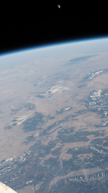
An astronaut shot this oblique photograph of the Missouri Plateau, where the Rocky Mountains meet the Great Plains of central-northwest United States. Across the scene, six national forests and grasslands stand at higher elevations in Montana, Wyoming, and South Dakota. Toward the horizon, the Missouri River is faintly visible snaking across North Dakota.
The Missouri Plateau is a gently sloping region that rises above the flatter plains. The lighter brown areas of land in the photo are deeply cut by braided rivers, and the land is often utilized for livestock pastures and farming.
The western part of the plateau avoided glacial erosion during the most recent ice age. This prevented the Missouri Plateau from being flattened like the North Dakota plains beyond the Missouri River.
The Black Hills of South Dakota stand out in stark contrast to the surrounding plains. Some of the rocks in those hills are 2.5 billion years old. A combination of Laramide tectonics (65 million years ago) and the erosion of younger sedimentary rock layers created and exposed the Black Hills.
