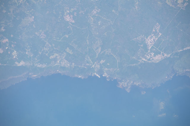
ISS057-E-55004
| NASA Photo ID | ISS057-E-55004 |
| Focal Length | 420mm |
| Date taken | 2018.10.17 |
| Time taken | 14:13:36 GMT |

Spacecraft nadir point: 29.0° N, 84.9° W
Photo center point: 29.8° N, 83.6° W
Photo center point by machine learning:
Photo center point: 29.8° N, 83.6° W
Photo center point by machine learning:
Nadir to Photo Center: Northeast
Spacecraft Altitude: 217 nautical miles (402km)
Country or Geographic Name: | USA-FLORIDA |
Features: | FLOODING, KEATON BEACH, GULF OF MEXICO |
| Features Found Using Machine Learning: | |
Cloud Cover Percentage: | 10 (1-10)% |
Sun Elevation Angle: | 30° |
Sun Azimuth: | 122° |
Camera: | Nikon D5 Electronic Still Camera |
Focal Length: | 420mm |
Camera Tilt: | 23 degrees |
Format: | 5568E: 5568 x 3712 pixel CMOS sensor, 35.9 x 23.9 mm, total pixels: 21.33 million, Nikon FX format |
Film Exposure: | |
| Additional Information | |
| Width | Height | Annotated | Cropped | Purpose | Links |
|---|---|---|---|---|---|
| 5568 pixels | 3712 pixels | No | No | Download Image | |
| 640 pixels | 427 pixels | No | No | Download Image |
Download Packaged File
Download a Google Earth KML for this Image
View photo footprint information
Download a GeoTIFF for this photo
Georeferenced by human interaction - exported 2018-10-22-203000-UTCAn explanation of the georeference file(s) above
Image Caption: none
