ISS056-E-94636
| NASA Photo ID | ISS056-E-94636 |
| Focal Length | 1600mm |
| Date taken | 2018.07.10 |
| Time taken | 15:16:22 GMT |
5568 x 3712 pixels 720 x 480 pixels 3712 x 5568 pixels 427 x 640 pixels
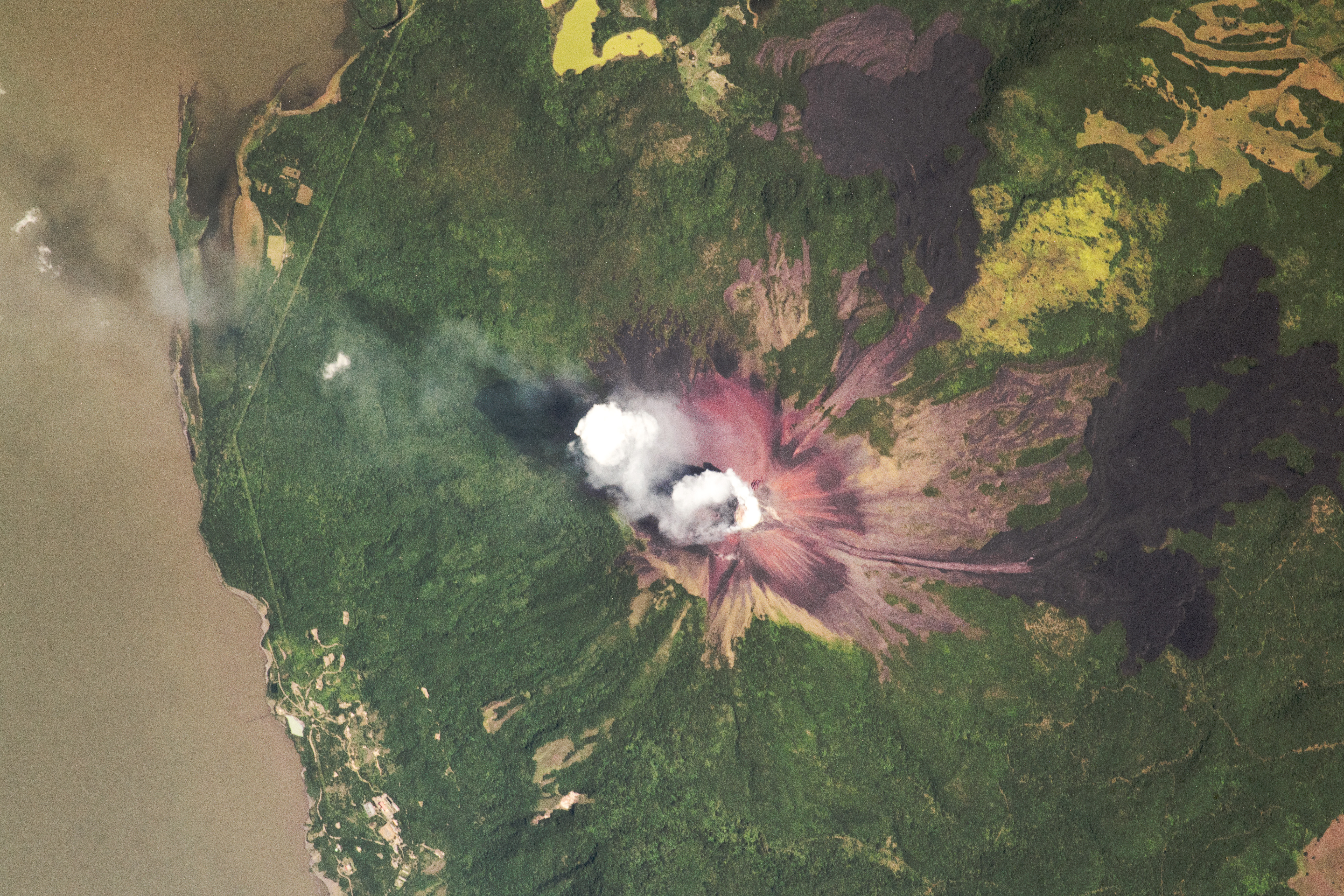
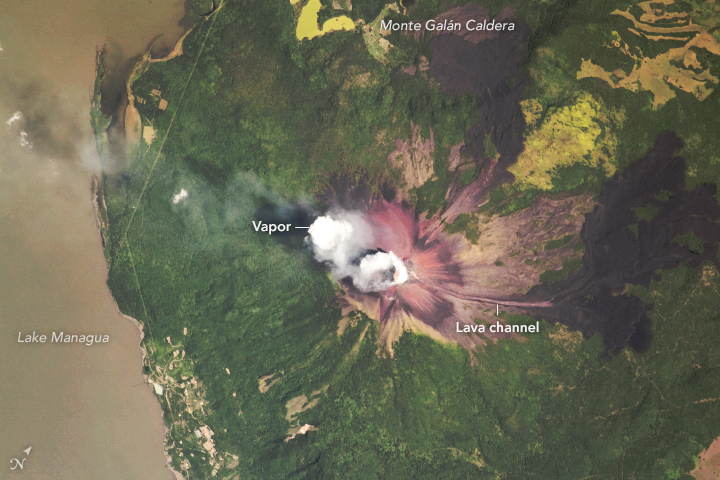
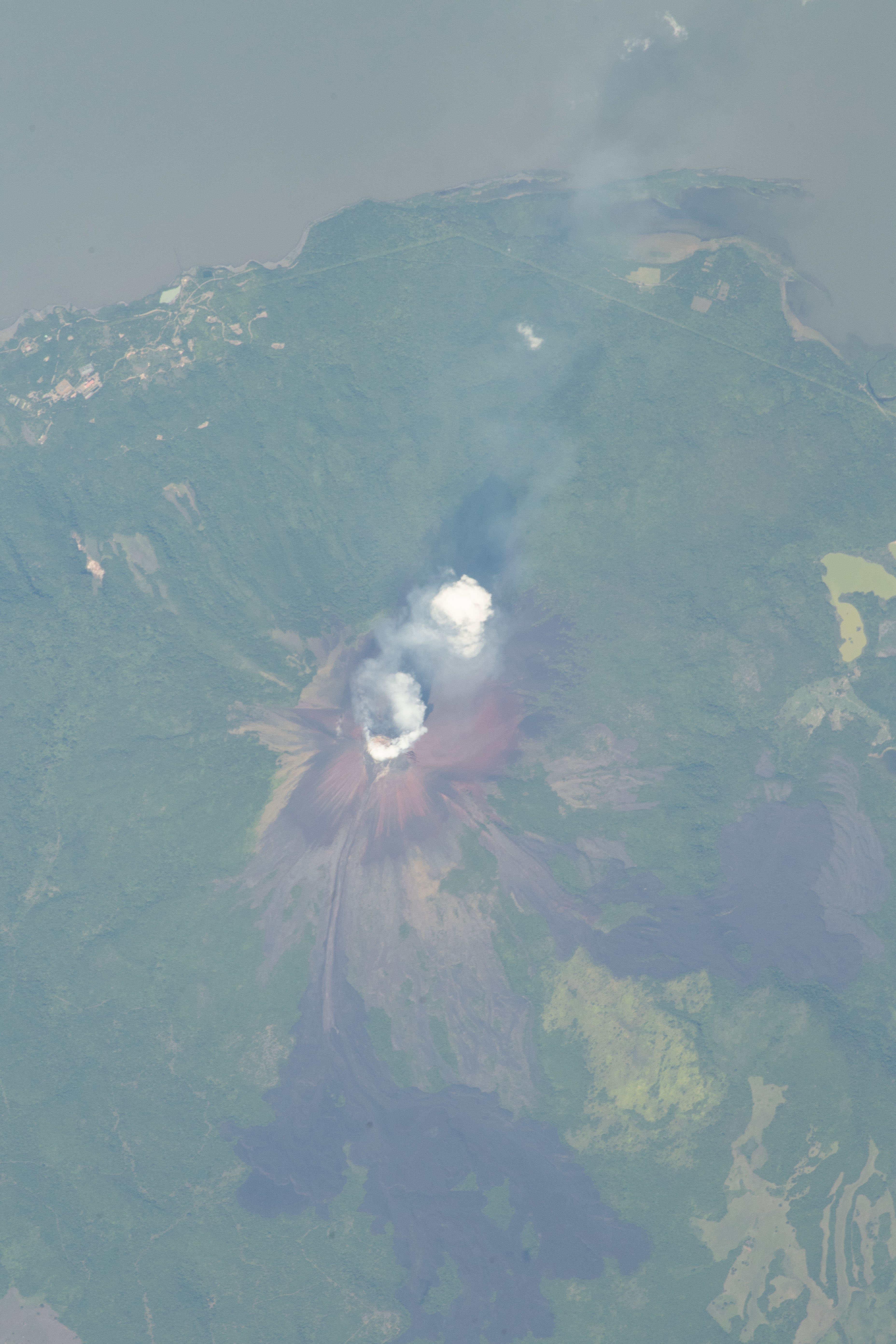

Photo center point: 12.4° N, 86.5° W
Photo center point by machine learning:
Country or Geographic Name: | NICARAGUA |
Features: | MOMOTOMBO VOLCANO, LAKE MANAGUA |
| Features Found Using Machine Learning: | |
Cloud Cover Percentage: | 10 (1-10)% |
Sun Elevation Angle: | 52° |
Sun Azimuth: | 70° |
Camera: | Nikon D5 Electronic Still Camera |
Focal Length: | 1600mm |
Camera Tilt: | 9 degrees |
Format: | 5568E: 5568 x 3712 pixel CMOS sensor, 35.9 x 23.9 mm, total pixels: 21.33 million, Nikon FX format |
Film Exposure: | |
| Additional Information | |
| Width | Height | Annotated | Cropped | Purpose | Links |
|---|---|---|---|---|---|
| 5568 pixels | 3712 pixels | No | No | NASA's Earth Observatory web site | Download Image |
| 720 pixels | 480 pixels | Yes | Yes | NASA's Earth Observatory web site | Download Image |
| 3712 pixels | 5568 pixels | No | No | Download Image | |
| 427 pixels | 640 pixels | No | No | Download Image |
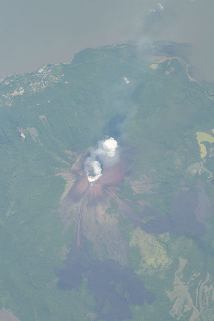
An astronaut aboard the International Space Station (ISS) shot this photograph of Momotombo Volcano in western Nicaragua. This active stratovolcano was once described as "the smoking terror" in a 1902 stereograph set.
In 1898, Lieutenant Walker of the U.S. Navy surveyed Nicaragua for a potential canal route. As Walker traversed the area near Momotombo, he described the volcano as a lofty, sulfur-stained peak emitting large volumes of vapor from the summit. The plume in this July 2018 image may be similar to the vapor described by Walker. Seven years after Walker's survey (1905), Momotombo erupted. More than 100 years later, a new eruptive phase began in 2015.
A channel runs down the eastern flank of the volcano, where lava has reached low-lying surroundings. This channel existed before the 2015 eruption, so it gave the most recent lava flow an easy path down from the crater. Lava levees appear on either side of the channel as dark rock.
A geothermal field surrounds Momotombo, and it has been used to produce renewable energy since 1983. Hot fumaroles - openings at Earth's surface where volcanic gas or steam is emitted - are found around Momotombo. The presence of fumaroles indicates that magma is near the surface, creating the hot conditions for geothermal energy to be harnessed.
Due to the northeastward subduction of the Cocos Plate beneath Nicaragua, many volcanoes can be found along the country's western coast. Just north of Momotombo lies the Monte Galan caldera, a circular volcanic depression filled with older volcanic deposits, vegetation, and small lagoons. Momotombo also shares a lakeshore with the dormant Apoyeque Volcano along Lake Managua. Together they make up a small portion of the greater Ring of Fire.
