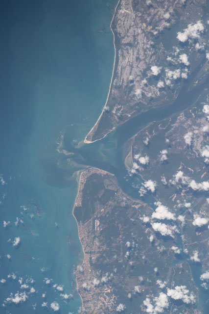
ISS056-E-200603
| NASA Photo ID | ISS056-E-200603 |
| Focal Length | 800mm |
| Date taken | 2018.10.01 |
| Time taken | 15:11:44 GMT |


Spacecraft nadir point: 11.1° S, 38.9° W
Photo center point: 13.1° S, 38.8° W
Photo center point by machine learning:
Photo center point: 13.1° S, 38.8° W
Photo center point by machine learning:
Nadir to Photo Center: South
Spacecraft Altitude: 221 nautical miles (409km)
Country or Geographic Name: | BRAZIL |
Features: | BARRA DO GARCEZ, JIRIBATUBA, TINGUI, JAGUARIPE |
| Features Found Using Machine Learning: | |
Cloud Cover Percentage: | 10 (1-10)% |
Sun Elevation Angle: | 76° |
Sun Azimuth: | 303° |
Camera: | Nikon D5 Electronic Still Camera |
Focal Length: | 800mm |
Camera Tilt: | Low Oblique |
Format: | 5568E: 5568 x 3712 pixel CMOS sensor, 35.9 x 23.9 mm, total pixels: 21.33 million, Nikon FX format |
Film Exposure: | |
| Additional Information | |
| Width | Height | Annotated | Cropped | Purpose | Links |
|---|---|---|---|---|---|
| 3712 pixels | 5568 pixels | No | No | Download Image | |
| 427 pixels | 640 pixels | No | No | Download Image |
Download Packaged File
Download a Google Earth KML for this Image
View photo footprint information
Download a GeoTIFF for this photo
Image Caption: CATALOGED BY UT-BROWNSVILLE/STARGATE
