ISS056-E-13626

| NASA Photo ID | ISS056-E-13626 |
| Focal Length | 78mm |
| Date taken | 2018.06.17 |
| Time taken | 18:47:05 GMT |
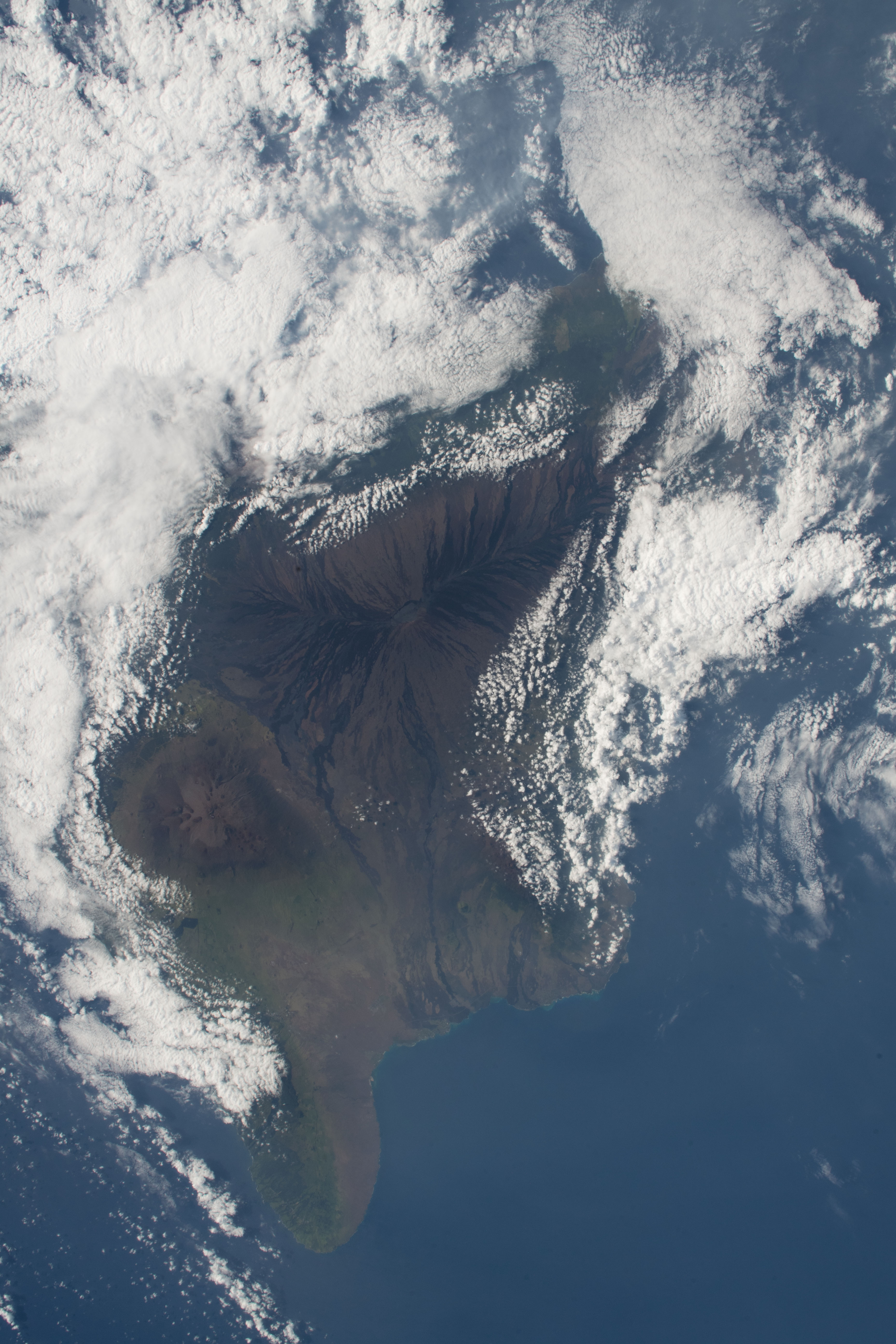

Spacecraft nadir point: 17.6° N, 157.5° W
Photo center point: 19.5° N, 155.5° W
Photo center point by machine learning:
Photo center point: 19.5° N, 155.5° W
Photo center point by machine learning:
Nadir to Photo Center: Northeast
Spacecraft Altitude: 219 nautical miles (406km)
Country or Geographic Name: | USA-HAWAII |
Features: | PACIFIC OCEAN, ISLAND OF HAWAI'I, MAUNA LOA VOLCANO, MAUNA KEA VOLCANO |
| Features Found Using Machine Learning: | |
Cloud Cover Percentage: | 75 (51-75)% |
Sun Elevation Angle: | 38° |
Sun Azimuth: | 74° |
Camera: | Nikon D5 Electronic Still Camera |
Focal Length: | 78mm |
Camera Tilt: | 37 degrees |
Format: | 5568E: 5568 x 3712 pixel CMOS sensor, 35.9 x 23.9 mm, total pixels: 21.33 million, Nikon FX format |
Film Exposure: | |
| Additional Information | |
| Width | Height | Annotated | Cropped | Purpose | Links |
|---|---|---|---|---|---|
| 3712 pixels | 5568 pixels | No | No | Download Image | |
| 427 pixels | 640 pixels | No | No | Download Image |
Download Packaged File
Download a Google Earth KML for this Image
View photo footprint information
Download a GeoTIFF for this photo
Image Caption: CATALOGED BY TEXAS STATE UNIVERSITY
