ISS056-E-1165
| NASA Photo ID | ISS056-E-1165 |
| Focal Length | 28mm |
| Date taken | 2018.06.03 |
| Time taken | 18:57:36 GMT |
Cloud masks available for this image:
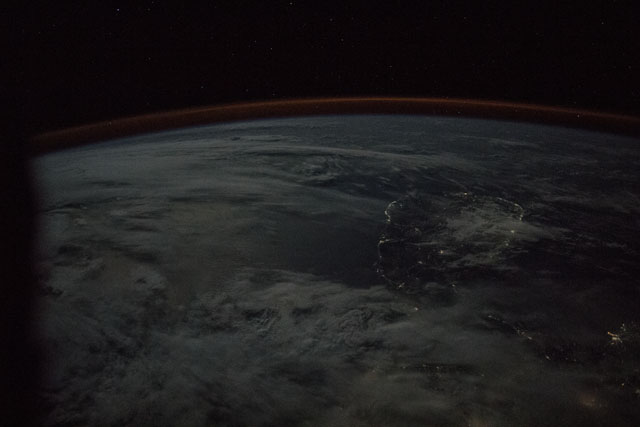
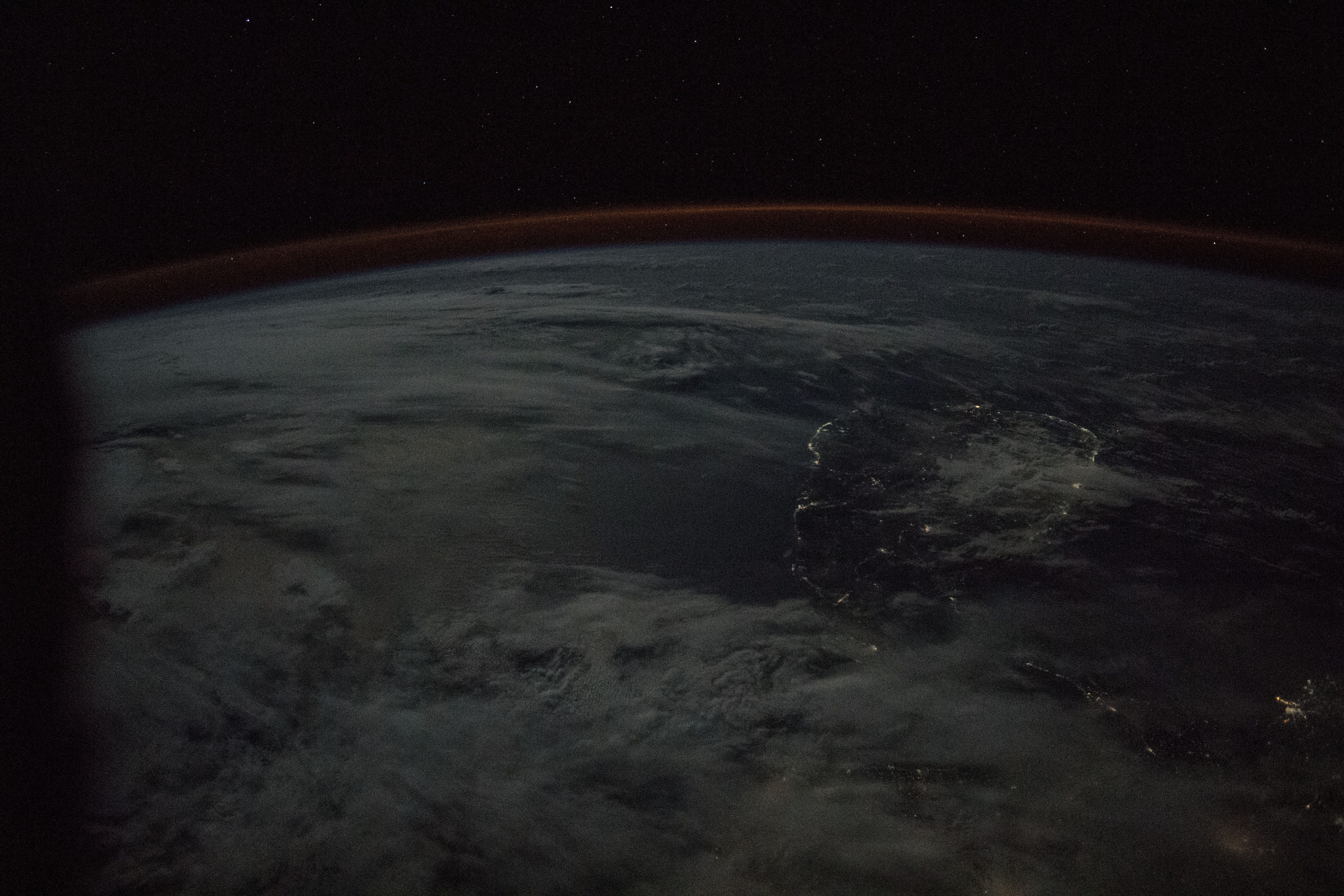
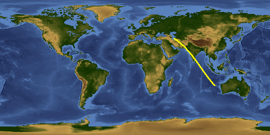
Spacecraft nadir point: 12.9° N, 78.4° E
Photo center point: 7.5° N, 82.5° E
Photo center point by machine learning:
Photo center point: 7.5° N, 82.5° E
Photo center point by machine learning:
Nadir to Photo Center: Southeast
Spacecraft Altitude: 217 nautical miles (402km)
Country or Geographic Name: | SRI LANKA |
Features: | SRI LANKA |
| Features Found Using Machine Learning: | PAN- |
Cloud Cover Percentage: | 75 (51-75)% |
Sun Elevation Angle: | -55° |
Sun Azimuth: | 5° |
Camera: | Nikon D5 Electronic Still Camera |
Focal Length: | 28mm |
Camera Tilt: | High Oblique |
Format: | 5568E: 5568 x 3712 pixel CMOS sensor, 35.9 x 23.9 mm, total pixels: 21.33 million, Nikon FX format |
Film Exposure: | |
| Additional Information | |
This photo is one of the photos used to create this time-lapse video:
| Width | Height | Annotated | Cropped | Purpose | Links |
|---|---|---|---|---|---|
| 5568 pixels | 3712 pixels | No | No | Download Image | |
| 640 pixels | 427 pixels | No | No | Download Image |
Download Packaged File
Download a Google Earth KML for this Image
View photo footprint information
Download a GeoTIFF for this photo
Image Caption: CATALOGED BY TEXAS STATE UNIVERSITY
