ISS055-E-69945

| NASA Photo ID | ISS055-E-69945 |
| Focal Length | 1600mm |
| Date taken | 2018.05.13 |
| Time taken | 18:15:49 GMT |


Spacecraft nadir point: 20.8° N, 152.5° W
Photo center point: 19.4° N, 155.3° W
Photo center point by machine learning:
Photo center point: 19.4° N, 155.3° W
Photo center point by machine learning:
Nadir to Photo Center: West
Spacecraft Altitude: 217 nautical miles (402km)
Country or Geographic Name: | USA-HAWAII |
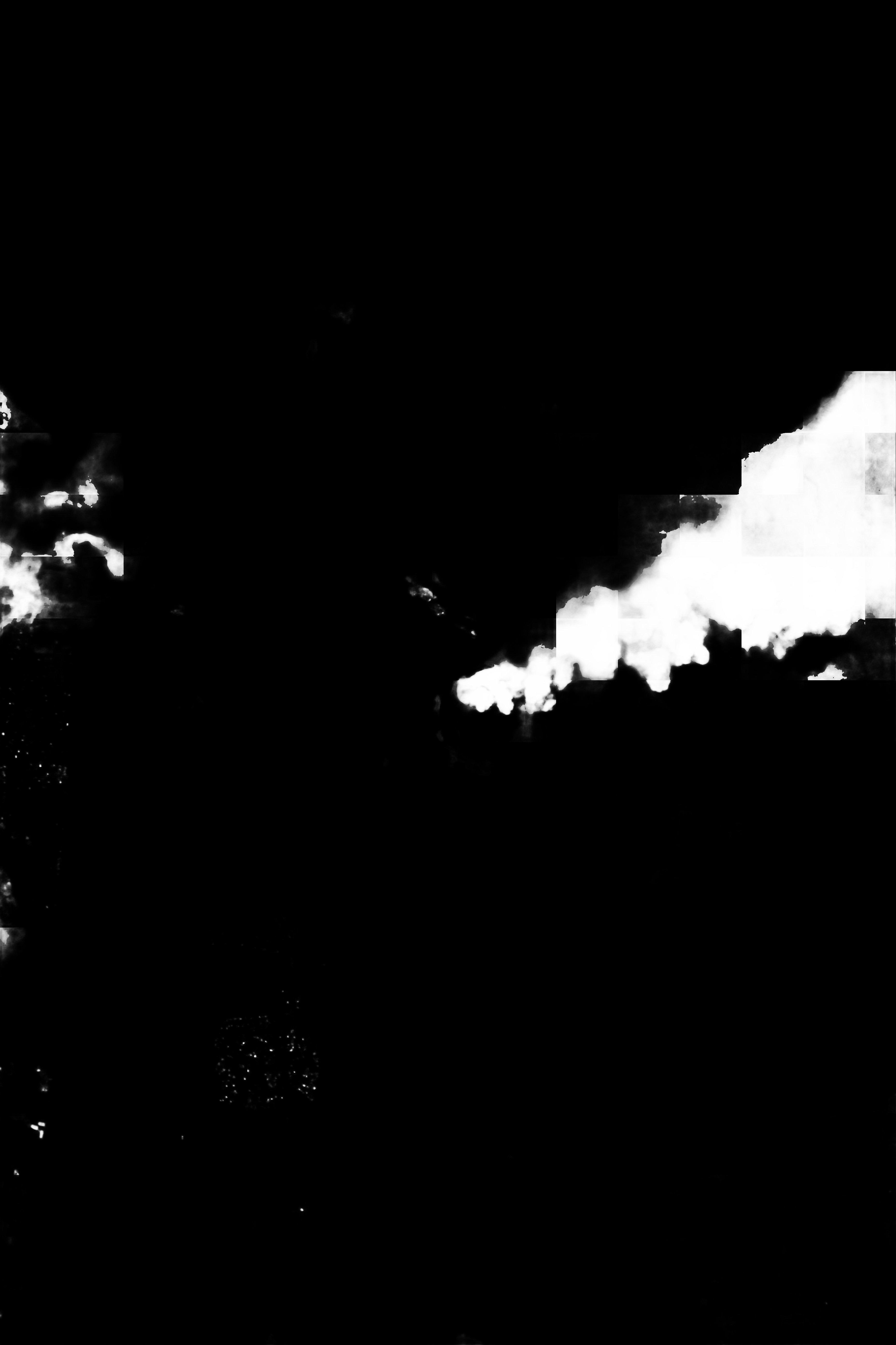
Features: | ISLAND OF HAWAI'I, VOLCANO, KILAUEA, KEANAKOKO'I CRATER, VOLCANIC ERUPTION PLUME, HALE MA'UMA'U CRATER |
| Features Found Using Machine Learning: | |
Cloud Cover Percentage: | 10 (1-10)% |
Sun Elevation Angle: | 36° |
Sun Azimuth: | 82° |
Camera: | Nikon D5 Electronic Still Camera |
Focal Length: | 1600mm |
Camera Tilt: | 41 degrees |
Format: | 5568E: 5568 x 3712 pixel CMOS sensor, 35.9 x 23.9 mm, total pixels: 21.33 million, Nikon FX format |
Film Exposure: | |
| Additional Information | |
| Width | Height | Annotated | Cropped | Purpose | Links |
|---|---|---|---|---|---|
| 3712 pixels | 5568 pixels | No | No | Download Image | |
| 427 pixels | 640 pixels | No | No | Download Image |
Download Packaged File
Download a Google Earth KML for this Image
View photo footprint information
Download a GeoTIFF for this photo
Georeferenced by human interaction - exported 2018-05-16-003348-UTCAn explanation of the georeference file(s) above
Image Caption: This handheld, visible wavelength (red-green-blue) digital camera image of a steam and ash plume rising from Hale Ma'uma'u Crater on Kilauea Volcano, Hawai'i was taken by a crew member on the International Space Station (ISS) on May 13, 2018 using a Nikon D5 camera and an 1600 mm lens. The image was taken during the 2018 Kilauea Volcano Lower East Rift Zone eruptive activity. Crew members on the ISS were requested to take images throughout the eruption by the JSC Earth Sciences and Remote Sensing (ESRS) Unit. Imagery collected by handheld cameras was then georeferenced by the ESRS for delivery to end users (the United States Geological Survey and NASA Earth Sciences Disasters Program).
