ISS054-E-53958
| NASA Photo ID | ISS054-E-53958 |
| Focal Length | 200mm |
| Date taken | 2018.02.24 |
| Time taken | 08:44:50 GMT |
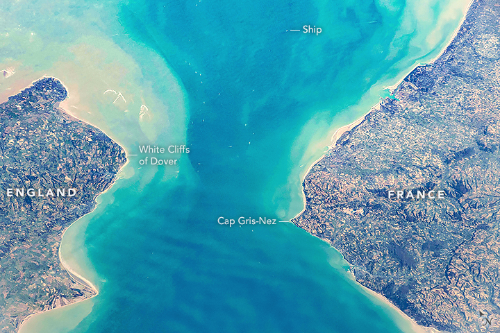
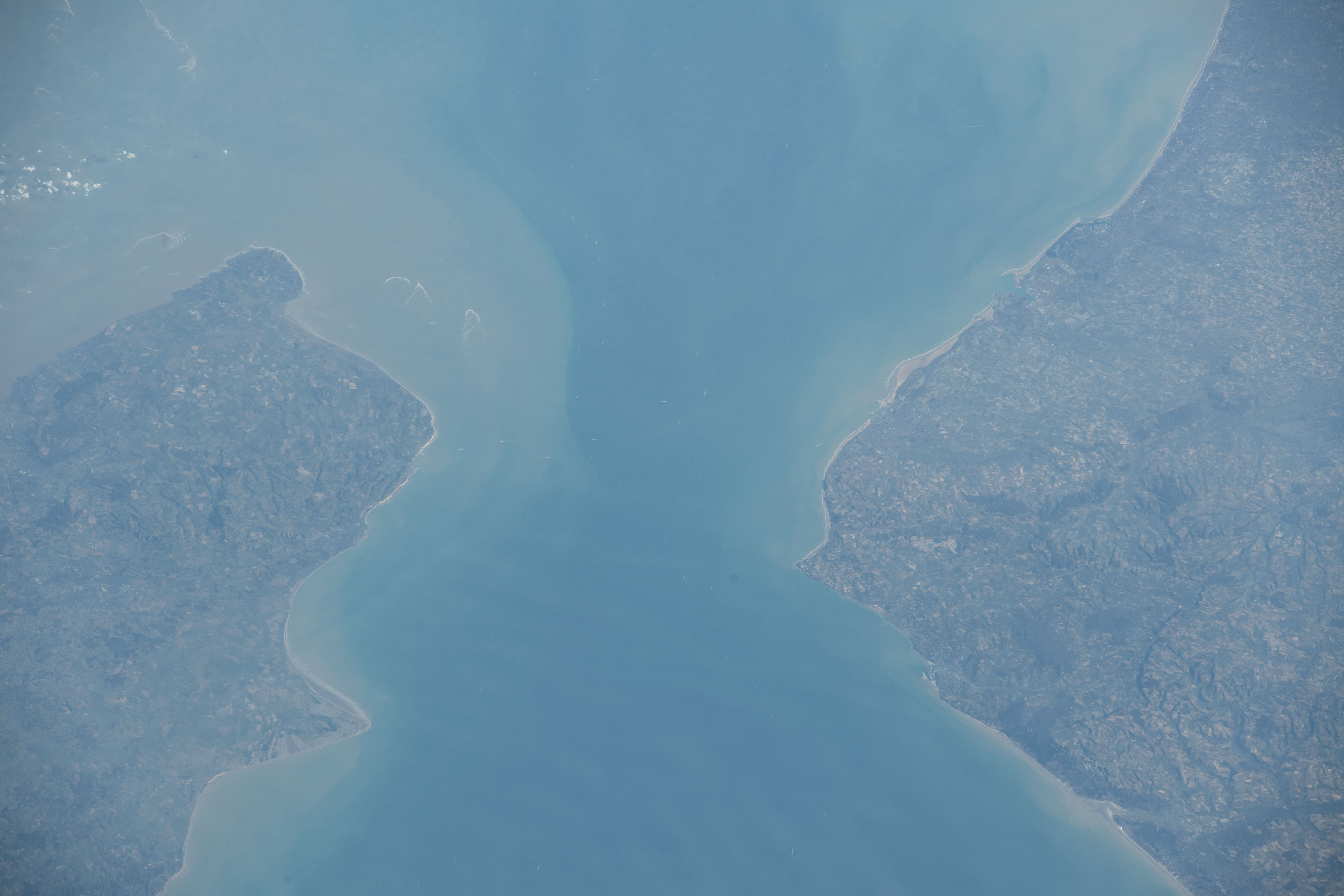


Photo center point: 51.0° N, 1.6° E
Photo center point by machine learning:
Country or Geographic Name: | FRANCE |
Features: | STRAIT OF DOVER, CALAIS, ENGLISH CHANNEL |
| Features Found Using Machine Learning: | |
Cloud Cover Percentage: | 10 (1-10)% |
Sun Elevation Angle: | 14° |
Sun Azimuth: | 121° |
Camera: | Nikon D5 Electronic Still Camera |
Focal Length: | 200mm |
Camera Tilt: | High Oblique |
Format: | 5568E: 5568 x 3712 pixel CMOS sensor, 35.9 x 23.9 mm, total pixels: 21.33 million, Nikon FX format |
Film Exposure: | |
| Additional Information | |
| Width | Height | Annotated | Cropped | Purpose | Links |
|---|---|---|---|---|---|
| 720 pixels | 480 pixels | Yes | Yes | NASA's Earth Observatory web site | Download Image |
| 5568 pixels | 3712 pixels | No | No | Download Image | |
| 640 pixels | 427 pixels | No | No | Download Image |
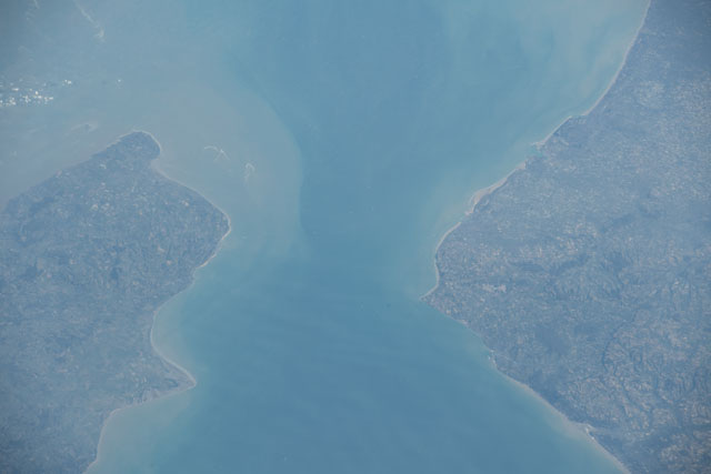
An astronaut aboard the International Space Station shot this photograph of the Strait of Dover, the narrowest part of the English Channel.
Over the years, adventurous swimmers have attempted to swim the 35-kilometers (21 miles) from Dover, England, to the French coastline at Cap Gris-Nez. Swimmers commonly follow a curved path due to tidal currents, making the actual route longer than the projected straight-line distance between the coasts. This challenge can take swimmers 7 to 20 hours to complete one-way, and few have chosen to swim back.
Dover is famous for its White Cliffs, a section of coastline with abrupt cliffs made of a stark white chalk. The same geologic formation is found across the channel at Cap Blanc-Nez, indicating that the land surface between the two coasts was once continuous. Erosion of this surface over hundreds of thousands of years, followed by rising sea levels in the past 10,000 years, created the English Channel.
Beneath the Strait of Dover, the undersea Channel Tunnel allows trains and cars to quickly travel from southern England to northern France. This helps decrease maritime traffic, as more than 400 commercial vessels cross the Strait daily. Dozens of ships are visible in this photograph.
