ISS053-E-357550
| NASA Photo ID | ISS053-E-357550 |
| Focal Length | 500mm |
| Date taken | 2017.12.11 |
| Time taken | 07:43:29 GMT |
5568 x 3712 pixels 720 x 480 pixels 5568 x 3712 pixels 640 x 427 pixels
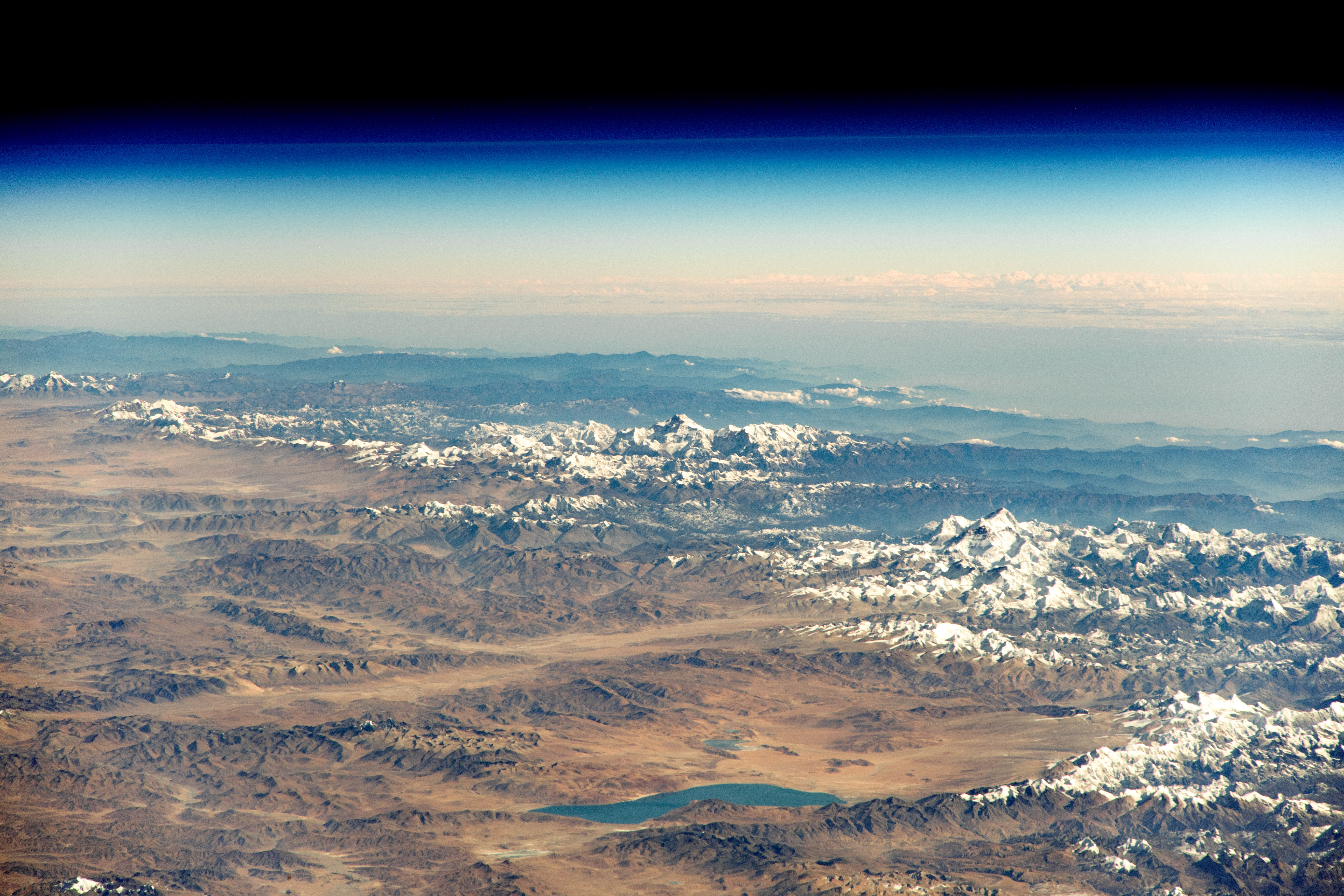
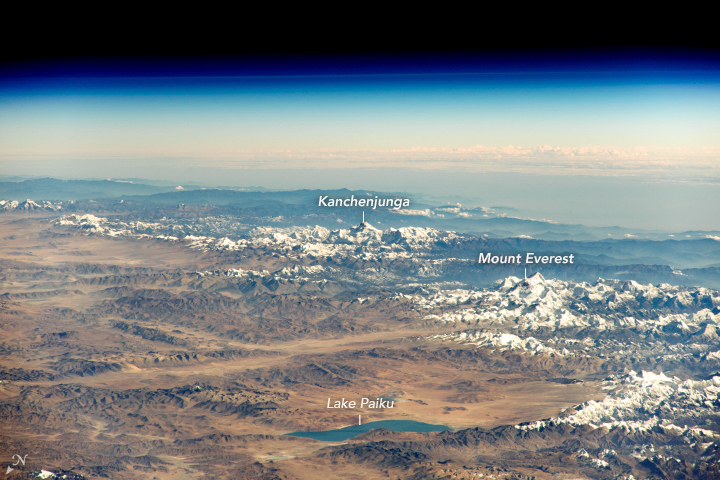
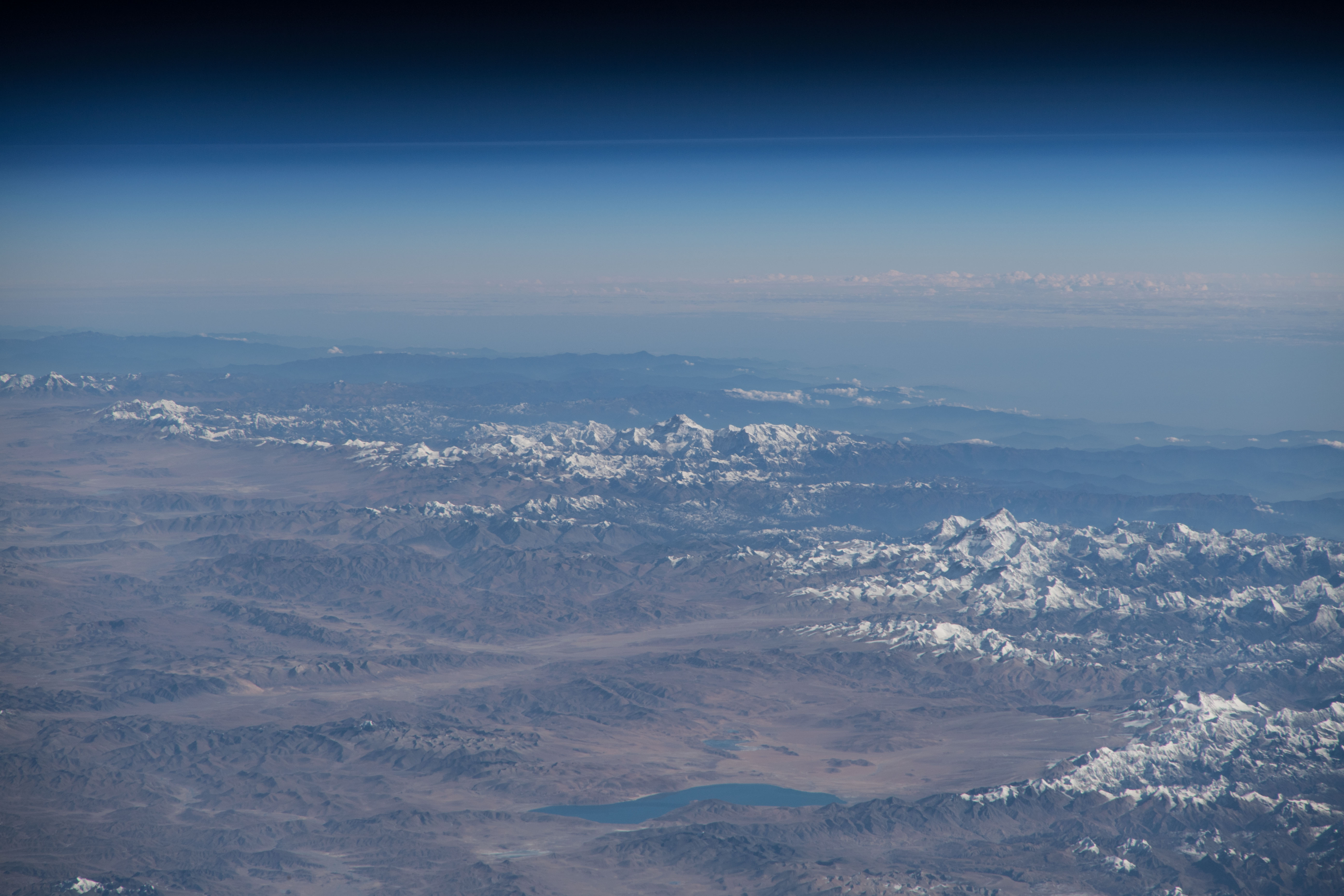
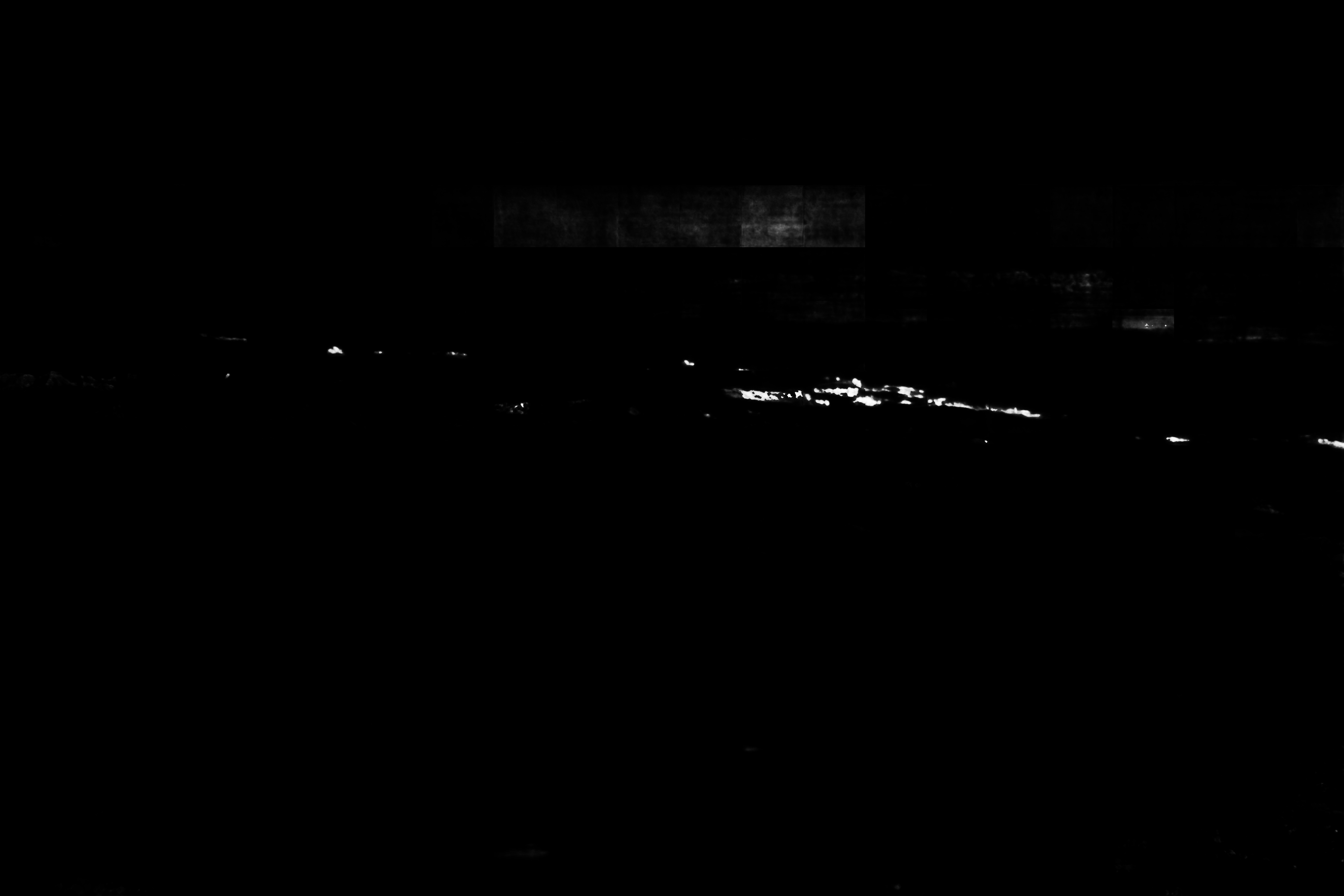
Photo center point: 28.3° N, 87.1° E
Photo center point by machine learning:
Country or Geographic Name: | CHINA |
Features: | PAN- HIMALAYAS, MT. EVEREST, LAKE PAIKU |
| Features Found Using Machine Learning: | PAN- |
Cloud Cover Percentage: | 25 (11-25)% |
Sun Elevation Angle: | 33° |
Sun Azimuth: | 189° |
Camera: | Nikon D5 Electronic Still Camera |
Focal Length: | 500mm |
Camera Tilt: | High Oblique |
Format: | 5568E: 5568 x 3712 pixel CMOS sensor, 35.9 x 23.9 mm, total pixels: 21.33 million, Nikon FX format |
Film Exposure: | |
| Additional Information | |
| Width | Height | Annotated | Cropped | Purpose | Links |
|---|---|---|---|---|---|
| 5568 pixels | 3712 pixels | No | No | NASA's Earth Observatory web site | Download Image |
| 720 pixels | 480 pixels | Yes | No | NASA's Earth Observatory web site | Download Image |
| 5568 pixels | 3712 pixels | No | No | Download Image | |
| 640 pixels | 427 pixels | No | No | Download Image |
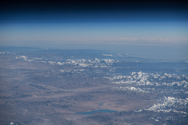
An astronaut aboard the International Space Station shot this oblique photograph of Mount Everest, Earth's tallest mountain (when measured from sea level). Standing on the border of China and Nepal, Everest is the centerpiece of the Great Himalaya Range, the highest and northernmost section of the Himalayas. Many of the world's tallest peaks are found here, including Kanchenjunga (8,586 meters/28,169 feet) and Everest (8,850 meters/29,035 feet). Stretching 2,300 kilometers (1,400 miles) across Pakistan, India, Nepal, and China, the mountain range has an average elevation above 6,100 meters (20,000 feet).
The snow-capped peaks of the Himalayas persist year-round thanks to two main periods of precipitation. Winter snow accumulates from December through May, with greater snowfall occurring in the western part of the range. By the end of May, summer monsoon winds start to channel moist air toward the eastern Himalayas, where precipitation will occur as either rain or snow until September. The fairest weather in the region occurs from September through early December.
The peaks of the Himalayas are a dramatic expression of the massive tectonic forces that drove the crustal plates of India and Asia into each other about 40 to 50 million years ago. The Himalayas as a whole started forming 25 to 30 million years ago, while the Great Himalaya Range began building up about 2.6 million years ago. These tectonic forces are still active today, causing Everest and the surrounding mountains to rise more than 1 centimeter per year.
In addition to tectonic activity, the Himalayas have many active glaciers - the primary force behind the continuous erosion of Everest and the other peaks. As these glaciers melt, the water drains into rivers which find their way into catchments such as Lake Paiku, which collects glacial melt, snowmelt, and summer monsoon rains.
