ISS052-E-932

| NASA Photo ID | ISS052-E-932 |
| Focal Length | 500mm |
| Date taken | 2017.06.10 |
| Time taken | 22:30:52 GMT |
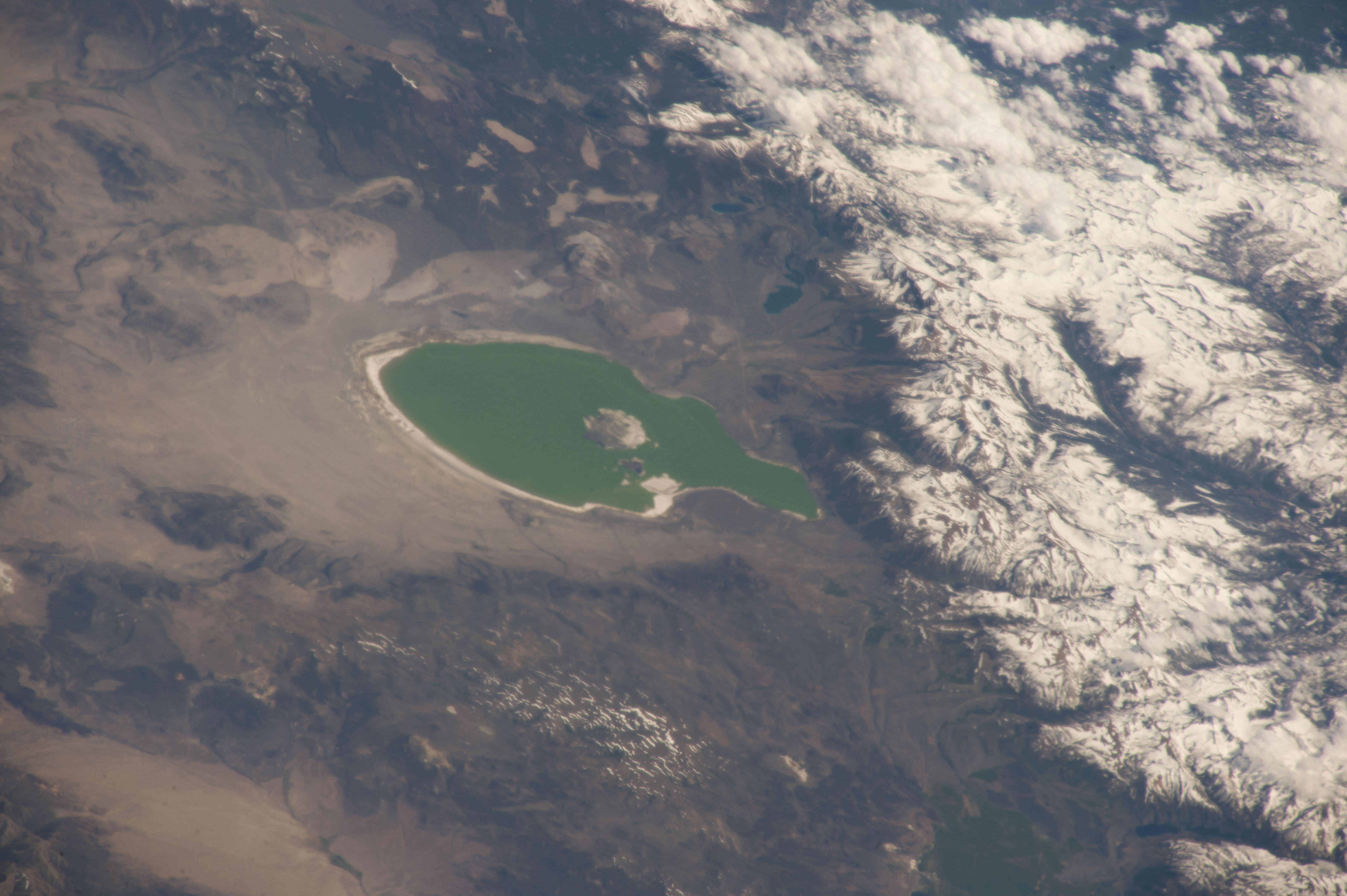

Spacecraft nadir point: 44.9° N, 116.1° W
Photo center point: 38.0° N, 119.1° W
Photo center point by machine learning:
Photo center point: 38.0° N, 119.1° W
Photo center point by machine learning:
Nadir to Photo Center: South
Spacecraft Altitude: 217 nautical miles (402km)
Country or Geographic Name: | USA-CALIFORNIA |
Features: | MONO LAKE, GRANT LAKE, SNOW |
| Features Found Using Machine Learning: | |
Cloud Cover Percentage: | 25 (11-25)% |
Sun Elevation Angle: | 50° |
Sun Azimuth: | 252° |
Camera: | Nikon D4 Electronic Still Camera |
Focal Length: | 500mm |
Camera Tilt: | High Oblique |
Format: | 4928E: 4928 x 3280 pixel CMOS sensor, 36.0mm x 23.9mm, total pixels: 16.6 million, Nikon FX format |
Film Exposure: | |
| Additional Information | |
| Width | Height | Annotated | Cropped | Purpose | Links |
|---|---|---|---|---|---|
| 4928 pixels | 3280 pixels | No | No | Download Image | |
| 640 pixels | 426 pixels | No | No | Download Image |
Download Packaged File
Download a Google Earth KML for this Image
View photo footprint information
Download a GeoTIFF for this photo
Image Caption: none
