ISS052-E-8401
| NASA Photo ID | ISS052-E-8401 |
| Focal Length | 1150mm |
| Date taken | 2017.06.24 |
| Time taken | 12:30:16 GMT |
4928 x 3280 pixels 720 x 480 pixels 4928 x 3280 pixels 640 x 426 pixels

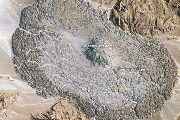


Photo center point: 28.0° N, 54.9° E
Photo center point by machine learning:
Country or Geographic Name: | IRAN |
Features: | ZAGROS MOUNTAINS, SALT GLACIER |
| Features Found Using Machine Learning: | |
Cloud Cover Percentage: | 10 (1-10)% |
Sun Elevation Angle: | 32° |
Sun Azimuth: | 282° |
Camera: | Nikon D4 Electronic Still Camera |
Focal Length: | 1150mm |
Camera Tilt: | 39 degrees |
Format: | 4928E: 4928 x 3280 pixel CMOS sensor, 36.0mm x 23.9mm, total pixels: 16.6 million, Nikon FX format |
Film Exposure: | |
| Additional Information | |
| Width | Height | Annotated | Cropped | Purpose | Links |
|---|---|---|---|---|---|
| 4928 pixels | 3280 pixels | No | No | NASA's Earth Observatory web site | Download Image |
| 720 pixels | 480 pixels | Yes | No | NASA's Earth Observatory web site | Download Image |
| 4928 pixels | 3280 pixels | No | No | Download Image | |
| 640 pixels | 426 pixels | No | No | Download Image |
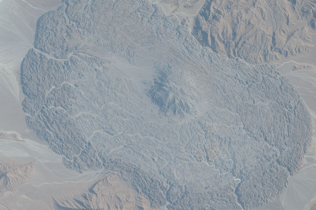
The scale and form of many impressive features on Earth's surface can only be fully appreciated through an overhead view. The astronauts on board the International Space Station may enjoy the best overhead view of all.
The Zagros Mountains of southeastern Iran are the location of numerous salt domes and salt glaciers, formed as a result of the depositional history and tectonic forces operating in the region. While many of these landscape features are named on maps, the salt glacier in this photograph remains unnamed on global maps and atlases.
The vaguely hourglass (or bowtie) shaped morphology of the salt glacier is due to the central location of the salt dome, which formed within the central Zagros ridge crest (top and lower left). Salt extruded from the dome and then flowed downslope into the adjacent valleys. For a sense of scale, the distance across the salt glacier from northwest to southeast is approximately 14 kilometers (8 miles).
Much like what happens in flowing ice glaciers, concentric transverse ridges have formed in the salt perpendicular to the flow direction. While bright salt materials are visible in stream beds incising the salt glacier, older surfaces - those farther from the central salt dome - appear dark, most likely due to windblown dust deposition over time or entrainment of sediments in the salt during flow.
