ISS052-E-78671
| NASA Photo ID | ISS052-E-78671 |
| Focal Length | 1150mm |
| Date taken | 2017.08.29 |
| Time taken | 21:01:08 GMT |
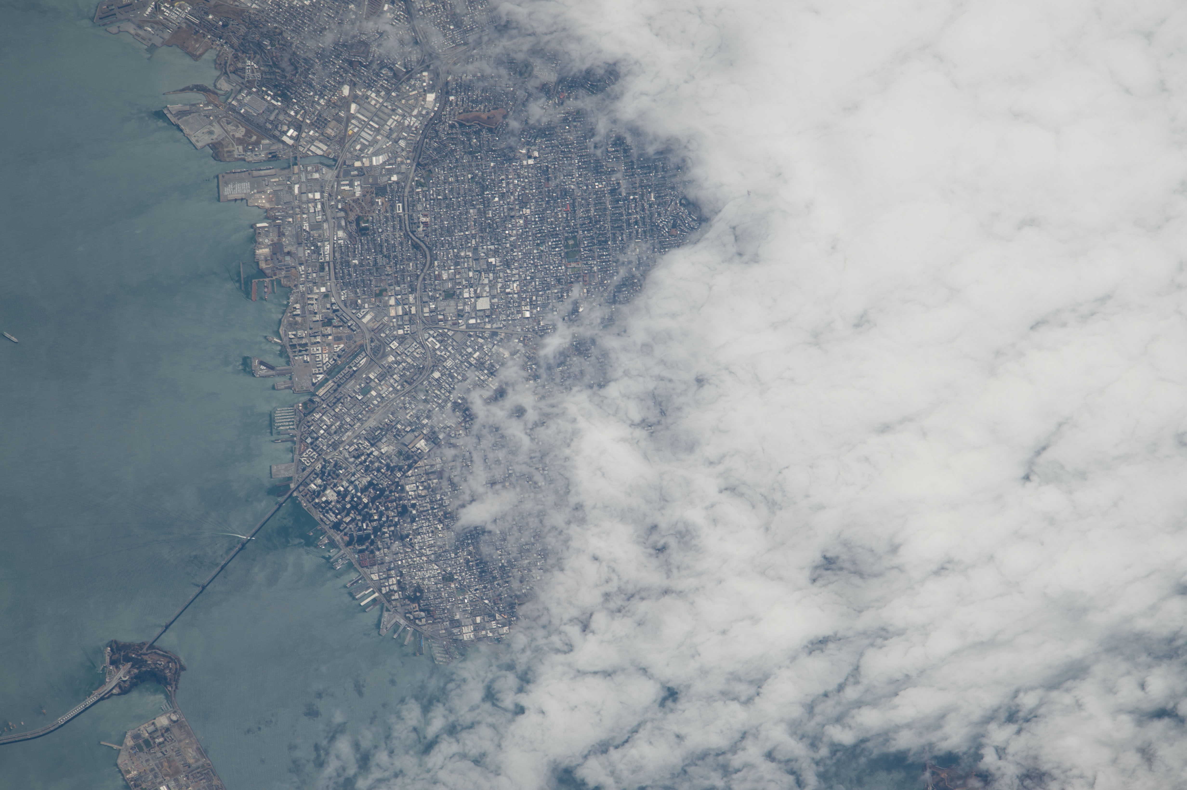


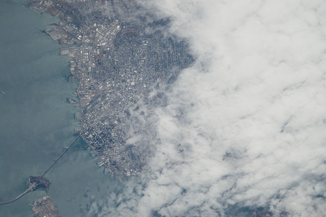
Spacecraft nadir point: 39.4° N, 122.8° W
Photo center point: 37.8° N, 122.4° W
Photo center point by machine learning: 37.78° N, 122.43° W
Photo center point: 37.8° N, 122.4° W
Photo center point by machine learning: 37.78° N, 122.43° W
Nadir to Photo Center: South
Spacecraft Altitude: 215 nautical miles (398km)

Country or Geographic Name: | USA-CALIFORNIA |
Features: | SAN FRANCISCO, SAN FRANCISCO BAY, OAKLAND BAY BRIDGE, YERBA BUENA ISLAND, TREASURE ISLAND |
| Features Found Using Machine Learning: | |
Cloud Cover Percentage: | 75 (51-75)% |
Sun Elevation Angle: | 58° |
Sun Azimuth: | 203° |
Camera: | Nikon D4 Electronic Still Camera |
Focal Length: | 1150mm |
Camera Tilt: | 25 degrees |
Format: | 4928E: 4928 x 3280 pixel CMOS sensor, 36.0mm x 23.9mm, total pixels: 16.6 million, Nikon FX format |
Film Exposure: | |
| Additional Information | |
| Width | Height | Annotated | Cropped | Purpose | Links |
|---|---|---|---|---|---|
| 4928 pixels | 3280 pixels | No | No | Download Image | |
| 640 pixels | 426 pixels | No | No | Download Image |
Download Packaged File
Download a Google Earth KML for this Image
View photo footprint information
Download a GeoTIFF for this photo
Image Caption: none
