ISS052-E-45458
| NASA Photo ID | ISS052-E-45458 |
| Focal Length | 1150mm |
| Date taken | 2017.08.12 |
| Time taken | 09:04:11 GMT |
4928 x 3280 pixels 720 x 480 pixels 150 x 100 pixels 4928 x 3280 pixels 640 x 426 pixels
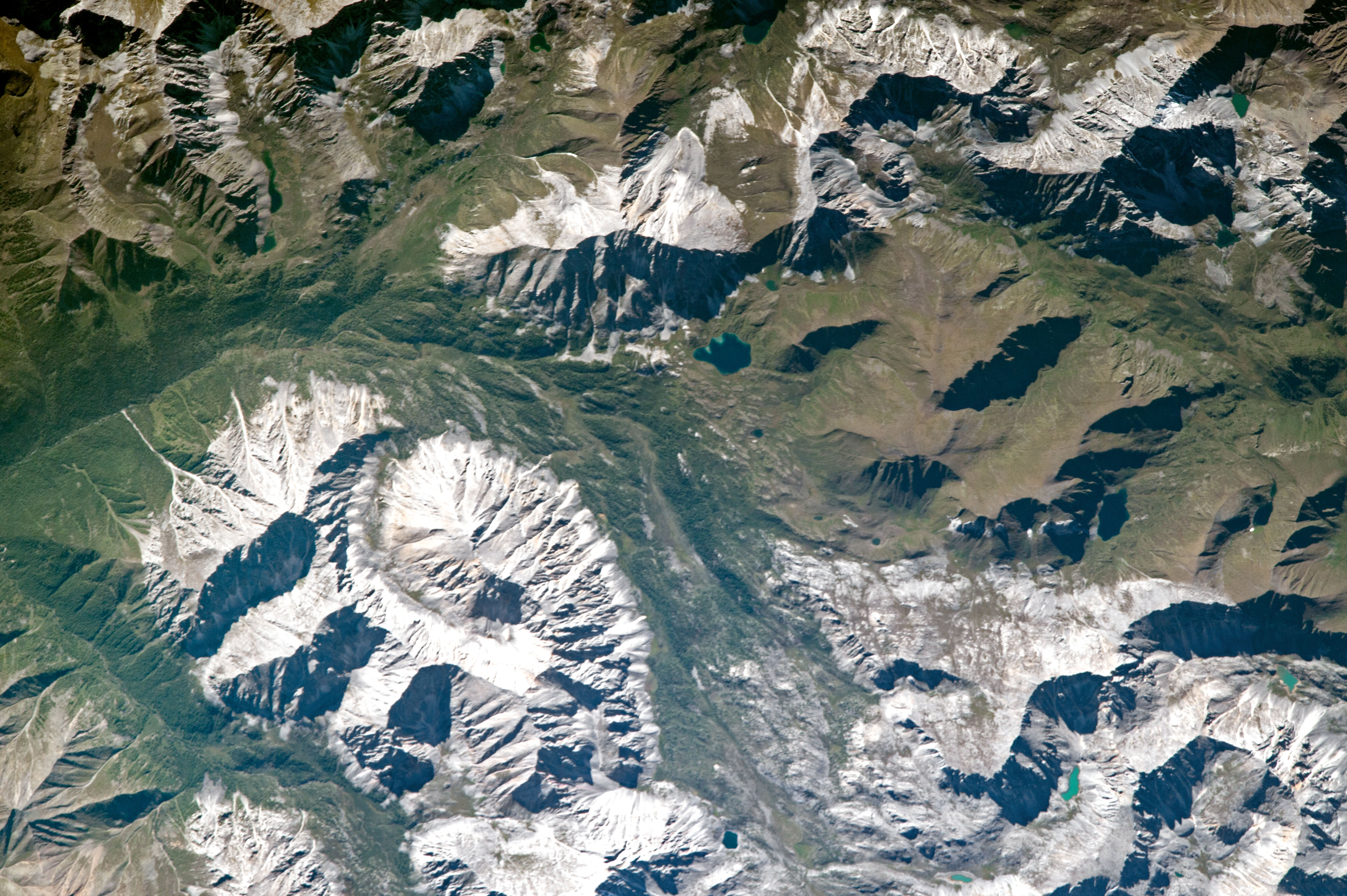
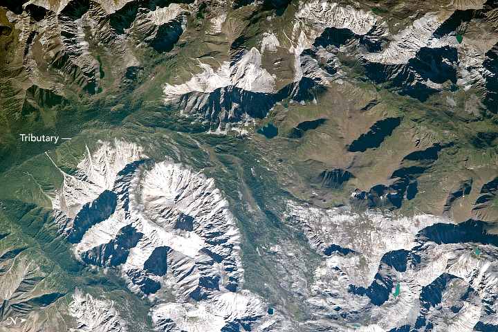

Photo center point: 51.0° N, 98.1° E
Photo center point by machine learning:
Country or Geographic Name: | MONGOLIA |
Features: | EASTERN SAYAN MOUNTAINS |
| Features Found Using Machine Learning: | |
Cloud Cover Percentage: | 10 (1-10)% |
Sun Elevation Angle: | 35° |
Sun Azimuth: | 249° |
Camera: | Nikon D4 Electronic Still Camera |
Focal Length: | 1150mm |
Camera Tilt: | 02 degrees |
Format: | 4928E: 4928 x 3280 pixel CMOS sensor, 36.0mm x 23.9mm, total pixels: 16.6 million, Nikon FX format |
Film Exposure: | |
| Additional Information | |
| Width | Height | Annotated | Cropped | Purpose | Links |
|---|---|---|---|---|---|
| 4928 pixels | 3280 pixels | No | No | NASA's Earth Observatory web site | Download Image |
| 720 pixels | 480 pixels | Yes | No | NASA's Earth Observatory web site | Download Image |
| 150 pixels | 100 pixels | Yes | Yes | NASA's Earth Observatory web site | Download Image |
| 4928 pixels | 3280 pixels | No | No | Download Image | |
| 640 pixels | 426 pixels | No | No | Download Image |
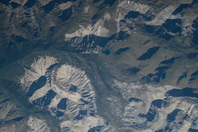
An astronaut aboard the International Space Station captured this long lens photograph of part of the Eastern Sayan Mountains in northern Mongolia. Shadows are cast on the mountain faces as the sun sets in the west and darkens the adjacent valleys. Lower elevations are indicated by taiga forests while snow covers mountain tops mostly bare of vegetation. The mountains are largely uninhabited; the closest mapped town is approximately 93 kilometers (58 miles) from image center. The region has served as a crossroads for journeyers and traders between Mongolia and Russia for centuries.
According to the Koppen Climate Classification, the region is classified as Dwc- snow with dry winters and cool summers. With slight fluctuations in temperature, snow melt and occasional precipitation travels down the mountain sides and into tributaries on the low river valley. These tributaries flow east, approximately 149 kilometers (155 miles), before emptying into Lake Khuvsgul, the largest fresh water lake in Mongolia by volume.
