ISS052-E-45251
| NASA Photo ID | ISS052-E-45251 |
| Focal Length | 1150mm |
| Date taken | 2017.08.12 |
| Time taken | 08:53:43 GMT |
4928 x 3280 pixels 720 x 480 pixels 4928 x 3280 pixels 640 x 426 pixels
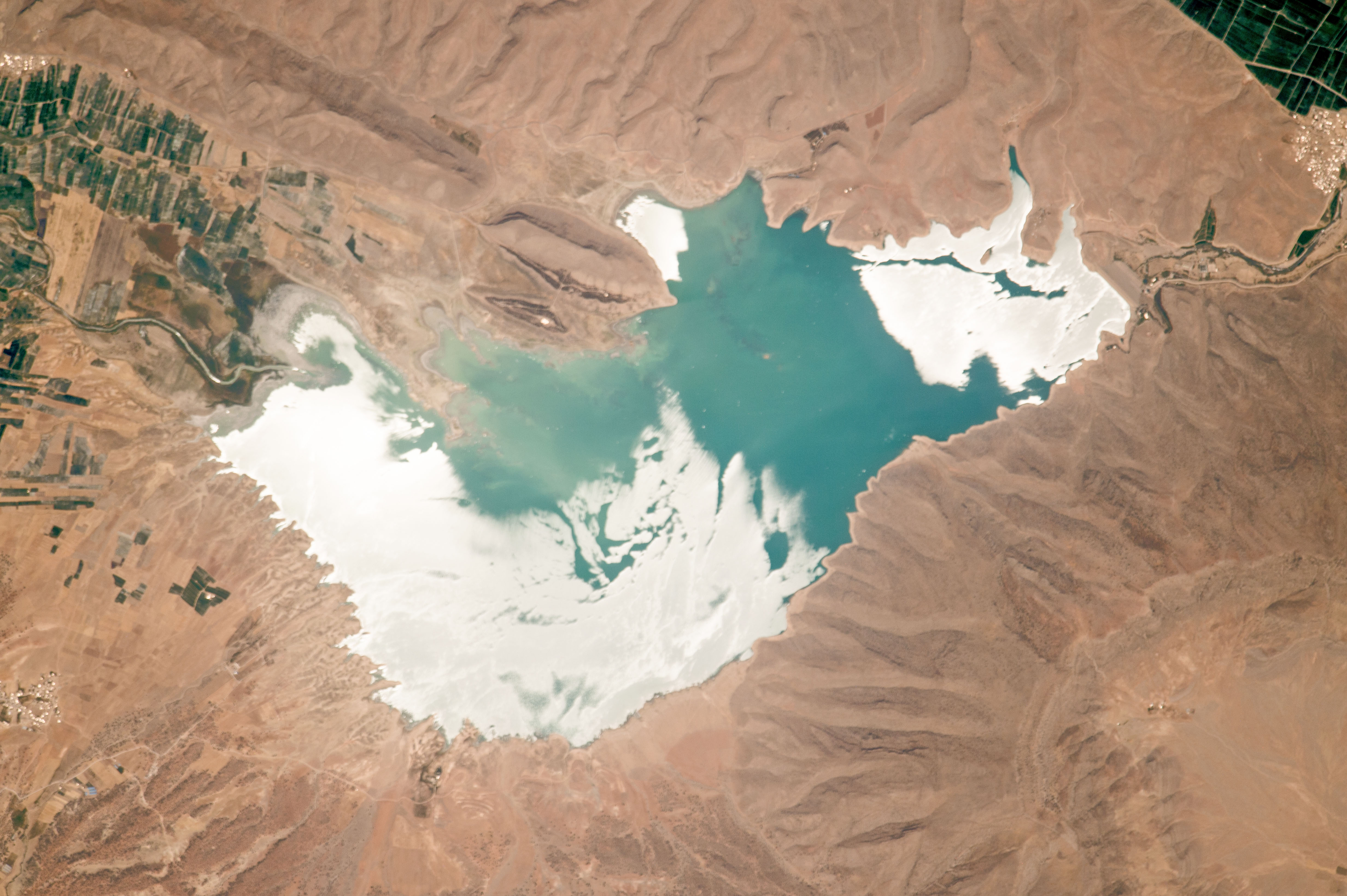
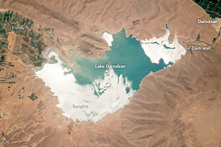


Photo center point: 30.2° N, 52.4° E
Photo center point by machine learning:
Country or Geographic Name: | IRAN |
Features: | DOROUDZAN LAKE, GLINT, AGR. |
| Features Found Using Machine Learning: | |
Cloud Cover Percentage: | 10 (1-10)% |
Sun Elevation Angle: | 73° |
Sun Azimuth: | 195° |
Camera: | Nikon D4 Electronic Still Camera |
Focal Length: | 1150mm |
Camera Tilt: | 16 degrees |
Format: | 4928E: 4928 x 3280 pixel CMOS sensor, 36.0mm x 23.9mm, total pixels: 16.6 million, Nikon FX format |
Film Exposure: | |
| Additional Information | |
| Width | Height | Annotated | Cropped | Purpose | Links |
|---|---|---|---|---|---|
| 4928 pixels | 3280 pixels | No | No | NASA's Earth Observatory web site | Download Image |
| 720 pixels | 480 pixels | Yes | Yes | NASA's Earth Observatory web site | Download Image |
| 4928 pixels | 3280 pixels | No | No | Download Image | |
| 640 pixels | 426 pixels | No | No | Download Image |
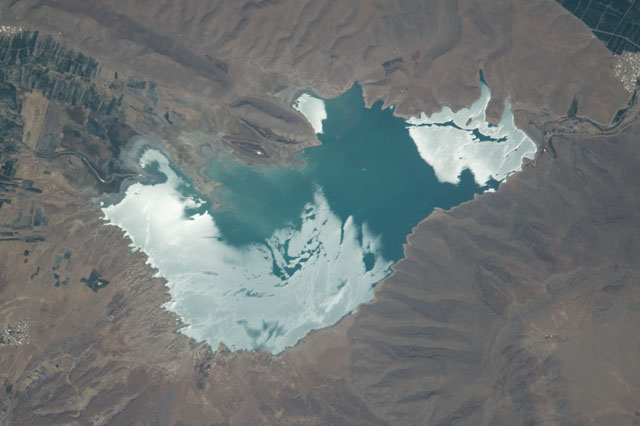
An astronaut aboard the International Space Station (ISS) focused a camera lens on a brilliant spot in Iran: the sun reflecting off Darodzan Lake. This waterbody in the desert, surrounded by the Zagros Mountains, is impounded behind a dam wall just upstream of the town of Darodzan.
Winds ruffle the water surface so that the reflection pattern is quite varied; it changes by the minute when viewed from the ISS. At the moment this image was taken, the sunglint effect was strongest near the dam wall. (The science of sunglint is explained here.) Other bright streaks in the middle of the lake show the counter-clockwise circulation of water. Yet more streaks show the direction of the wind (from the west).
Agricultural fields in deserts are closely tied to sources of water. In this region, fields are clustered along the river that feeds the lake. The river enters Darodzan Lake at a small delta (image left). Other fields are clustered downstream of the dam wall, next to the town. The dam wall itself was built at a narrow gap in steep ridges.
