ISS052-E-39692
| NASA Photo ID | ISS052-E-39692 |
| Focal Length | 95mm |
| Date taken | 2017.08.09 |
| Time taken | 23:24:10 GMT |


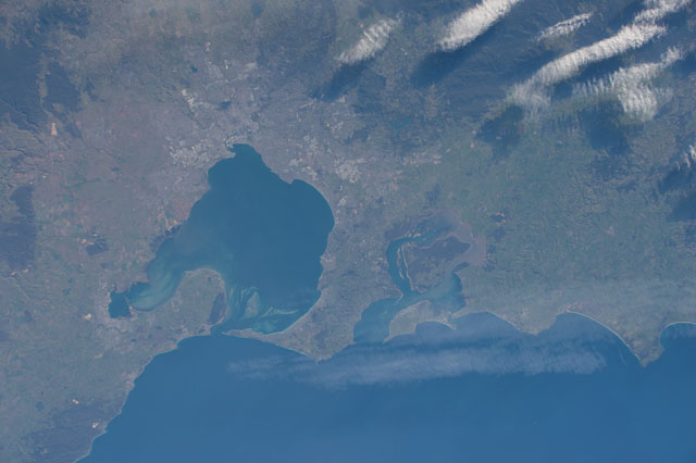
Spacecraft nadir point: 37.2° S, 143.8° E
Photo center point: 38.2° S, 145.2° E
Photo center point by machine learning:
Photo center point: 38.2° S, 145.2° E
Photo center point by machine learning:
Nadir to Photo Center: Southeast
Spacecraft Altitude: 223 nautical miles (413km)
Country or Geographic Name: | AUSTRALIA-V |
Features: | PUBLIC INPUTS, PO. PHILLIP B., BASS STR., VICTORIA, FRANKSTON, FRENCH I. (from public image detectives, not NASA): AUSTRALIA,MELBOURNE |
| Features Found Using Machine Learning: | |
Cloud Cover Percentage: | 10 (1-10)% |
Sun Elevation Angle: | 22° |
Sun Azimuth: | 49° |
Camera: | Nikon D4 Electronic Still Camera |
Focal Length: | 95mm |
Camera Tilt: | 25 degrees |
Format: | 4928E: 4928 x 3280 pixel CMOS sensor, 36.0mm x 23.9mm, total pixels: 16.6 million, Nikon FX format |
Film Exposure: | |
| Additional Information | |
| Width | Height | Annotated | Cropped | Purpose | Links |
|---|---|---|---|---|---|
| 4928 pixels | 3280 pixels | No | No | Download Image | |
| 640 pixels | 426 pixels | No | No | Download Image |
Download Packaged File
Download a Google Earth KML for this Image
View photo footprint information
Download a GeoTIFF for this photo
Image Caption: none
