ISS052-E-39523
| NASA Photo ID | ISS052-E-39523 |
| Focal Length | 500mm |
| Date taken | 2017.08.09 |
| Time taken | 15:52:56 GMT |
4928 x 3280 pixels 720 x 480 pixels 4928 x 3280 pixels 640 x 426 pixels
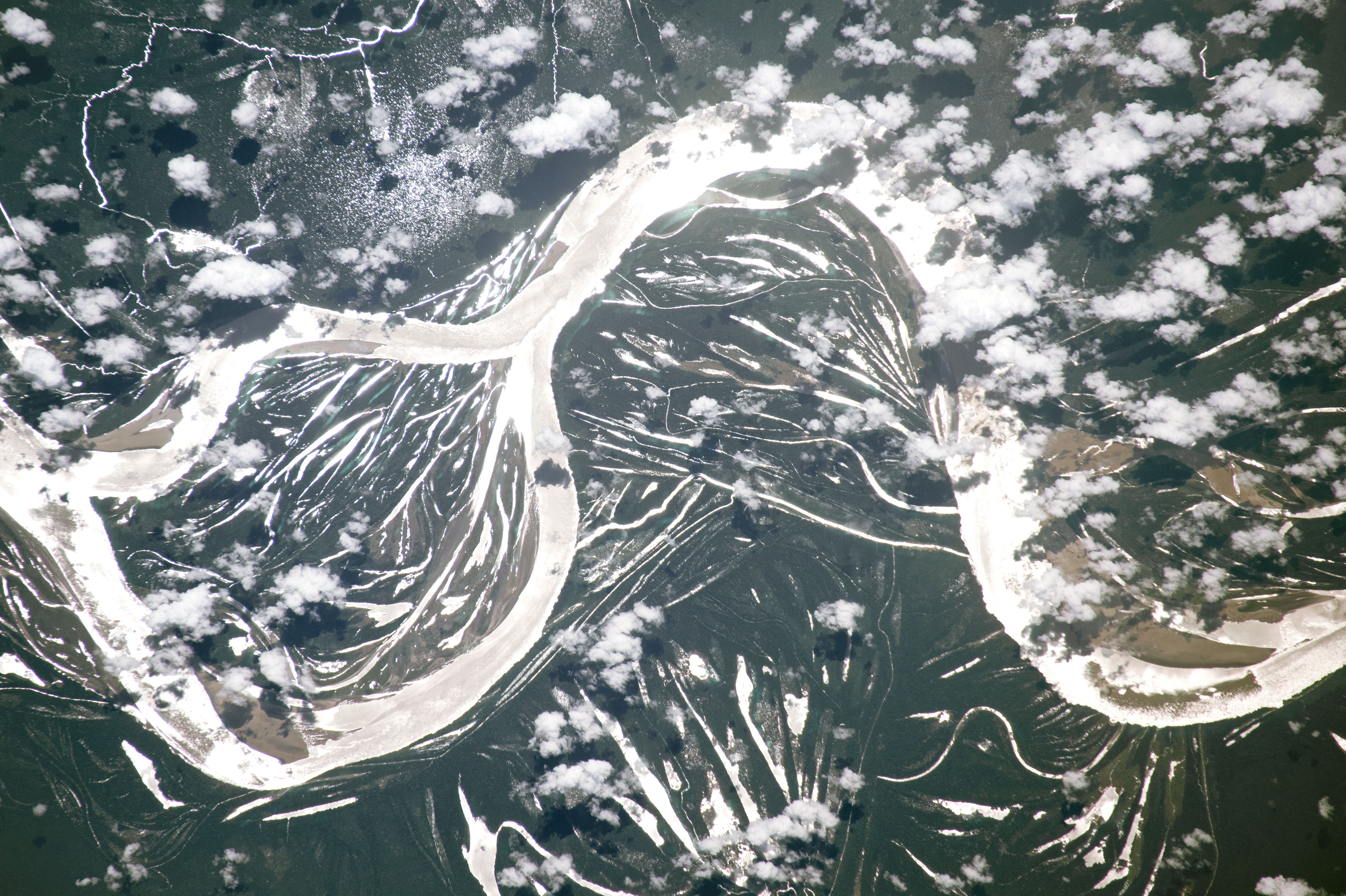
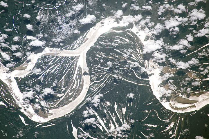
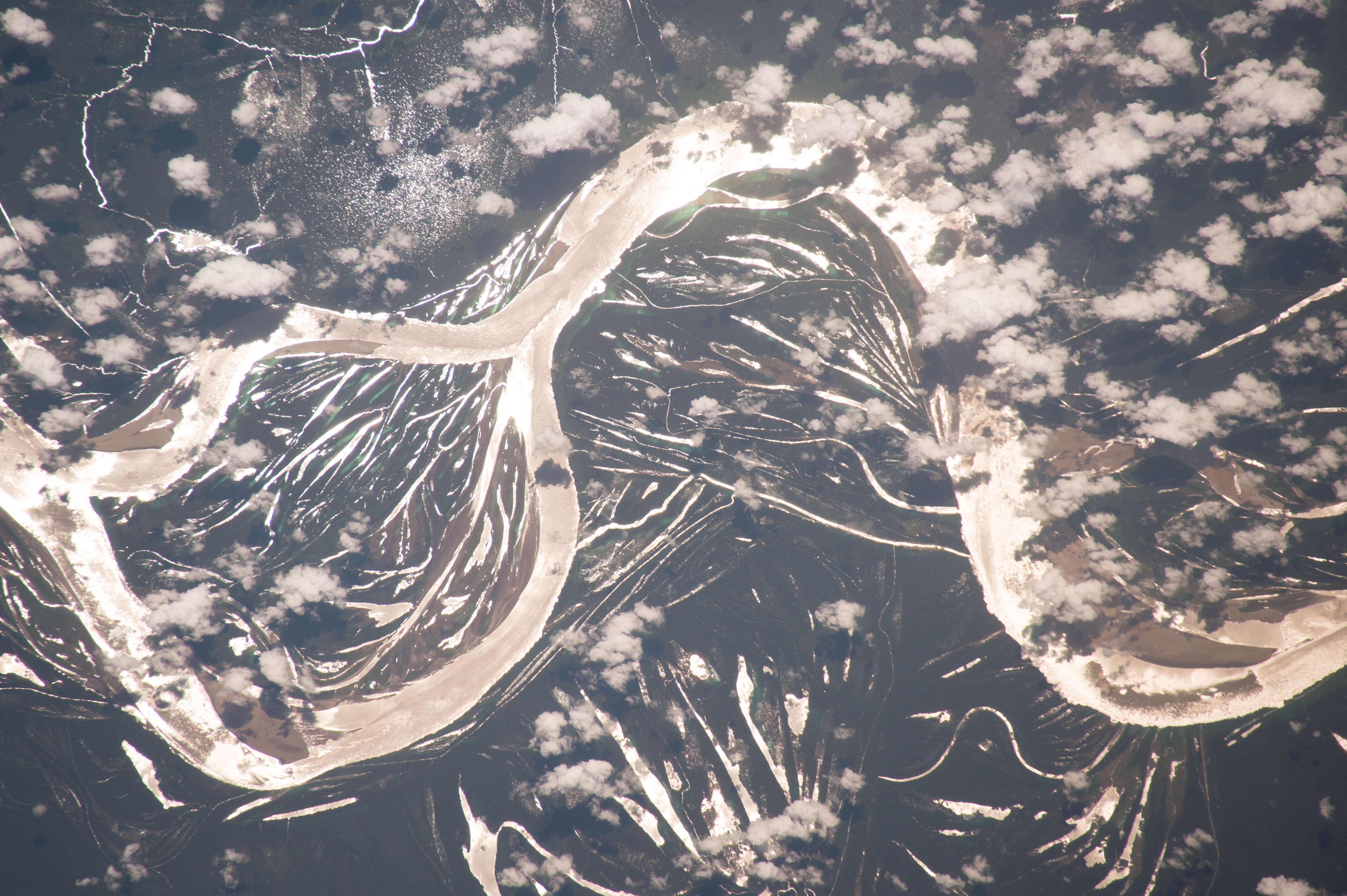


Photo center point: 2.7° S, 67.1° W
Photo center point by machine learning:
Country or Geographic Name: | BRAZIL |
Features: | AMAZON RIVER, SUN GLINT |
| Features Found Using Machine Learning: | |
Cloud Cover Percentage: | 25 (11-25)% |
Sun Elevation Angle: | 68° |
Sun Azimuth: | 29° |
Camera: | Nikon D4 Electronic Still Camera |
Focal Length: | 500mm |
Camera Tilt: | 20 degrees |
Format: | 4928E: 4928 x 3280 pixel CMOS sensor, 36.0mm x 23.9mm, total pixels: 16.6 million, Nikon FX format |
Film Exposure: | |
| Additional Information | |
| Width | Height | Annotated | Cropped | Purpose | Links |
|---|---|---|---|---|---|
| 4928 pixels | 3280 pixels | No | No | NASA's Earth Observatory web site | Download Image |
| 720 pixels | 480 pixels | No | Yes | NASA's Earth Observatory web site | Download Image |
| 4928 pixels | 3280 pixels | No | No | Download Image | |
| 640 pixels | 426 pixels | No | No | Download Image |
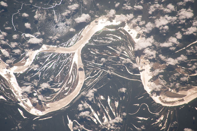
An astronaut aboard the International Space Station (ISS) focused a camera on the brilliant reflection of sunlight —sunglint—on three sweeping meanders of the Amazon River. The numerous thinner lines show the many remnants of prior channels of this highly mobile river. The reflected sunlight even shows numerous ponds (top left) in this very rainy part of the world. These ponds are usually not visible due to the dense forest cover in central Amazonia.
The Amazon River is the largest by water volume and sediment discharge in the world. The scale of the meanders here are immense compared with other large rivers. The amplitude from the top of the meander to the lower curves of the neighboring meanders is 18 kilometers (11 miles). Average meander amplitudes on the Mississippi River near New Orleans measure 6 kilometers (4 miles).
And the meander amplitude is increasing along this stretch of the river. Images from the late 1960s show the meanders as less winding. Since then, the loops have expanded, eroding the outside edges. Measurements taken from a 1969 photo and from this one show erosion has pushed the outer banks out by more than 1.2 kilometers (0.75 miles), while depositing new sediment on the inside of the meander loops.
