ISS052-E-27327

| NASA Photo ID | ISS052-E-27327 |
| Focal Length | 400mm |
| Date taken | 2017.08.04 |
| Time taken | 15:48:40 GMT |
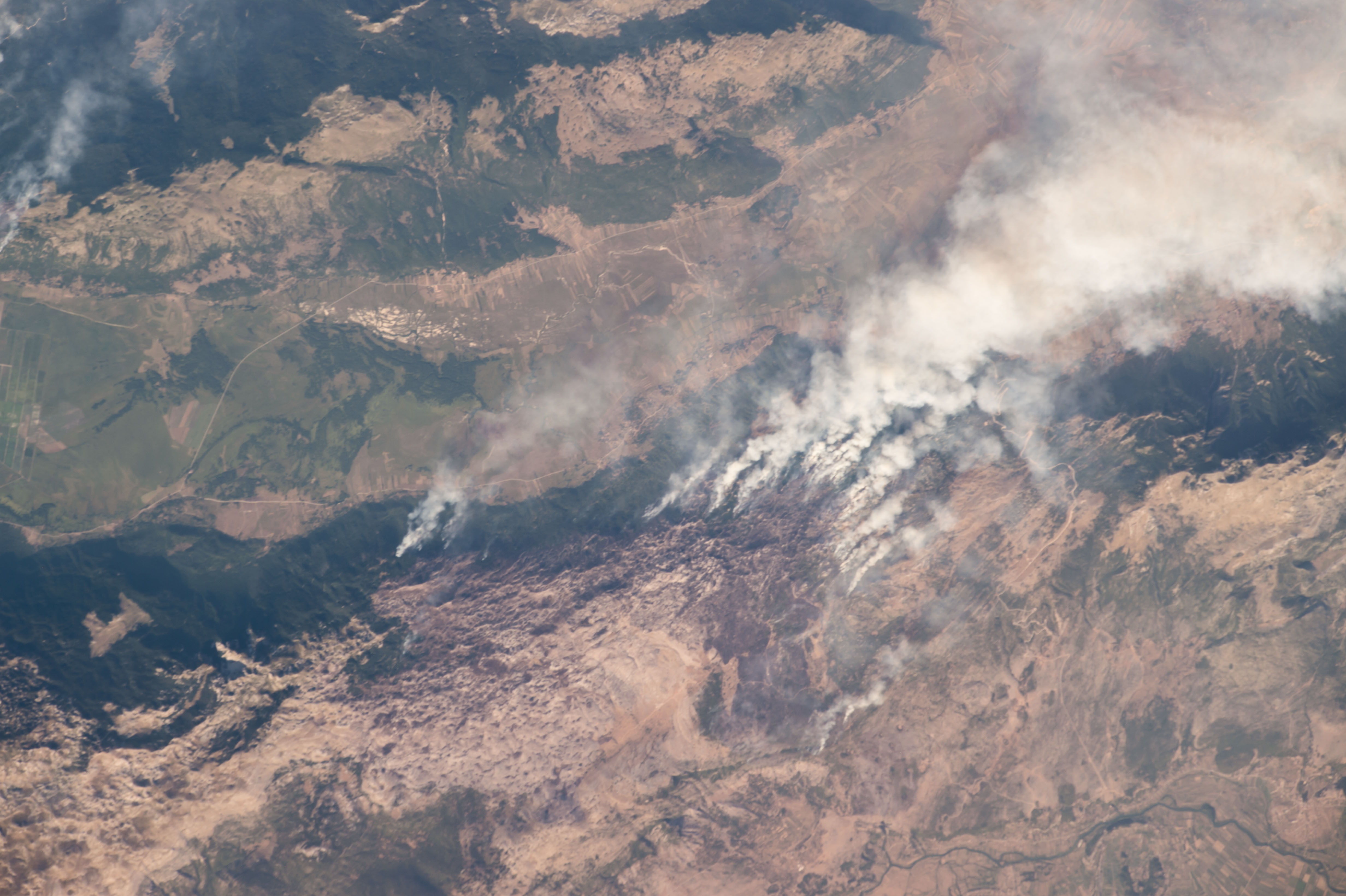

Spacecraft nadir point: 44.7° N, 17.2° E
Photo center point: 43.9° N, 16.8° E
Photo center point by machine learning:
Photo center point: 43.9° N, 16.8° E
Photo center point by machine learning:
Nadir to Photo Center: South
Spacecraft Altitude: 213 nautical miles (394km)
Country or Geographic Name: | BOSNIA-HERZEGOVINA |
Features: | FIRES, SMOKE PLUMES, CELEBIC, PROLOG, LJUBUNCIC |
| Features Found Using Machine Learning: | |
Cloud Cover Percentage: | 10 (1-10)% |
Sun Elevation Angle: | 24° |
Sun Azimuth: | 271° |
Camera: | Nikon D4 Electronic Still Camera |
Focal Length: | 400mm |
Camera Tilt: | 14 degrees |
Format: | 4928E: 4928 x 3280 pixel CMOS sensor, 36.0mm x 23.9mm, total pixels: 16.6 million, Nikon FX format |
Film Exposure: | |
| Additional Information | |
| Width | Height | Annotated | Cropped | Purpose | Links |
|---|---|---|---|---|---|
| 4928 pixels | 3280 pixels | No | No | Download Image | |
| 640 pixels | 426 pixels | No | No | Download Image |
Download Packaged File
Download a Google Earth KML for this Image
View photo footprint information
Download a GeoTIFF for this photo
Georeferenced by human interaction - exported 2017-08-22-165335-UTCAn explanation of the georeference file(s) above
Image Caption: none
