ISS052-E-16508

| NASA Photo ID | ISS052-E-16508 |
| Focal Length | 210mm |
| Date taken | 2017.07.19 |
| Time taken | 11:28:53 GMT |
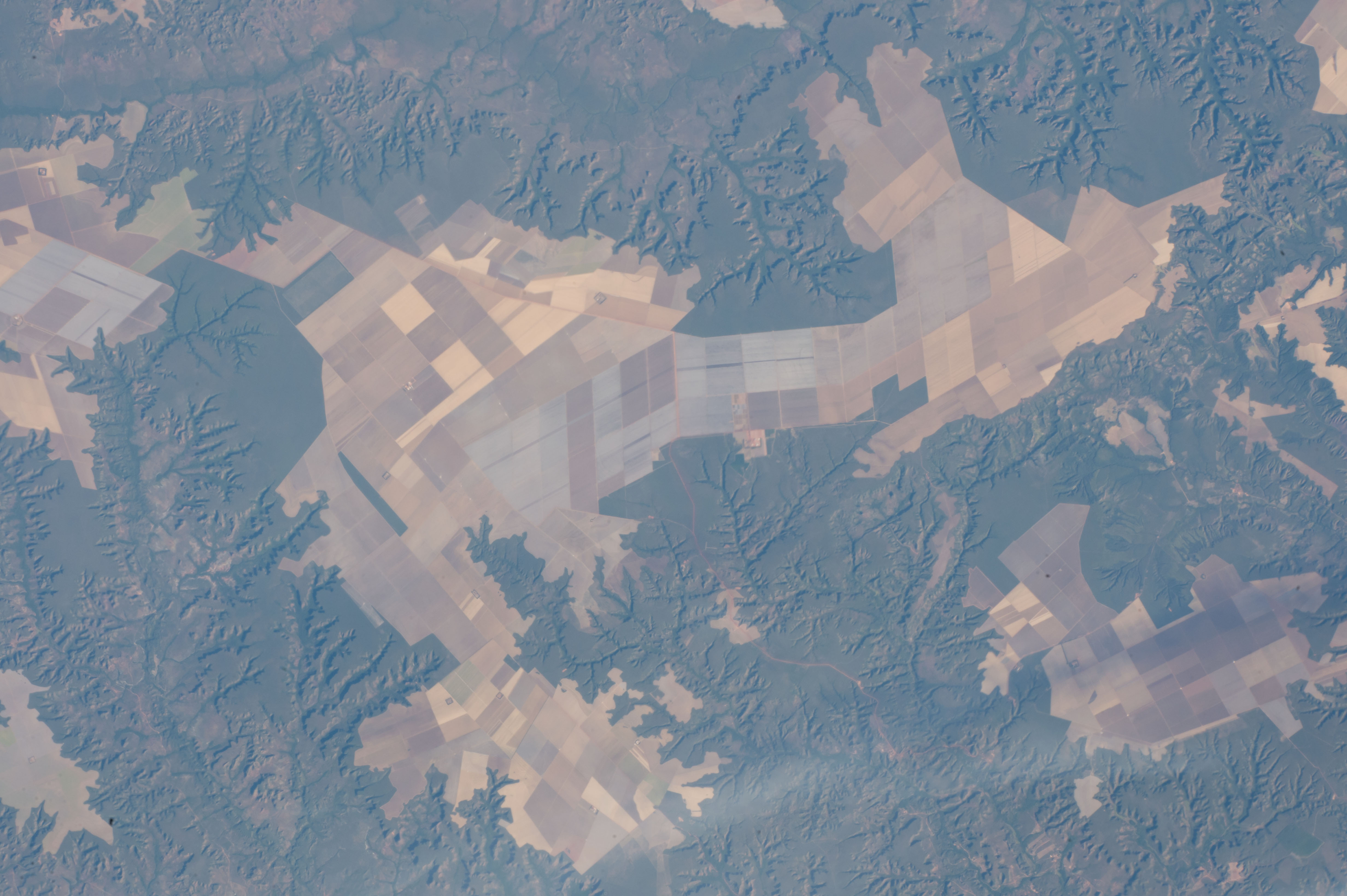


Photo center point: 8.5° S, 46.1° W
Photo center point by machine learning:
Country or Geographic Name: | BRAZIL |
Features: | AGR. FIELD PATTERNS, SCARPS, BALSAS R. |
| Features Found Using Machine Learning: | |
Cloud Cover Percentage: | 10 (1-10)% |
Sun Elevation Angle: | 29° |
Sun Azimuth: | 61° |
Camera: | Nikon D4 Electronic Still Camera |
Focal Length: | 210mm |
Camera Tilt: | 08 degrees |
Format: | 4928E: 4928 x 3280 pixel CMOS sensor, 36.0mm x 23.9mm, total pixels: 16.6 million, Nikon FX format |
Film Exposure: | |
| Additional Information | |
| Width | Height | Annotated | Cropped | Purpose | Links |
|---|---|---|---|---|---|
| 4928 pixels | 3280 pixels | No | No | Download Image | |
| 640 pixels | 426 pixels | No | No | Download Image |
An astronaut aboard the International Space Station focused a camera on the geometric patterns of farms on some plateaus in northeast Brazil. Here the fields, mainly soybeans and maize, have been planted right up to the edges of the small plateaus. The edges are ragged lines marked by cliffs.
The many flat plateau surfaces of southern Maranhão State are ideal for the wheeled machinery of mechanized agriculture. In fact, the capital city of the region, Balsas, is known as the “capital of mechanized agriculture.”
The steep-sided river valleys—such as that of the Balsas River—lie fully 200 meters (600 feet) below the plateaus. Numerous finger-like tributaries are eroding and creating smaller valleys, which are poor landscapes for mechanized farming. One result is that the forests around the valleys remain in their pristine form, even though southern Maranhão is part of Brazil’s long “arc of deforestation” on the southern margin of a dense forest zone.
