ISS050-E-30105

| NASA Photo ID | ISS050-E-30105 |
| Focal Length | 1150mm |
| Date taken | 2017.01.02 |
| Time taken | 11:42:21 GMT |
1000 x 666 pixels 540 x 360 pixels 4928 x 3280 pixels 720 x 480 pixels 4928 x 3280 pixels 640 x 426 pixels

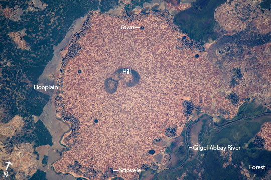

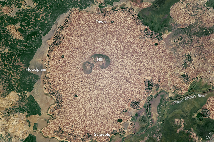
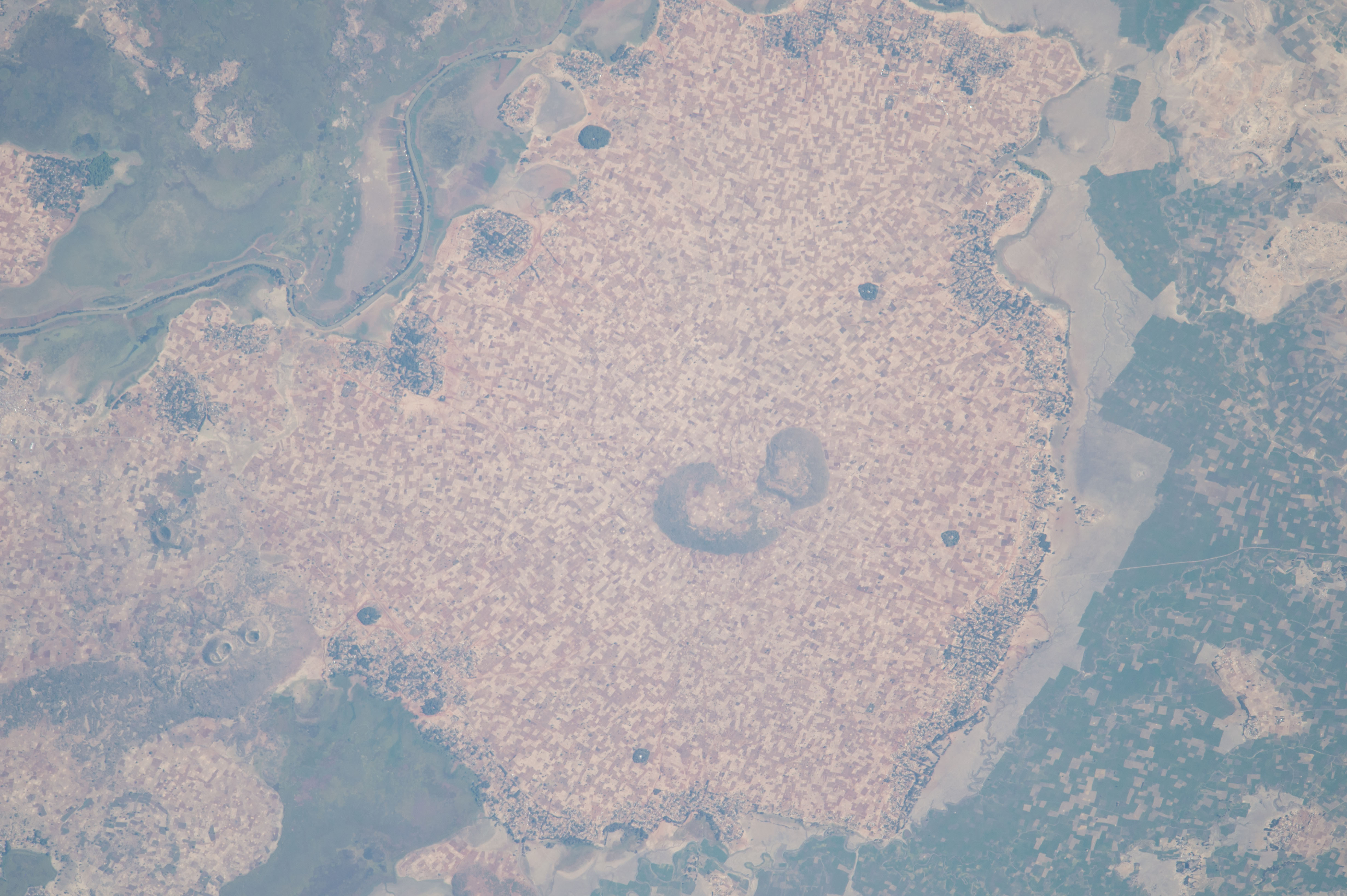


Photo center point: 11.7° N, 37.1° E
Photo center point by machine learning:
Country or Geographic Name: | ETHIOPIA |
Features: | GILGEL ABAY R., AGR., SCIOVELE, MIRAB GOJJAM, AMHARA REGION |
| Features Found Using Machine Learning: | |
Cloud Cover Percentage: | 10 (1-10)% |
Sun Elevation Angle: | 44° |
Sun Azimuth: | 224° |
Camera: | Nikon D4 Electronic Still Camera |
Focal Length: | 1150mm |
Camera Tilt: | 30 degrees |
Format: | 4928E: 4928 x 3280 pixel CMOS sensor, 36.0mm x 23.9mm, total pixels: 16.6 million, Nikon FX format |
Film Exposure: | |
| Additional Information | |
| Width | Height | Annotated | Cropped | Purpose | Links |
|---|---|---|---|---|---|
| 1000 pixels | 666 pixels | No | No | Earth From Space collection | Download Image |
| 540 pixels | 360 pixels | Yes | No | Earth From Space collection | Download Image |
| 4928 pixels | 3280 pixels | No | No | NASA's Earth Observatory web site | Download Image |
| 720 pixels | 480 pixels | Yes | No | NASA's Earth Observatory web site | Download Image |
| 4928 pixels | 3280 pixels | No | No | Download Image | |
| 640 pixels | 426 pixels | No | No | Download Image |
An astronaut aboard the International Space Station centered this photograph on numerous, densely packed agricultural fields that occupy all the higher ground in the center of the picture--a region ~8 km in diameter. Taken at the end of the dry season, the photograph shows fallow rain-fed fields (brown and tan colored)--except around the margins of the region where forested villages have access to river water (the largest village is Sciovele at image lower margin). Thin river channels are associated with long floodplains (at image left and lower right) that arc around the tan fields.
These floodplains are part of wide lower-lying wetlands that support both swamp vegetation and another set of fields where crops still thrive despite the dry season. Agriculture in the lower wetlands takes advantage of what is known as flood-recession agriculture where wet-season rainwater drains more slowly and is available for plant growth even in the middle of the dry season (the wetlands are part of a complex coastal zone of Lake Tana, which lies just outside the top of the image). Individual fields and angular margins at the floodplain visible at image left are indicative of this human use and modification of the wetlands. The Gilgel Abbay River (at image lower right) is lined with very narrow fields that give the greatest number of farmers access to water.
Forests occupy parts of the wetlands but also places on higher ground such as the hill in the center of the image, and five minuscule circular patches of forest that are dispersed among the fields. These surround monasteries that are characteristic of the region.
The relatively high rainfall in the Ethiopian Highlands makes the region suitable for growing coffee, oilseeds, and grains, especially subsistence crops such as wheat and sorghum. However, the recent years-long drought set off by an El Nino event is threatening Ethiopia's food supply. The United States and the Ethiopian Governments are planning for the need to support as many as 9.7 million people who will face food shortages.
