ISS050-E-28519

| NASA Photo ID | ISS050-E-28519 |
| Focal Length | 1150mm |
| Date taken | 2017.01.04 |
| Time taken | 17:28:18 GMT |
1000 x 666 pixels 540 x 359 pixels 4928 x 3280 pixels 720 x 480 pixels 4928 x 3280 pixels 640 x 426 pixels
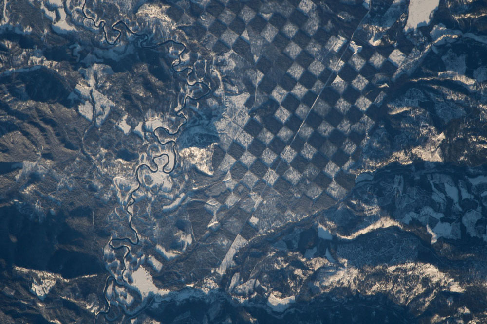

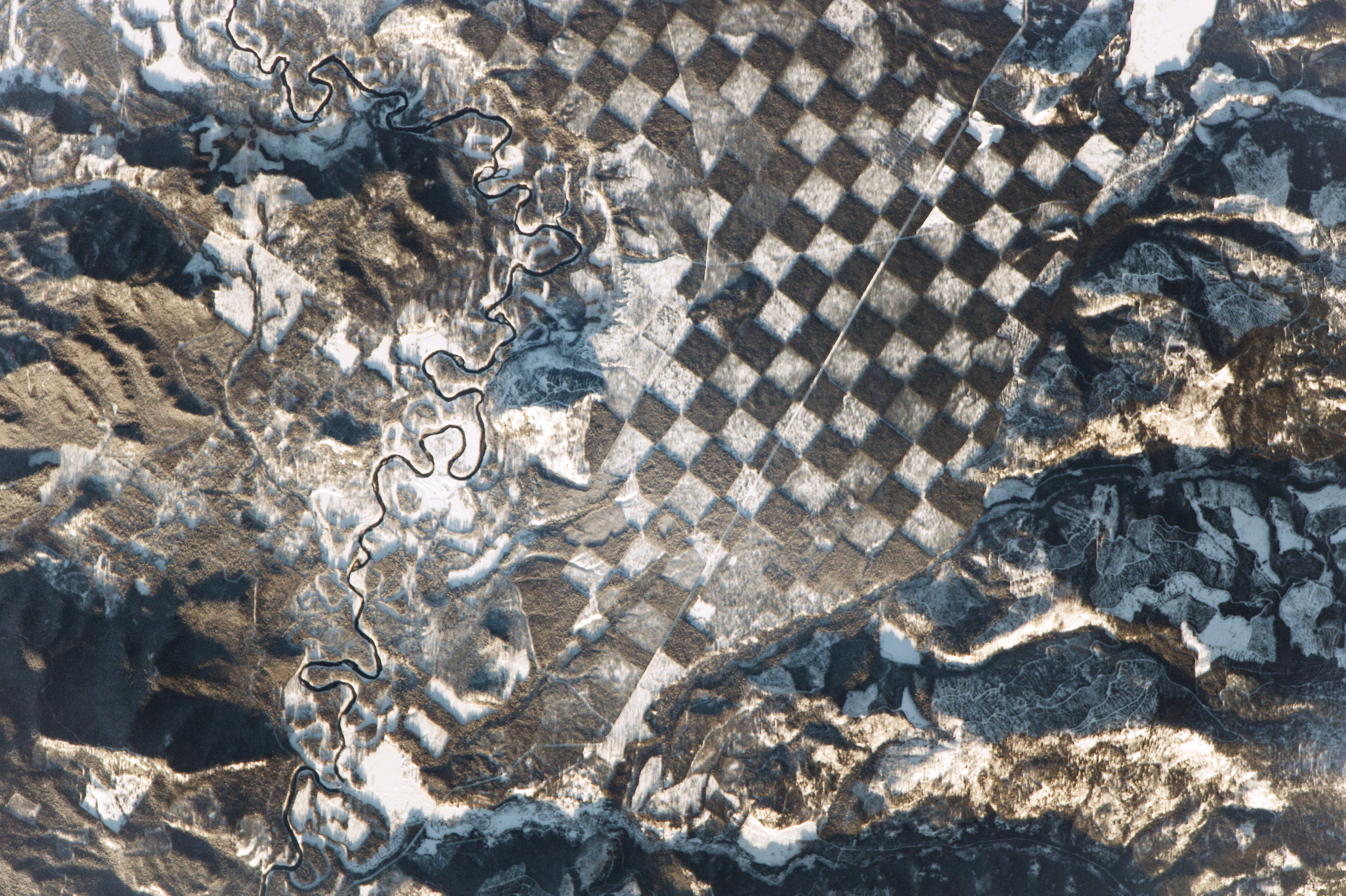
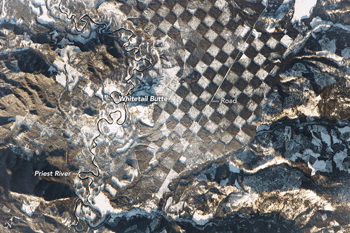
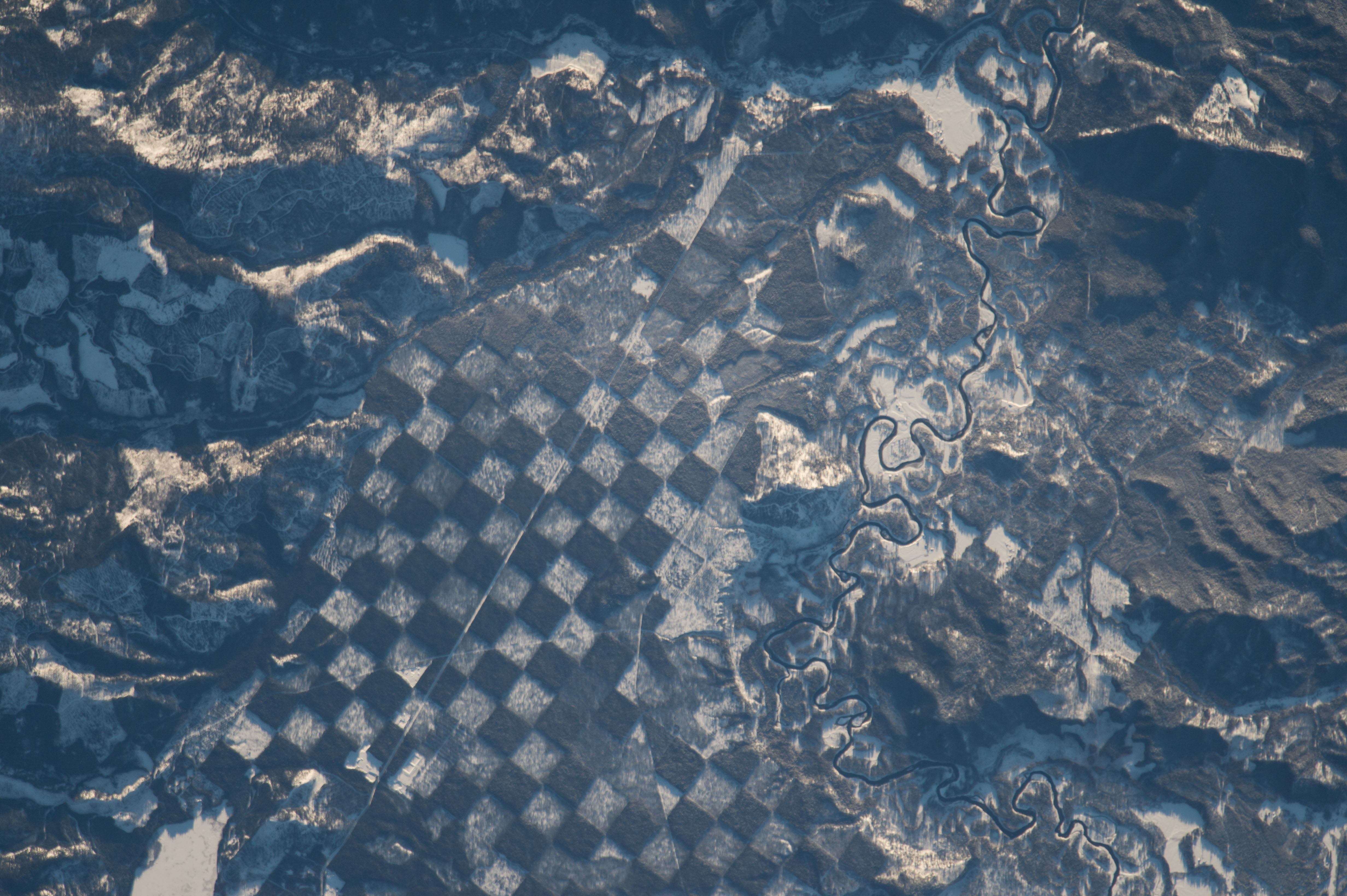

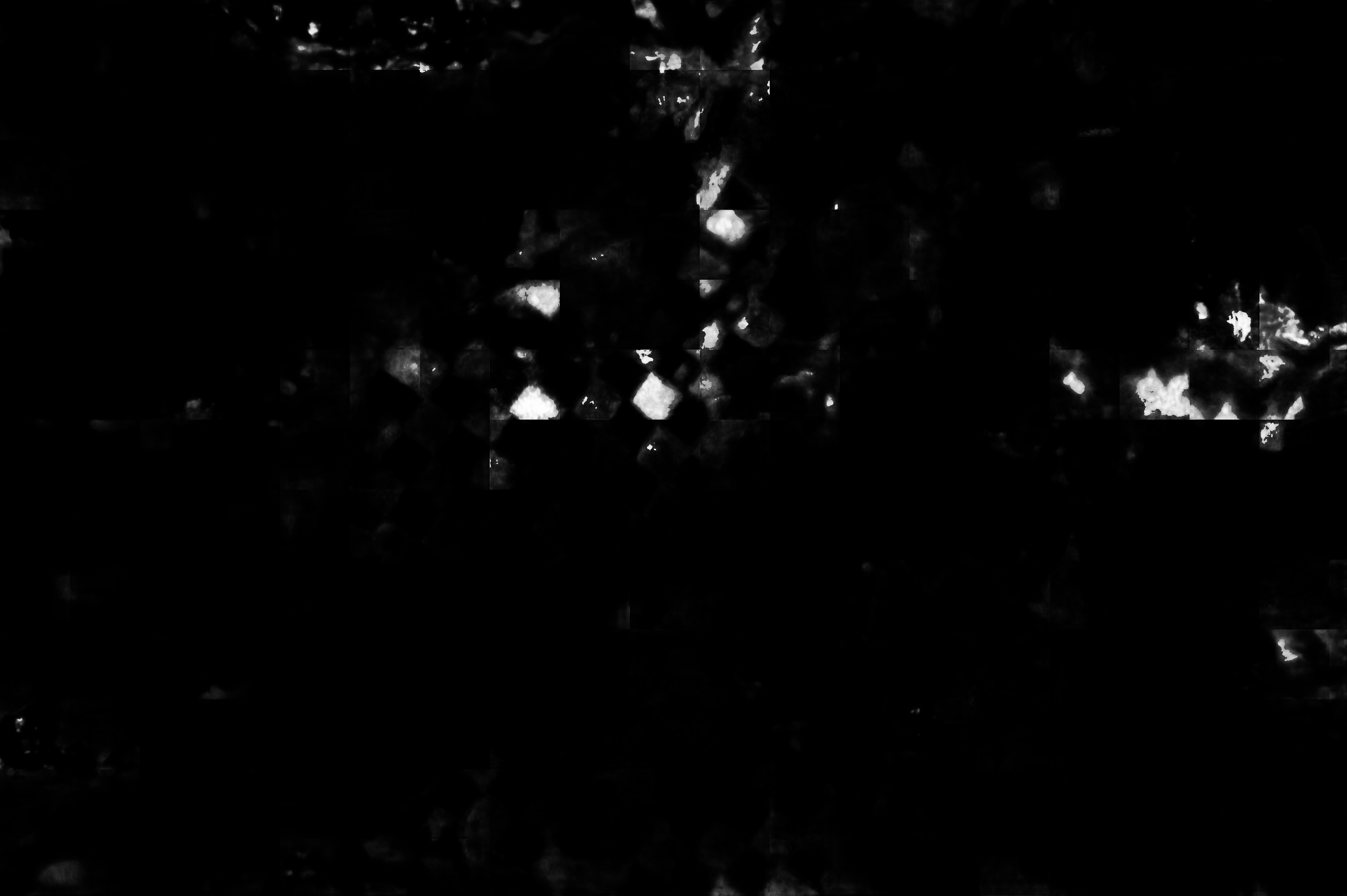
Photo center point: 48.4° N, 116.8° W
Photo center point by machine learning:
Country or Geographic Name: | USA-IDAHO |
Features: | PRIEST R., DEFORESTATION, WHITETAIL BUTTE, COLUMBIA MTS. |
| Features Found Using Machine Learning: | |
Cloud Cover Percentage: | 10 (1-10)% |
Sun Elevation Angle: | 13° |
Sun Azimuth: | 147° |
Camera: | Nikon D4 Electronic Still Camera |
Focal Length: | 1150mm |
Camera Tilt: | 17 degrees |
Format: | 4928E: 4928 x 3280 pixel CMOS sensor, 36.0mm x 23.9mm, total pixels: 16.6 million, Nikon FX format |
Film Exposure: | |
| Additional Information | |
| Width | Height | Annotated | Cropped | Purpose | Links |
|---|---|---|---|---|---|
| 1000 pixels | 666 pixels | No | No | Earth From Space collection | Download Image |
| 540 pixels | 359 pixels | No | No | Earth From Space collection | Download Image |
| 4928 pixels | 3280 pixels | No | No | NASA's Earth Observatory web site | Download Image |
| 720 pixels | 480 pixels | Yes | No | NASA's Earth Observatory web site | Download Image |
| 4928 pixels | 3280 pixels | No | No | Download Image | |
| 640 pixels | 426 pixels | No | No | Download Image |
An astronaut aboard the International Space Station captured this distinctive checkerboard pattern along the Priest River in northern Idaho. It was taken just before sunset so southfacing mountain sides glow while the north faces are shadowed. The checkerboard of white squares is snow visible on deforested ground where trees have been removed for logging. These alternate with the dark squares of dense forest that obscure the snow from the astronaut's view.
The checkerboard pattern resulted from an agreement in the early 1800s where alternate one-square-mile parcels of land were granted by the US Federal government to the Northern Pacific Railroad. These parcels were later sold to private companies and stripped for timber. This pattern is now seen as a method of maintaining the sustainability of forested tracts while still enabling logging companies to harvest trees. The forested squares are reserves now managed by the US Forest Service.
Dense vegetation acts as a natural filtration system for nearby rivers, preserving water quality from degradation by soil eroded off deforested hillsides. The Priest River, winding through the scene from top to bottom, is bordered on both sides by forest to further protect the quality of its water. Prior to 1968, the river was used to transport logs for nearly a century. Its function changed when the river's entire main stem was added to the list of Wild and Scenic Rivers in 1968 to preserve its "...outstanding natural, cultural, and recreational values in a free-flowing condition for the enjoyment of present and future generations". Whitetail Butte next to the river (at image center) was historically used by the US Forest Service as a lookout point for forest fires.
