ISS048-E-71980
| NASA Photo ID | ISS048-E-71980 |
| Focal Length | 50mm |
| Date taken | 2016.09.05 |
| Time taken | 10:44:36 GMT |
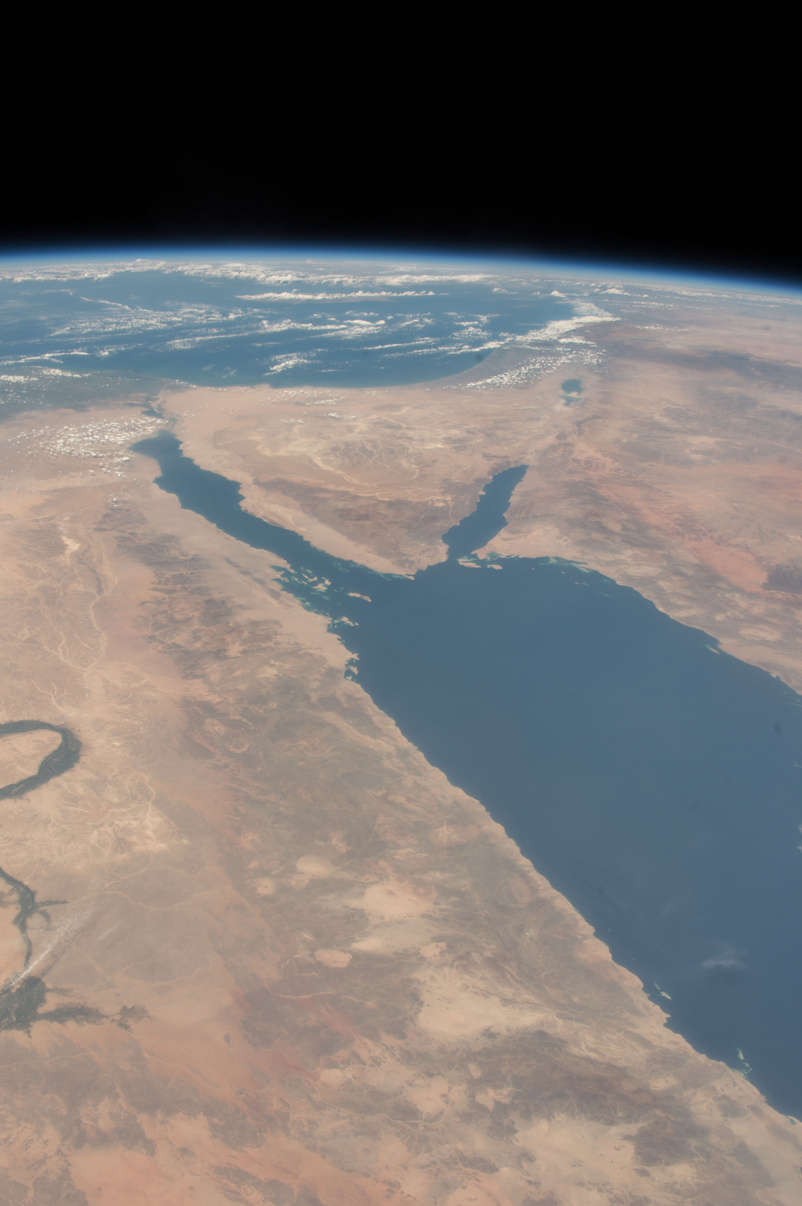
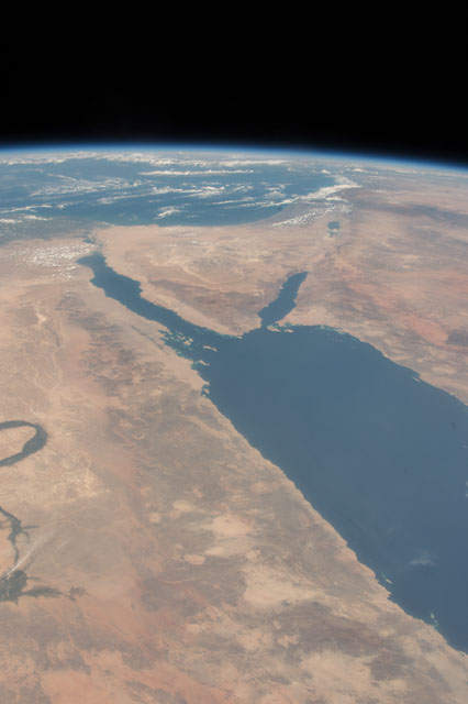
Spacecraft nadir point: 20.9° N, 33.9° E
Photo center point: 27.5° N, 34.0° E
Photo center point by machine learning:
Photo center point: 27.5° N, 34.0° E
Photo center point by machine learning:
Nadir to Photo Center: North
Spacecraft Altitude: 218 nautical miles (404km)
Country or Geographic Name: | EGYPT |
Features: | RED SEA, GULF OF SUEZ, GULF OF AQABA, HEJAZ MOUNTAINS, EASTERN DESERT, TABUK, AL MADINAH, NILE RIVER |
| Features Found Using Machine Learning: | PAN- |
Cloud Cover Percentage: | 25 (11-25)% |
Sun Elevation Angle: | 69° |
Sun Azimuth: | 228° |
Camera: | Nikon D4 Electronic Still Camera |
Focal Length: | 50mm |
Camera Tilt: | High Oblique |
Format: | 4928E: 4928 x 3280 pixel CMOS sensor, 36.0mm x 23.9mm, total pixels: 16.6 million, Nikon FX format |
Film Exposure: | |
| Additional Information | |
| Width | Height | Annotated | Cropped | Purpose | Links |
|---|---|---|---|---|---|
| 3280 pixels | 4928 pixels | No | No | Download Image | |
| 426 pixels | 640 pixels | No | No | Download Image |
Download Packaged File
Download a Google Earth KML for this Image
View photo footprint information
Download a GeoTIFF for this photo
Image Caption: CATALOGED BY TEXAS STATE UNIVERSITY
