ISS048-E-71652
| NASA Photo ID | ISS048-E-71652 |
| Focal Length | 500mm |
| Date taken | 2016.09.03 |
| Time taken | 18:28:41 GMT |
4928 x 3280 pixels 720 x 480 pixels 4928 x 3280 pixels 640 x 426 pixels
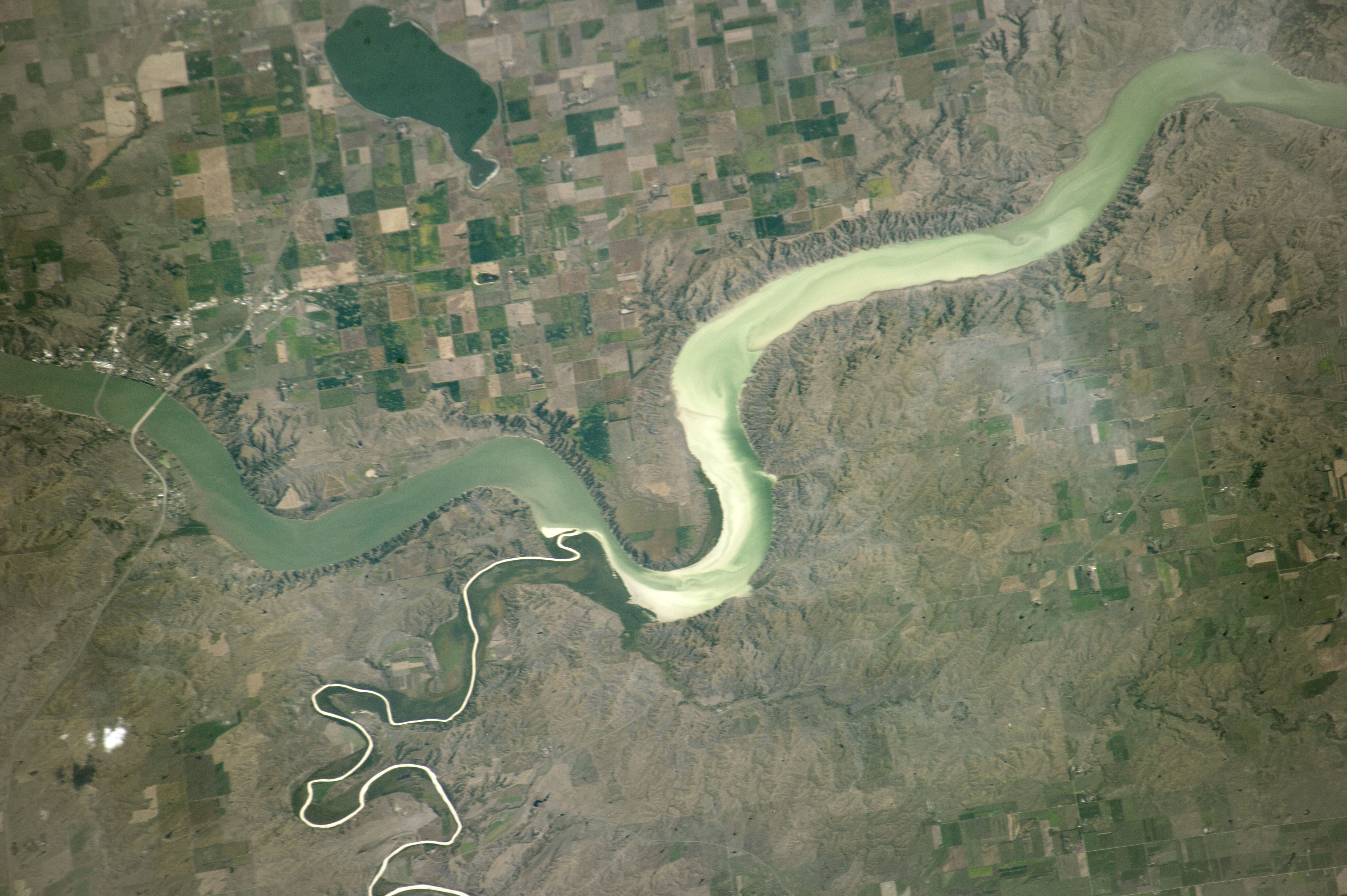
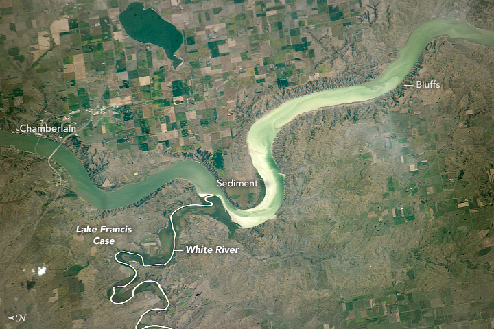
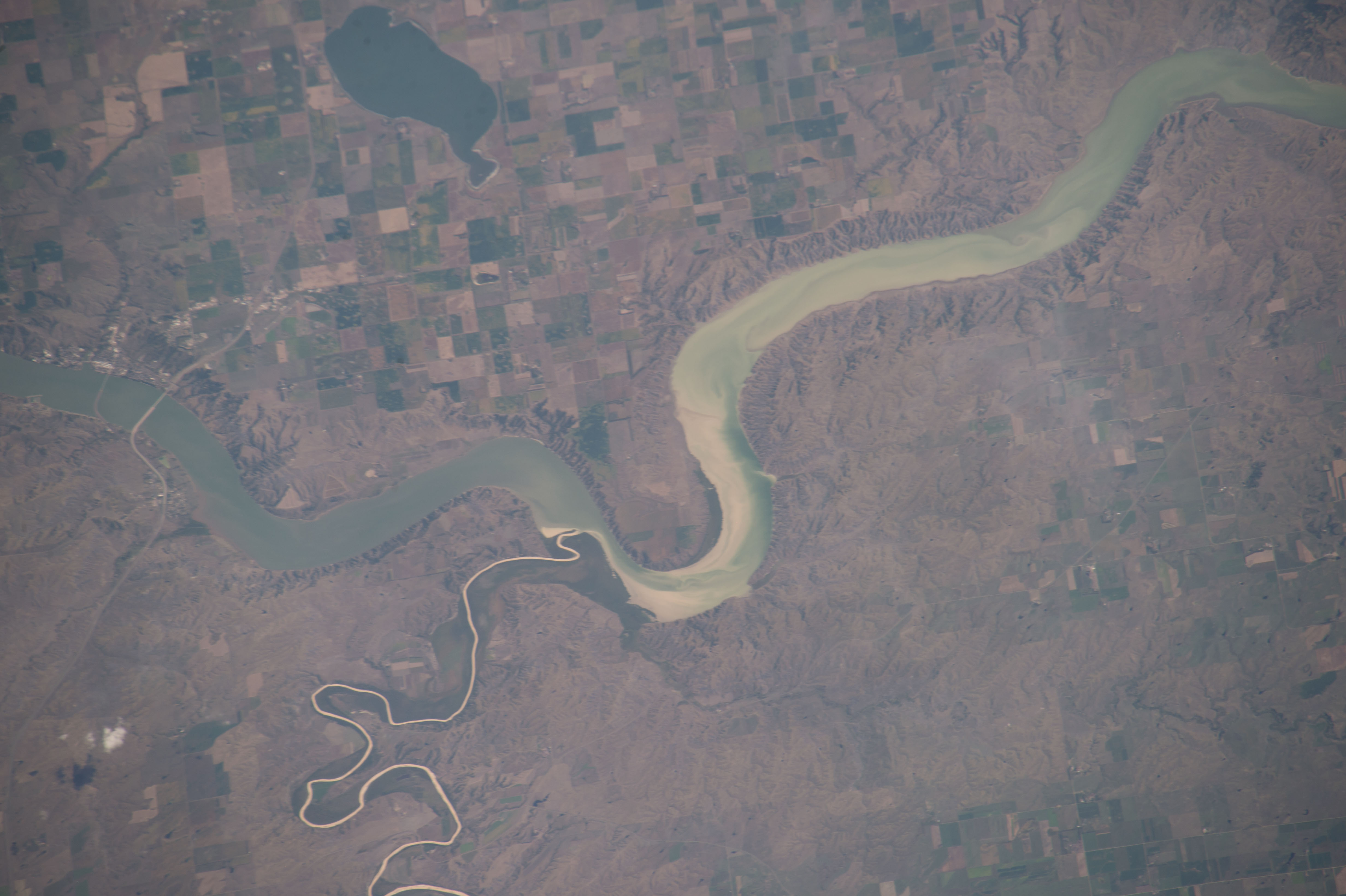


Photo center point: 43.6° N, 99.4° W
Photo center point by machine learning: 43.67° N, 99.41° W

Country or Geographic Name: | USA-SOUTH DAKOTA |
Features: | WHITE R., L. FRANCIS CASE, AGR. |
| Features Found Using Machine Learning: | |
Cloud Cover Percentage: | 10 (1-10)% |
Sun Elevation Angle: | 53° |
Sun Azimuth: | 170° |
Camera: | Nikon D4 Electronic Still Camera |
Focal Length: | 500mm |
Camera Tilt: | 47 degrees |
Format: | 4928E: 4928 x 3280 pixel CMOS sensor, 36.0mm x 23.9mm, total pixels: 16.6 million, Nikon FX format |
Film Exposure: | |
| Additional Information | |
| Width | Height | Annotated | Cropped | Purpose | Links |
|---|---|---|---|---|---|
| 4928 pixels | 3280 pixels | No | No | NASA's Earth Observatory web site | Download Image |
| 720 pixels | 480 pixels | Yes | No | NASA's Earth Observatory web site | Download Image |
| 4928 pixels | 3280 pixels | No | No | Download Image | |
| 640 pixels | 426 pixels | No | No | Download Image |
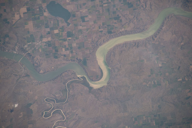
An astronaut aboard the International Space Station focused a camera on the White River where it pours milky-colored water into the blue-green of Lake Francis Case. The White River's name - Makhizita wakpa, or "White Dirt River" in the Lakota language - derives from the white sediment it carries from erosion and weathering of rocks and soils upstream, especially limestone and volcanic ash from sources near South Dakota's Badlands. (The white rocks exposed in the Badlands are visible in this photograph from the early days of the ISS.)
Lake Francis Case is an artificial reservoir on the Missouri River, and it fills the entire width of the Missouri River valley, marked by low but steep bluffs that line both shores. For scale, the bridge and causeway where Interstate Highway 90 crosses the reservoir (at the town of Chamberlain) is a mile long (1.6 kilometers). The town is the local commercial center for the many farms that surround Red Lake (top left).
