ISS044-E-27240
| NASA Photo ID | ISS044-E-27240 |
| Focal Length | 1150mm |
| Date taken | 2015.08.01 |
| Time taken | 13:28:06 GMT |
Resolutions offered for this image:
1000 x 666 pixels 540 x 360 pixels 4928 x 3280 pixels 720 x 480 pixels 4928 x 3280 pixels 640 x 426 pixels
1000 x 666 pixels 540 x 360 pixels 4928 x 3280 pixels 720 x 480 pixels 4928 x 3280 pixels 640 x 426 pixels


Spacecraft nadir point: 24.8° S, 44.3° E
Photo center point: 25.0° S, 44.1° E
Photo center point by machine learning:
Photo center point: 25.0° S, 44.1° E
Photo center point by machine learning:
Nadir to Photo Center: Southwest
Spacecraft Altitude: 219 nautical miles (406km)
Country or Geographic Name: | MADAGASCAR |
Features: | LINTA R. DELTA, DUNES, REEFS, MANGROVE |
| Features Found Using Machine Learning: | |
Cloud Cover Percentage: | 10 (1-10)% |
Sun Elevation Angle: | 14° |
Sun Azimuth: | 298° |
Camera: | Nikon D4 Electronic Still Camera |
Focal Length: | 1150mm |
Camera Tilt: | 04 degrees |
Format: | 4928E: 4928 x 3280 pixel CMOS sensor, 36.0mm x 23.9mm, total pixels: 16.6 million, Nikon FX format |
Film Exposure: | |
| Additional Information | |
| Width | Height | Annotated | Cropped | Purpose | Links |
|---|---|---|---|---|---|
| 1000 pixels | 666 pixels | No | No | Earth From Space collection | Download Image |
| 540 pixels | 360 pixels | Yes | No | Earth From Space collection | Download Image |
| 4928 pixels | 3280 pixels | No | No | NASA's Earth Observatory web site | Download Image |
| 720 pixels | 480 pixels | Yes | No | NASA's Earth Observatory web site | Download Image |
| 4928 pixels | 3280 pixels | No | No | Download Image | |
| 640 pixels | 426 pixels | No | No | Download Image |
Download Packaged File
Download a Google Earth KML for this Image
View photo footprint information
Download a GeoTIFF for this photo
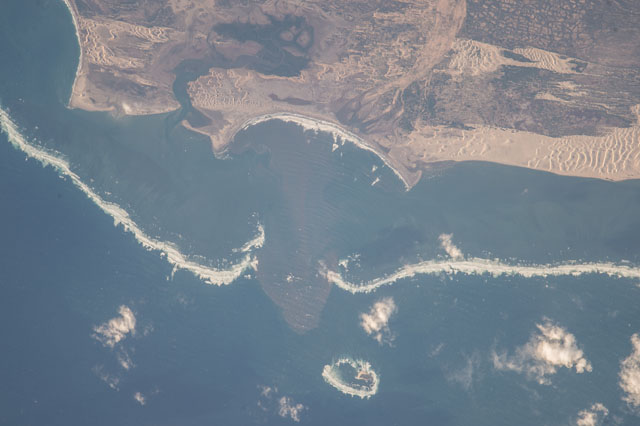
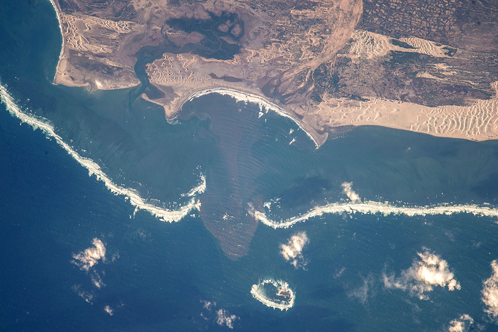
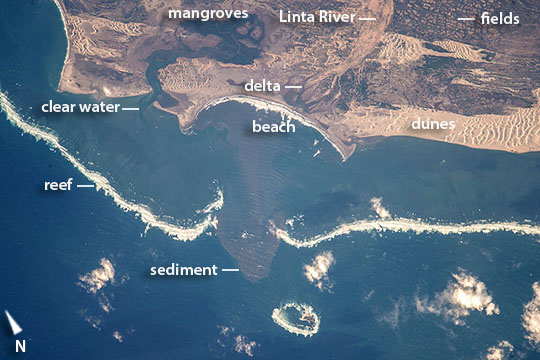
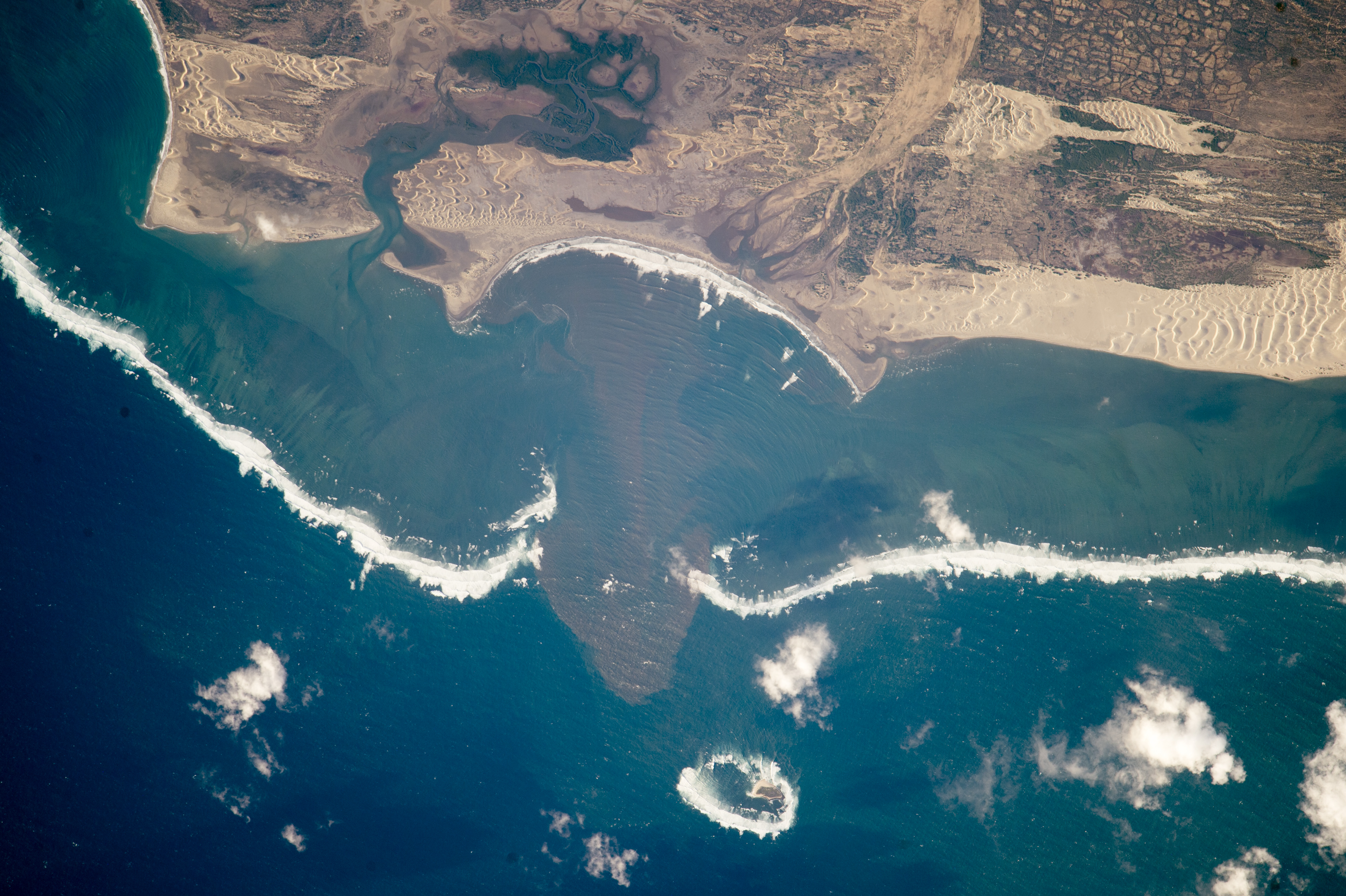
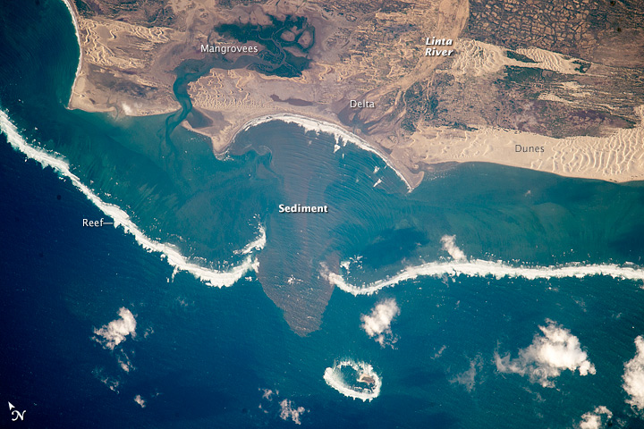
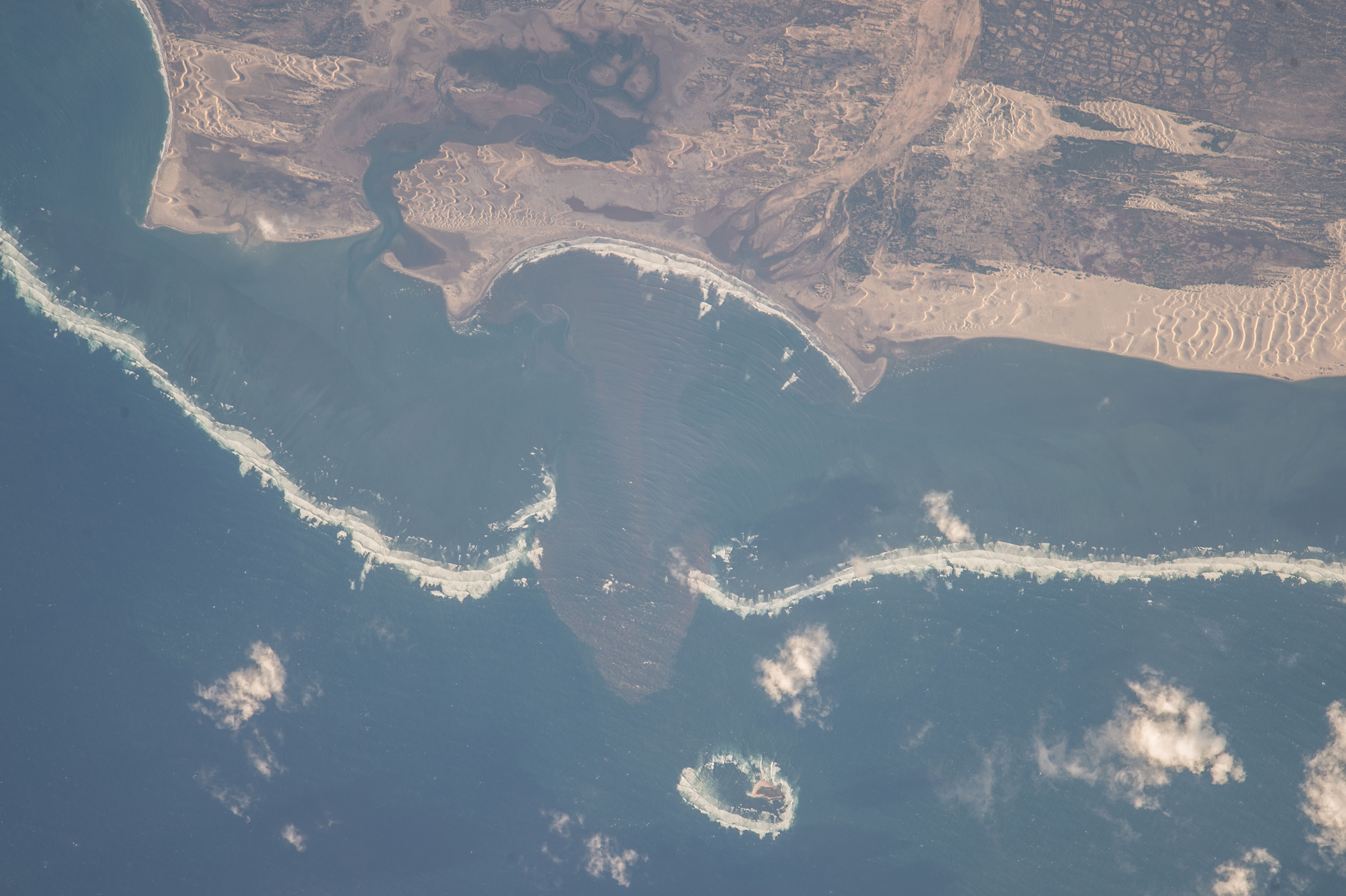
Image Caption: Linta River delta and dunes, southern Madagascar
Astronauts aboard the International Space Station used a very long lens to shoot this detailed image of the remote Linta River delta zone in southern Madagascar--showing 7.5 miles (12.1 km) of complex shoreline. Waves break far offshore (1.4 mi, 2.25 km) against a long line of coral reefs. A gap in the reef opposite the delta indicates where the river flowed at times of low sea level when the shoreline was far to the southwest of its present position, crossing the lower left corner of the image.
Bright, light-toned dunes cast shadows in the late afternoon sun. These winds build sand dunes by blowing sand out of the Linta River bed (image upper left). The bigger dune field (image upper right) is fed by sand moving from another delta out of the picture right. Just inland, numerous agricultural blocky fields occupy earlier dune fields (image far top right).
