ISS044-E-45576

| NASA Photo ID | ISS044-E-45576 |
| Focal Length | 28mm |
| Date taken | 2015.08.10 |
| Time taken | 08:02:49 GMT |
Resolutions offered for this image:
1002 x 735 pixels 540 x 396 pixels 4928 x 3280 pixels 720 x 480 pixels 4928 x 3280 pixels 640 x 426 pixels
1002 x 735 pixels 540 x 396 pixels 4928 x 3280 pixels 720 x 480 pixels 4928 x 3280 pixels 640 x 426 pixels


Cloud masks available for this image:
Spacecraft nadir point: 16.7° N, 99.2° W
Photo center point: 15.0° N, 88.5° W
Photo center point by machine learning:
Photo center point: 15.0° N, 88.5° W
Photo center point by machine learning:
Nadir to Photo Center: East
Spacecraft Altitude: 216 nautical miles (400km)
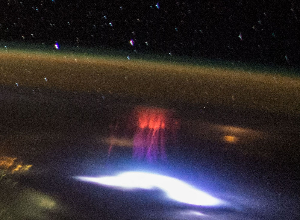
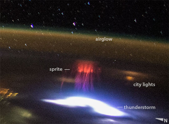
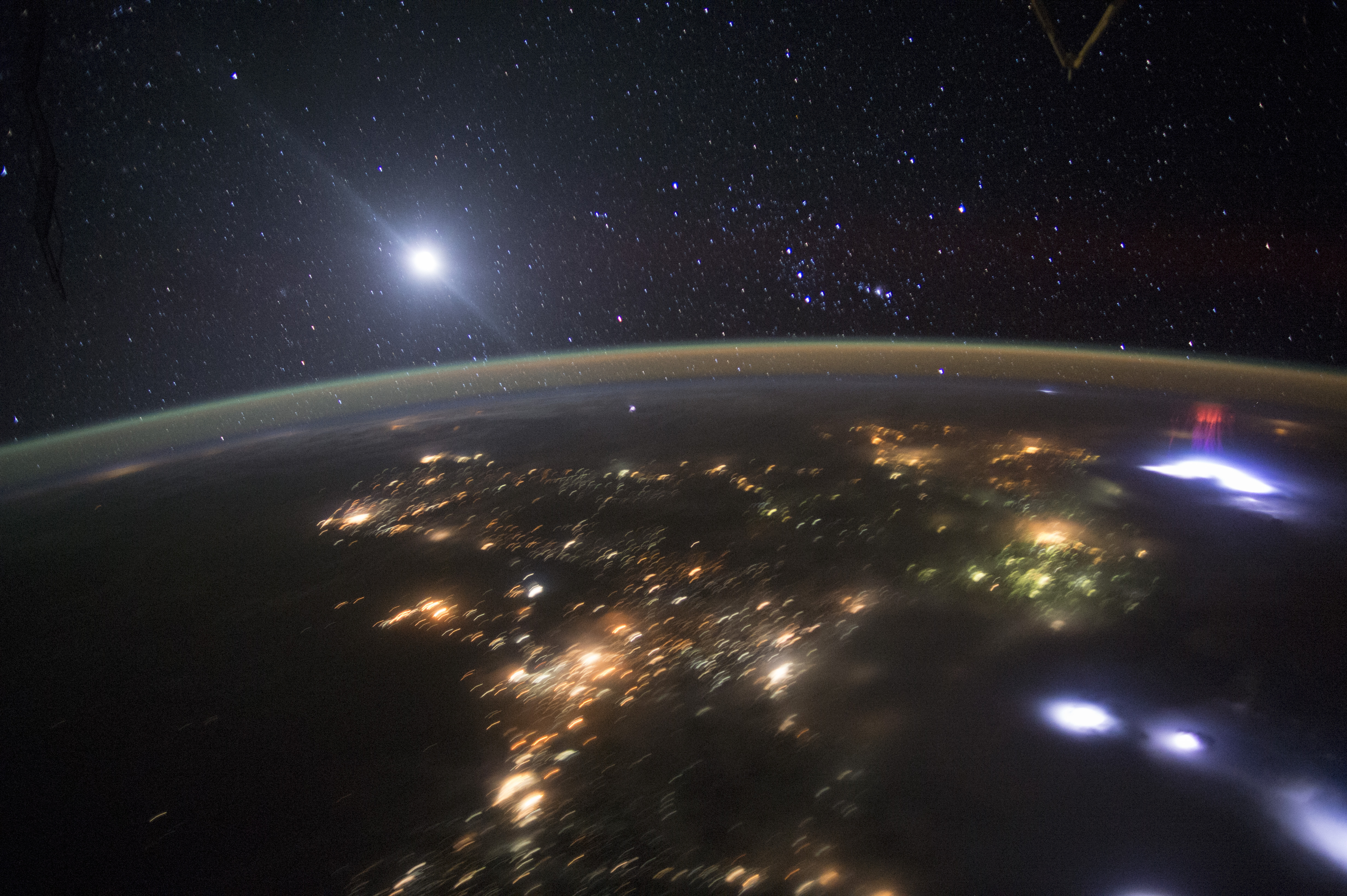
Country or Geographic Name: | HONDURAS |
Features: | CENTRAL AMERICA AT NIGHT |
| Features Found Using Machine Learning: | LIGHTNING, PAN- |
Cloud Cover Percentage: | 10 (1-10)% |
Sun Elevation Angle: | -52° |
Sun Azimuth: | 33° |
Camera: | Nikon D4 Electronic Still Camera |
Focal Length: | 28mm |
Camera Tilt: | High Oblique |
Format: | 4928E: 4928 x 3280 pixel CMOS sensor, 36.0mm x 23.9mm, total pixels: 16.6 million, Nikon FX format |
Film Exposure: | |
| Additional Information | |
| Width | Height | Annotated | Cropped | Purpose | Links |
|---|---|---|---|---|---|
| 1002 pixels | 735 pixels | No | Yes | Earth From Space collection | Download Image |
| 540 pixels | 396 pixels | Yes | Yes | Earth From Space collection | Download Image |
| 4928 pixels | 3280 pixels | No | No | NASA's Earth Observatory web site | Download Image |
| 720 pixels | 480 pixels | Yes | Yes | NASA's Earth Observatory web site | Download Image |
| 4928 pixels | 3280 pixels | No | No | Download Image | |
| 640 pixels | 426 pixels | No | No | Download Image |
Download Packaged File
Download a Google Earth KML for this Image
View photo footprint information
Download a GeoTIFF for this photo
Georeferenced by human interaction - exported 2016-08-17-001649-UTCGeoreferenced by human interaction - exported 2016-08-24-010628-UTC
Georeferenced by human interaction - exported 2018-01-16-161617-UTC
An explanation of the georeference file(s) above
Image Caption: none
