ISS043-E-86375
| NASA Photo ID | ISS043-E-86375 |
| Focal Length | 24mm |
| Date taken | 2015.04.03 |
| Time taken | 22:57:36 GMT |
Resolutions offered for this image:
1000 x 666 pixels 540 x 360 pixels 2464 x 1640 pixels 720 x 480 pixels 4928 x 3280 pixels 640 x 426 pixels
1000 x 666 pixels 540 x 360 pixels 2464 x 1640 pixels 720 x 480 pixels 4928 x 3280 pixels 640 x 426 pixels

Cloud masks available for this image:
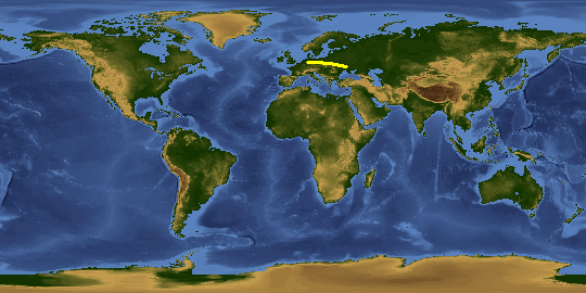
Spacecraft nadir point: 51.8° N, 9.7° E
Photo center point: 58.0° N, 14.0° E
Photo center point by machine learning:
Photo center point: 58.0° N, 14.0° E
Photo center point by machine learning:
Nadir to Photo Center: Northeast
Spacecraft Altitude: 213 nautical miles (394km)
Country or Geographic Name: | SWEDEN |
Features: | SOUTHERN SCANDINAVIA AT NIGHT |
| Features Found Using Machine Learning: | AURORA, PAN- |
Cloud Cover Percentage: | 50 (26-50)% |
Sun Elevation Angle: | -33° |
Sun Azimuth: | 352° |
Camera: | Nikon D4 Electronic Still Camera |
Focal Length: | 24mm |
Camera Tilt: | High Oblique |
Format: | 4928E: 4928 x 3280 pixel CMOS sensor, 36.0mm x 23.9mm, total pixels: 16.6 million, Nikon FX format |
Film Exposure: | |
| Additional Information | |
This photo is one of the photos used to create this time-lapse video:
| Width | Height | Annotated | Cropped | Purpose | Links |
|---|---|---|---|---|---|
| 1000 pixels | 666 pixels | No | No | Earth From Space collection | Download Image |
| 540 pixels | 360 pixels | Yes | No | Earth From Space collection | Download Image |
| 2464 pixels | 1640 pixels | No | No | NASA's Earth Observatory web site | Download Image |
| 720 pixels | 480 pixels | Yes | No | NASA's Earth Observatory web site | Download Image |
| 4928 pixels | 3280 pixels | No | No | Download Image | |
| 640 pixels | 426 pixels | No | No | Download Image |
Download Packaged File
Download a Google Earth KML for this Image
View photo footprint information
Download a GeoTIFF for this photo
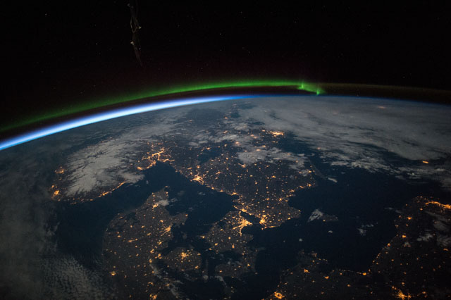
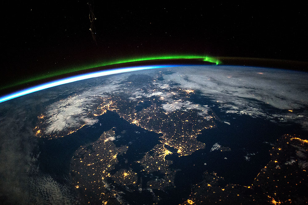
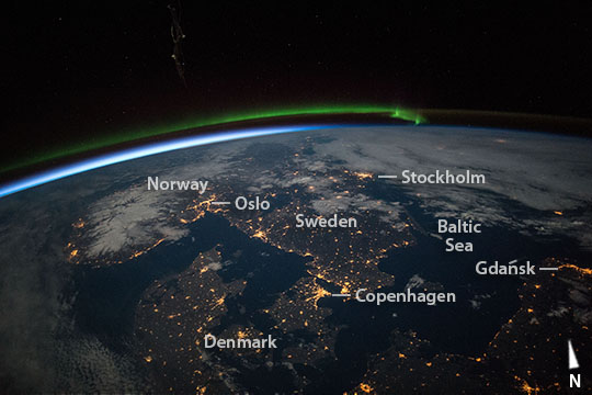
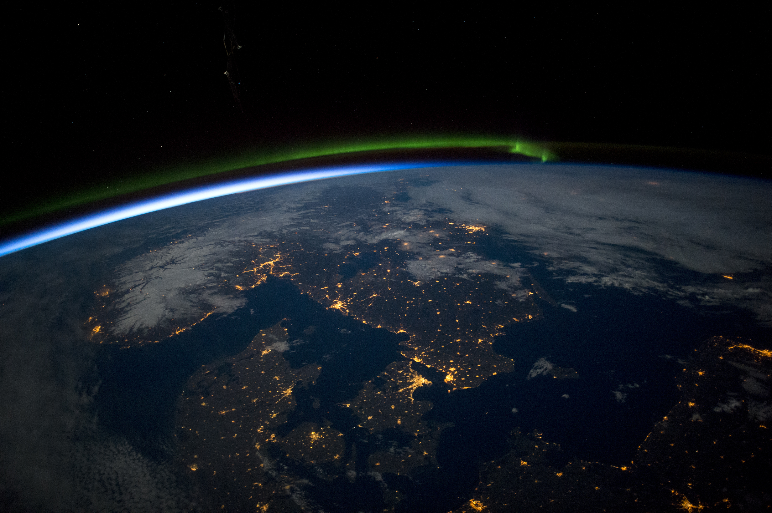
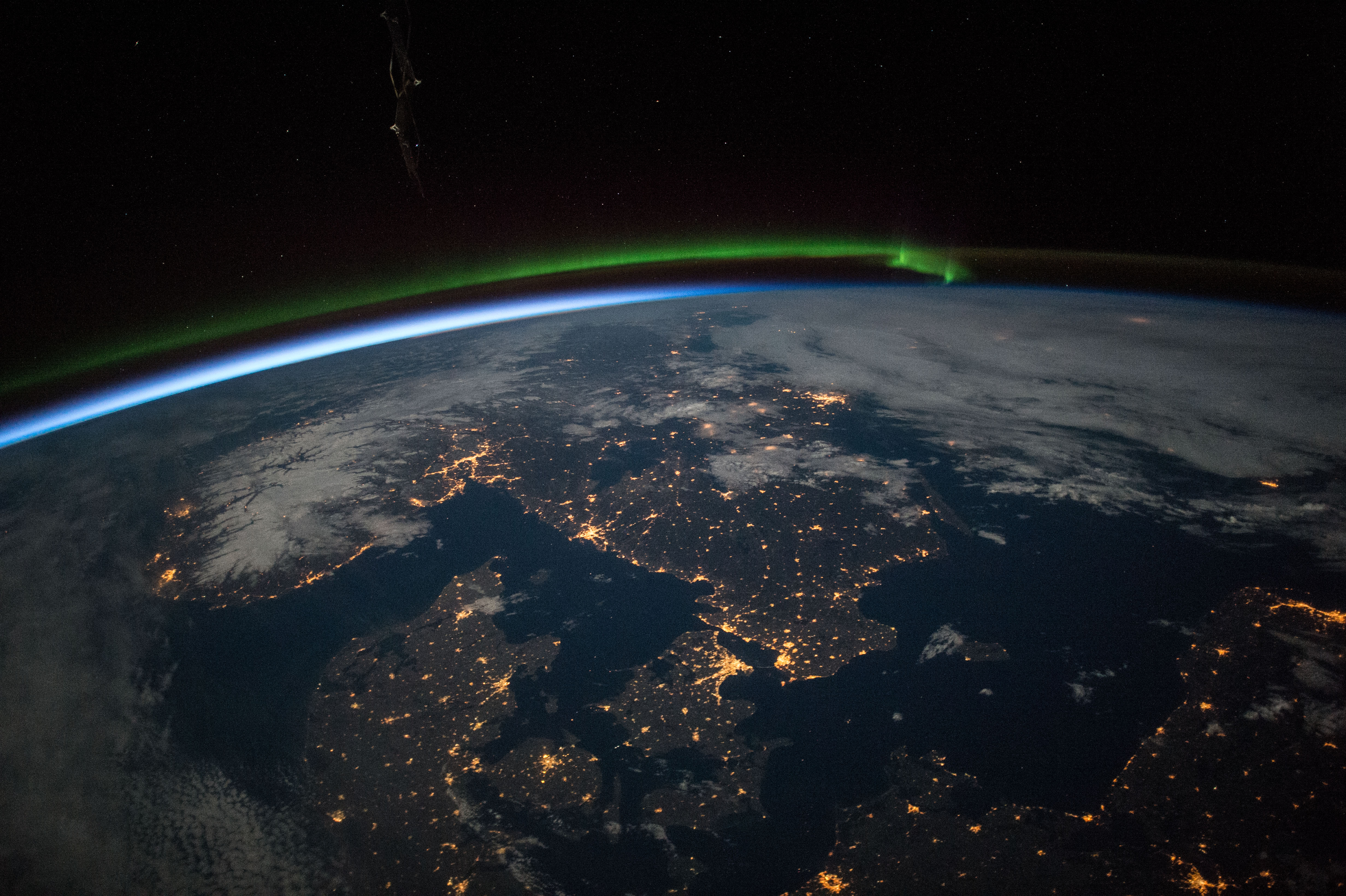
Image Caption: Scandinavia at night
Astronauts aboard the International Space Station took this image of southern Scandinavia just before midnight under a full moon. Prominent features include a green aurora to the north (upper middle of the image), the blackness of the Baltic Sea (lower right), clouds (top right) and snow in Norway illuminated under a full moon. City lights clearly show the recognizable coastline of the Skagerrak and Kattegat seaway leading into the Baltic Sea that separates Denmark from its neighbors to the north. The largest light clusters on the seaway are the capital cities of Oslo and Copenhagen. Cities facing the Baltic are the Polish port of Gdansk and the Swedish capital, Stockholm. Smaller cities in northern Germany reveal the Baltic coastline (lower right).
Astronauts aboard the International Space Station took this image of southern Scandinavia just before midnight under a full moon. Prominent features include a green aurora to the north (upper middle of the image), the blackness of the Baltic Sea (lower right), clouds (top right) and snow in Norway illuminated under a full moon. City lights clearly show the recognizable coastline of the Skagerrak and Kattegat seaway leading into the Baltic Sea that separates Denmark from its neighbors to the north. The largest light clusters on the seaway are the capital cities of Oslo and Copenhagen. Cities facing the Baltic are the Polish port of Gdansk and the Swedish capital, Stockholm. Smaller cities in northern Germany reveal the Baltic coastline (lower right).
