ISS043-E-5265
| NASA Photo ID | ISS043-E-5265 |
| Focal Length | 116mm |
| Date taken | 2015.03.14 |
| Time taken | 18:56:33 GMT |
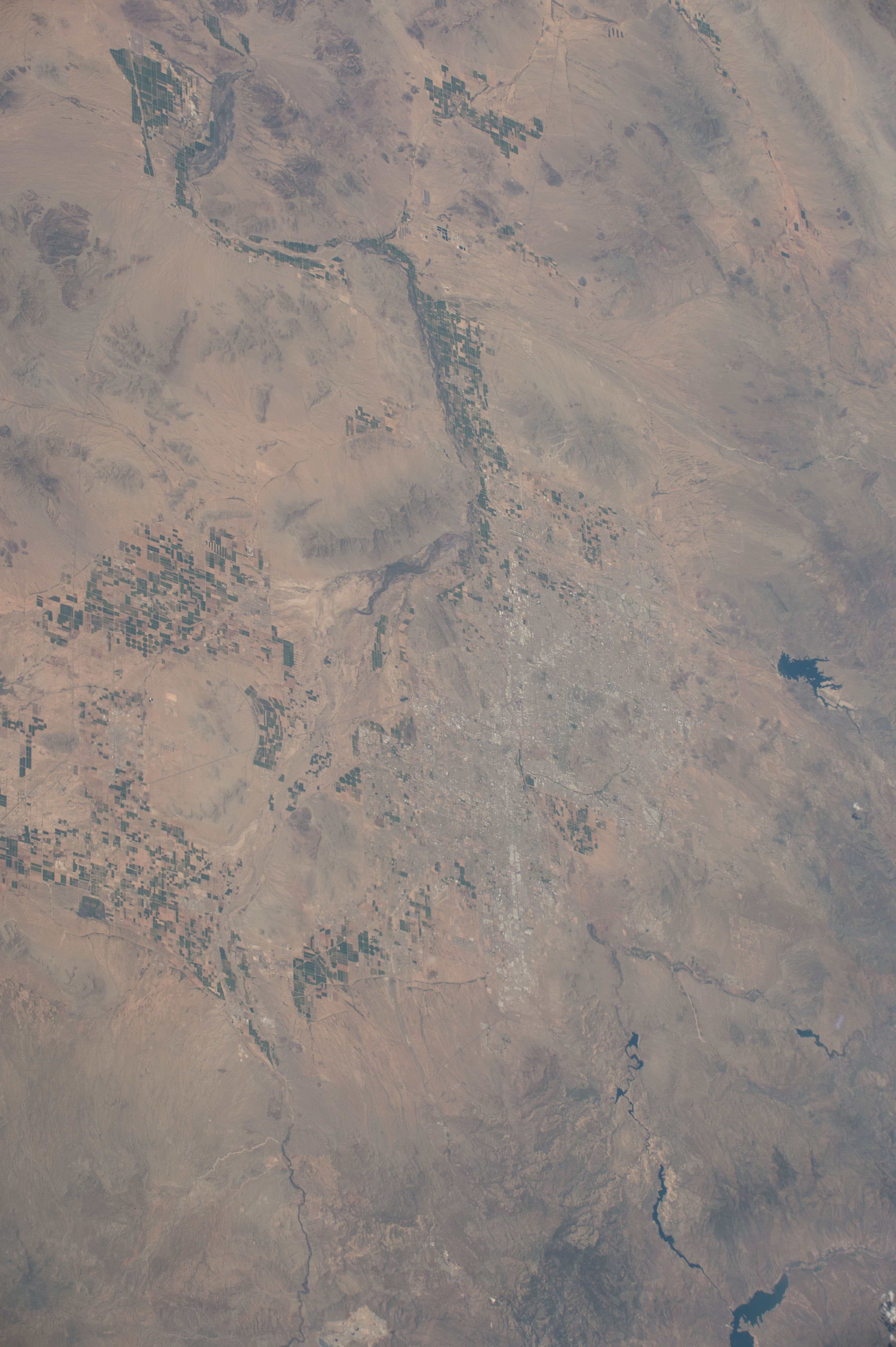


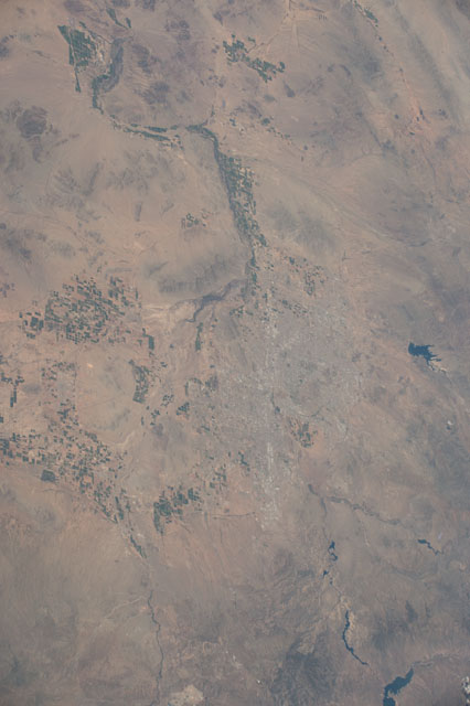
Spacecraft nadir point: 31.1° N, 109.0° W
Photo center point: 33.4° N, 112.1° W
Photo center point by machine learning:
Photo center point: 33.4° N, 112.1° W
Photo center point by machine learning:
Nadir to Photo Center: Northwest
Spacecraft Altitude: 212 nautical miles (393km)
Country or Geographic Name: | USA-ARIZONA |
Features: | PUBLIC INPUTS (from public image detectives, not NASA): SAGUARO,GILA RIVER,LAKES: PLEASANT,CASA GRANDE; ARIZONA,SALT RIVER,BARTLETT; PHOENIX METRO AREA,LUKE AIR FORCE BASE(KLUF),THEODORE ROOSEVELT LAKE,LAKE PLEASANT,PHOENIX AZ,APACHE LAKE,PHOENIX SKY HARBOR INTERNATIONAL AIRPORT (KPHX) |
| Features Found Using Machine Learning: | |
Cloud Cover Percentage: | 10 (1-10)% |
Sun Elevation Angle: | 56° |
Sun Azimuth: | 167° |
Camera: | Nikon D4 Electronic Still Camera |
Focal Length: | 116mm |
Camera Tilt: | 48 degrees |
Format: | 4928E: 4928 x 3280 pixel CMOS sensor, 36.0mm x 23.9mm, total pixels: 16.6 million, Nikon FX format |
Film Exposure: | |
| Additional Information | |
| Width | Height | Annotated | Cropped | Purpose | Links |
|---|---|---|---|---|---|
| 3280 pixels | 4928 pixels | No | No | Download Image | |
| 426 pixels | 640 pixels | No | No | Download Image |
Download Packaged File
Download a Google Earth KML for this Image
View photo footprint information
Download a GeoTIFF for this photo
Image Caption: none
