ISS043-E-3097
| NASA Photo ID | ISS043-E-3097 |
| Focal Length | 28mm |
| Date taken | 2015.03.13 |
| Time taken | 23:46:54 GMT |
Cloud masks available for this image:
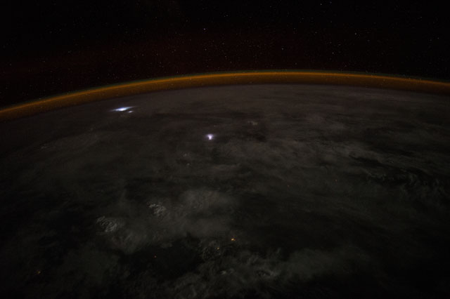
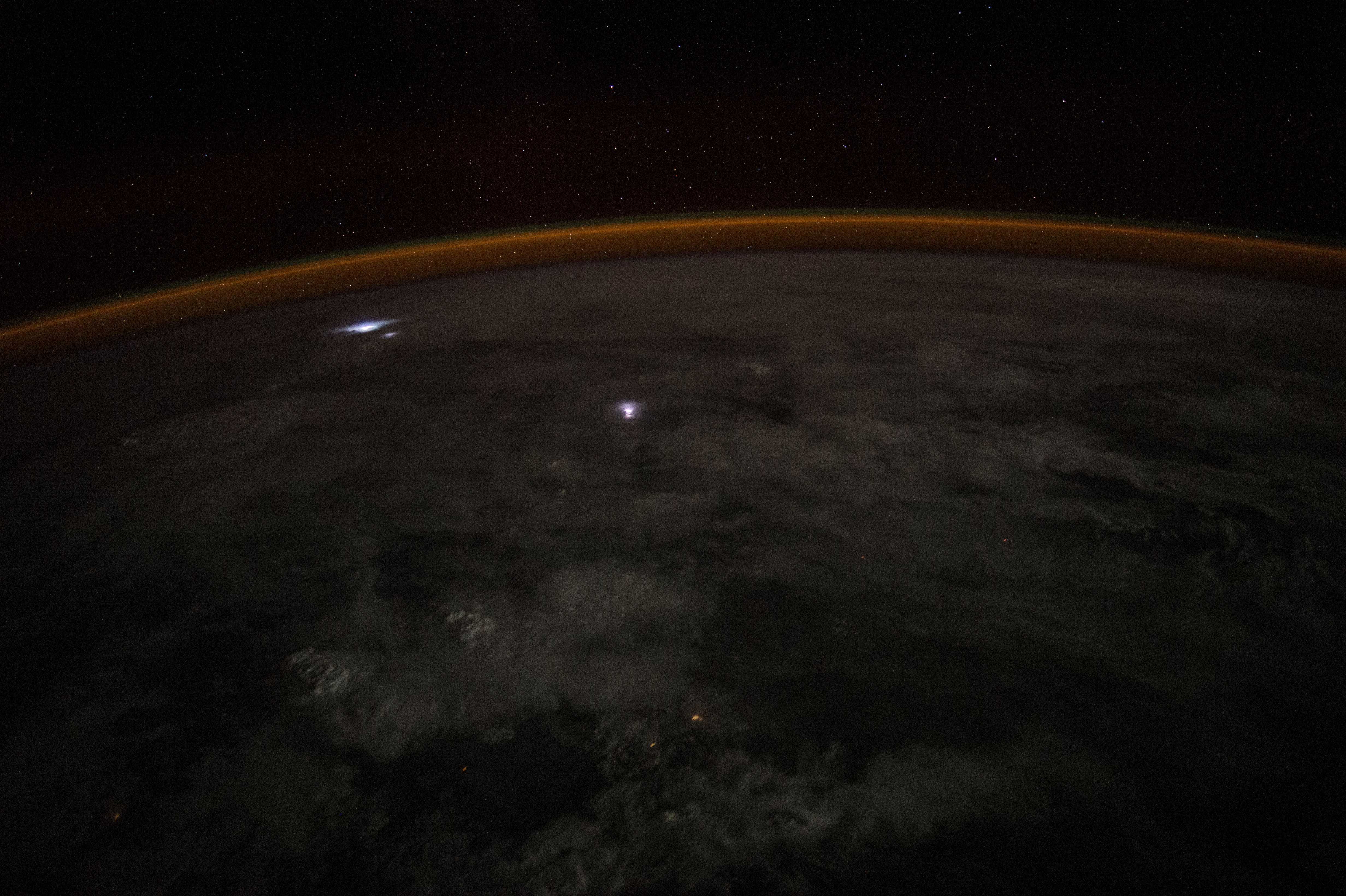
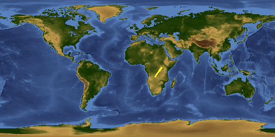
Spacecraft nadir point: 10.9° S, 22.9° E
Photo center point:
Photo center point by machine learning:
Photo center point:
Photo center point by machine learning:
Nadir to Photo Center:
Spacecraft Altitude: 219 nautical miles (406km)
Country or Geographic Name: | AFRICA |
Features: | PAN-ATMOSPHERIC LIMB, AIRGLOW, STAR FIELD, LIGHTNING IN CLOUDS AT NIGHT |
| Features Found Using Machine Learning: | PAN- |
Cloud Cover Percentage: | 100 (76-100)% |
Sun Elevation Angle: | -68° |
Sun Azimuth: | 127° |
Camera: | Nikon D4 Electronic Still Camera |
Focal Length: | 28mm |
Camera Tilt: | High Oblique |
Format: | 4928E: 4928 x 3280 pixel CMOS sensor, 36.0mm x 23.9mm, total pixels: 16.6 million, Nikon FX format |
Film Exposure: | |
| Additional Information | |
This photo is one of the photos used to create this time-lapse video:
| Width | Height | Annotated | Cropped | Purpose | Links |
|---|---|---|---|---|---|
| 4928 pixels | 3280 pixels | No | No | Download Image | |
| 640 pixels | 426 pixels | No | No | Download Image |
Download Packaged File
Download a Google Earth KML for this Image
View photo footprint information
Download a GeoTIFF for this photo
Image Caption: none
