ISS043-E-101445

| NASA Photo ID | ISS043-E-101445 |
| Focal Length | 800mm |
| Date taken | 2015.04.10 |
| Time taken | 16:19:32 GMT |
Resolutions offered for this image:
1000 x 691 pixels 540 x 373 pixels 4928 x 3280 pixels 720 x 480 pixels 4928 x 3280 pixels 640 x 426 pixels
1000 x 691 pixels 540 x 373 pixels 4928 x 3280 pixels 720 x 480 pixels 4928 x 3280 pixels 640 x 426 pixels


Spacecraft nadir point: 27.1° S, 46.0° W
Photo center point: 27.6° S, 48.6° W
Photo center point by machine learning: 27.61° S, 48.58° W
Photo center point: 27.6° S, 48.6° W
Photo center point by machine learning: 27.61° S, 48.58° W
Nadir to Photo Center: West
Spacecraft Altitude: 219 nautical miles (406km)

Country or Geographic Name: | BRAZIL |
Features: | FLORIANOPOLIS, AIRPORT, SEDIMENT PLUMES |
| Features Found Using Machine Learning: | |
Cloud Cover Percentage: | 10 (1-10)% |
Sun Elevation Angle: | 51° |
Sun Azimuth: | 330° |
Camera: | Nikon D4 Electronic Still Camera |
Focal Length: | 800mm |
Camera Tilt: | 36 degrees |
Format: | 4928E: 4928 x 3280 pixel CMOS sensor, 36.0mm x 23.9mm, total pixels: 16.6 million, Nikon FX format |
Film Exposure: | |
| Additional Information | |
| Width | Height | Annotated | Cropped | Purpose | Links |
|---|---|---|---|---|---|
| 1000 pixels | 691 pixels | No | No | Earth From Space collection | Download Image |
| 540 pixels | 373 pixels | Yes | No | Earth From Space collection | Download Image |
| 4928 pixels | 3280 pixels | No | No | NASA's Earth Observatory web site | Download Image |
| 720 pixels | 480 pixels | Yes | Yes | NASA's Earth Observatory web site | Download Image |
| 4928 pixels | 3280 pixels | No | No | Download Image | |
| 640 pixels | 426 pixels | No | No | Download Image |
Download Packaged File
Download a Google Earth KML for this Image
View photo footprint information
Download a GeoTIFF for this photo
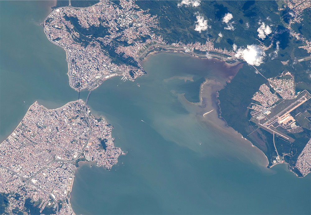
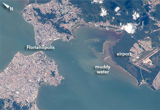
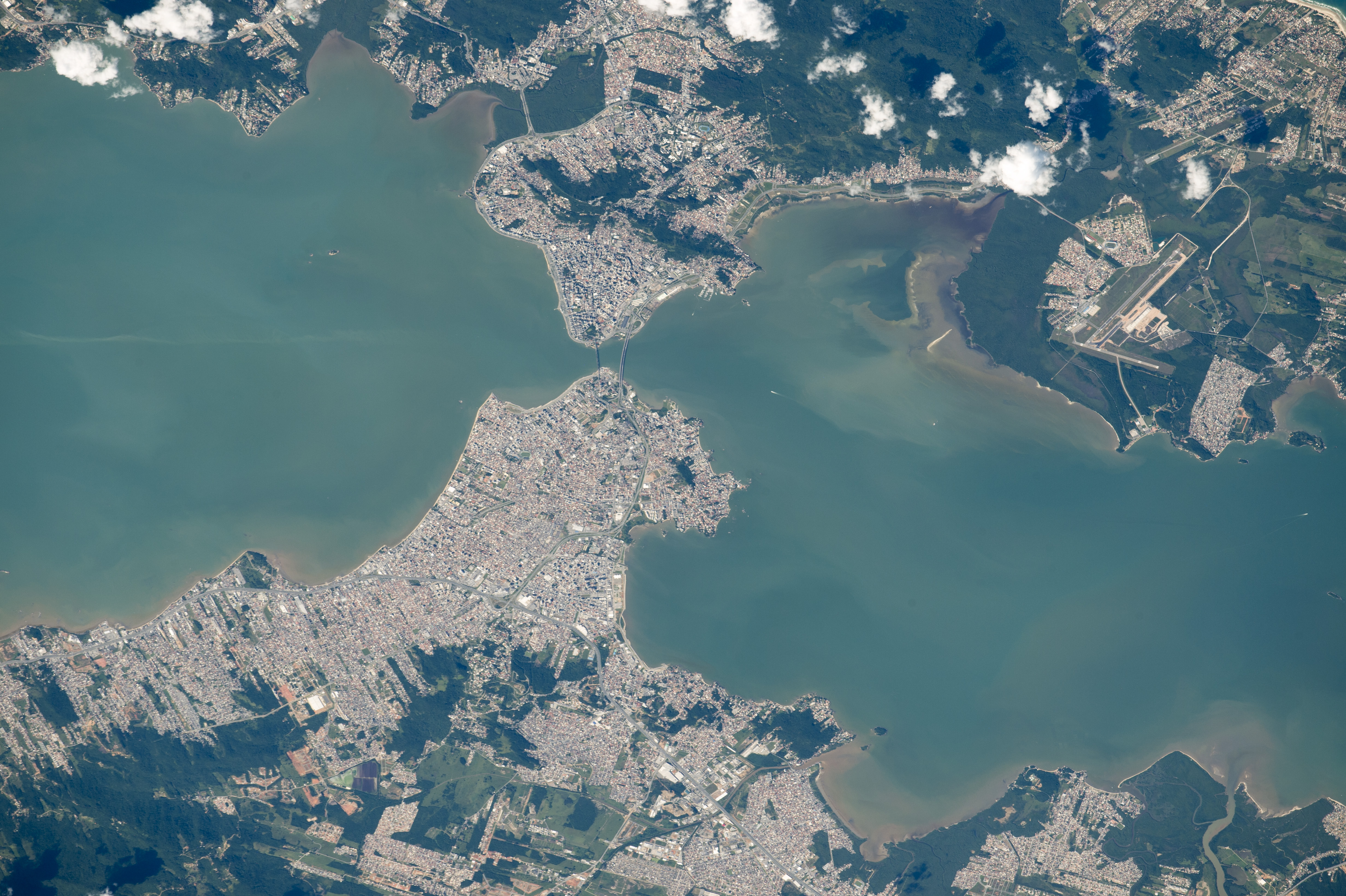
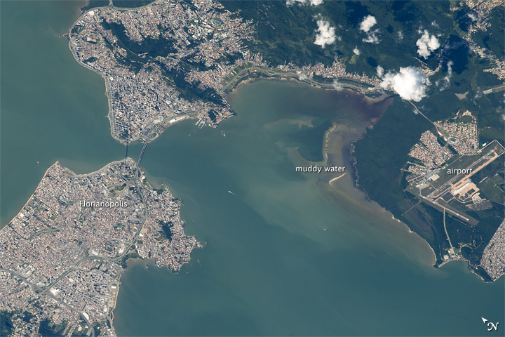
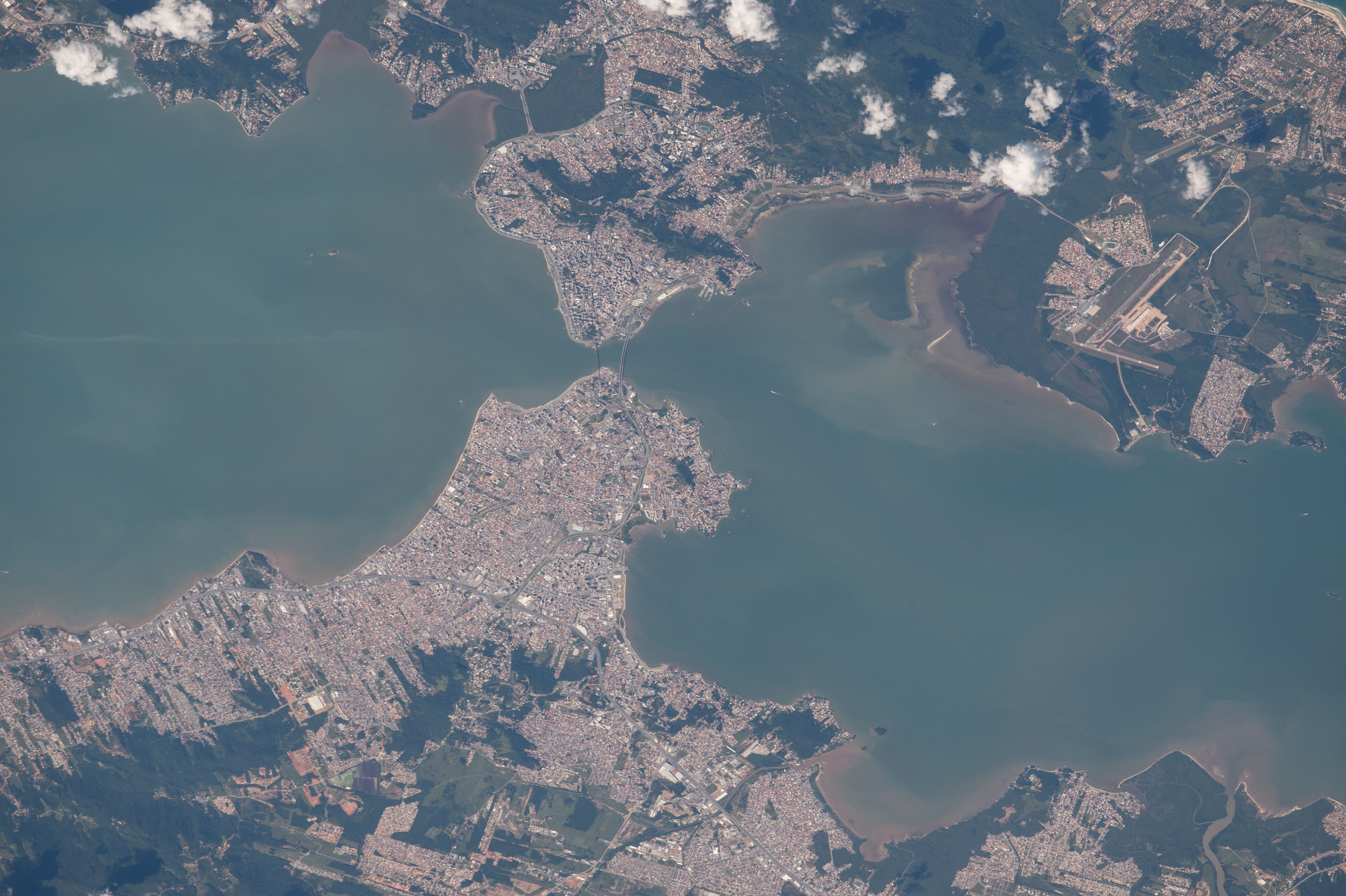
Image Caption: Florianopolis, southern Brazilian
This image was taken as astronauts aboard the International Space Station flew over the headlands of the southern Brazilian port city of Florianopolis. The east side (image top right) and west side (image lower left) of the city are joined by bridges that span the 400 m-wide narrows. The International Airport of Florianopolis appears lower right. This city has one of the highest-quality-of-life indices in Brazil. The view shows the browner muddy outflow of a small stream that enters the bay near the airport. Most coastlines show faint brown tinges in the water that arise from wave action stirring up shoreline muds, as well as some city pollution.
This image was taken as astronauts aboard the International Space Station flew over the headlands of the southern Brazilian port city of Florianopolis. The east side (image top right) and west side (image lower left) of the city are joined by bridges that span the 400 m-wide narrows. The International Airport of Florianopolis appears lower right. This city has one of the highest-quality-of-life indices in Brazil. The view shows the browner muddy outflow of a small stream that enters the bay near the airport. Most coastlines show faint brown tinges in the water that arise from wave action stirring up shoreline muds, as well as some city pollution.
