ISS042-E-6851

| NASA Photo ID | ISS042-E-6851 |
| Focal Length | 650mm |
| Date taken | 2014.11.19 |
| Time taken | 21:59:53 GMT |
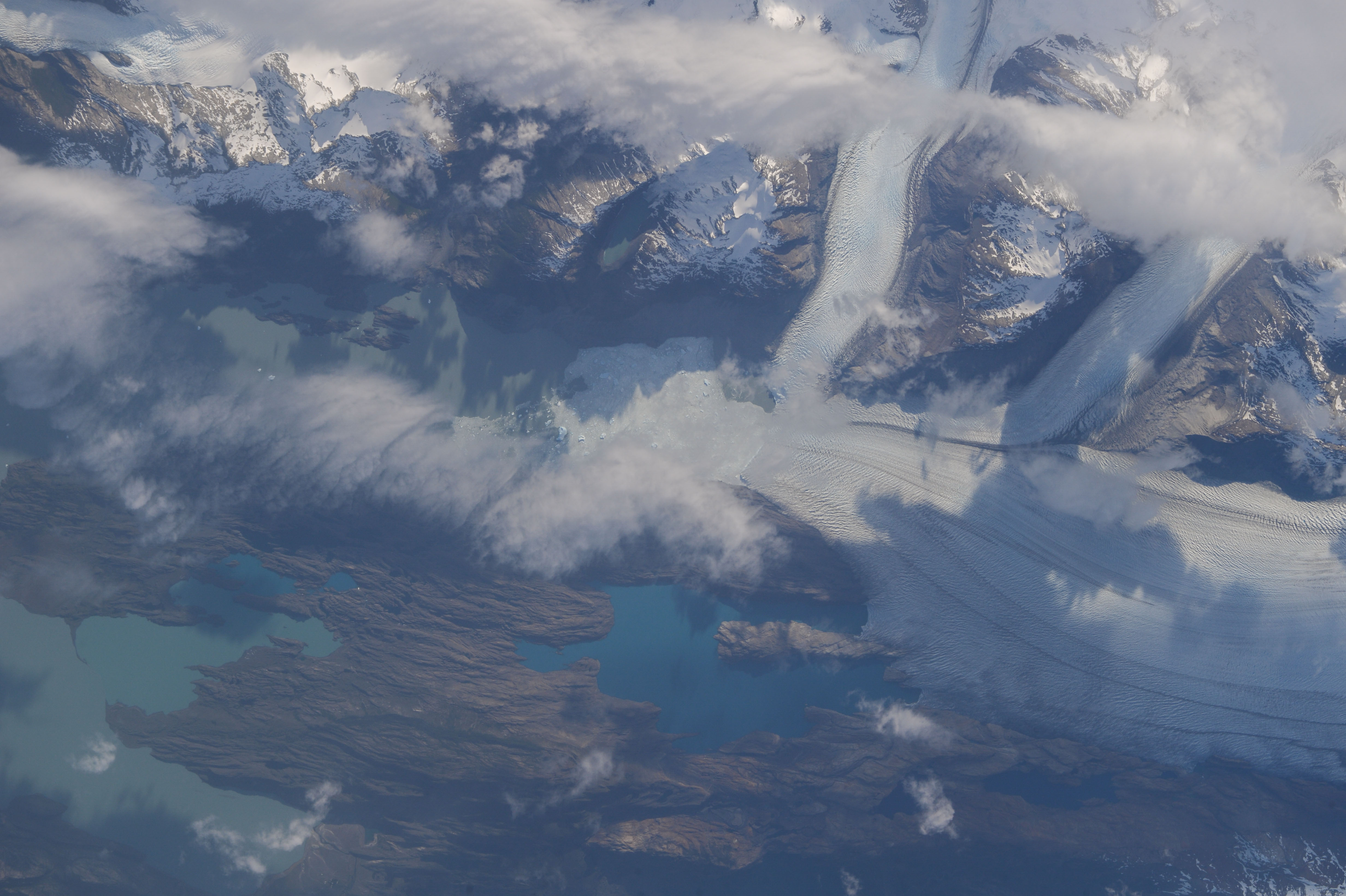


Spacecraft nadir point: 51.7° S, 75.2° W
Photo center point: 49.9° S, 73.3° W
Photo center point by machine learning:
Photo center point: 49.9° S, 73.3° W
Photo center point by machine learning:
Nadir to Photo Center: Northeast
Spacecraft Altitude: 227 nautical miles (420km)
Country or Geographic Name: | ARGENTINA |
Features: | PUBLIC INPUTS (from public image detectives, not NASA): PATAGONIA,LOS GLACIARES NATIONAL PARK,LAKE ARGENTINO,UPSALA GLACIER,PATAGONIAN ICE CAP,ARGENTINA |
| Features Found Using Machine Learning: | |
Cloud Cover Percentage: | 25 (11-25)% |
Sun Elevation Angle: | 22° |
Sun Azimuth: | 266° |
Camera: | Nikon D4 Electronic Still Camera |
Focal Length: | 650mm |
Camera Tilt: | 35 degrees |
Format: | 4928E: 4928 x 3280 pixel CMOS sensor, 36.0mm x 23.9mm, total pixels: 16.6 million, Nikon FX format |
Film Exposure: | |
| Additional Information | |
| Width | Height | Annotated | Cropped | Purpose | Links |
|---|---|---|---|---|---|
| 4928 pixels | 3280 pixels | No | No | Download Image | |
| 640 pixels | 426 pixels | No | No | Download Image |
Download Packaged File
Download a Google Earth KML for this Image
View photo footprint information
Download a GeoTIFF for this photo
Georeferenced automatically using the human-determined center point - exported 2018-01-09-222342-UTCAn explanation of the georeference file(s) above
Image Caption: none
