ISS041-E-20195

| NASA Photo ID | ISS041-E-20195 |
| Focal Length | 80mm |
| Date taken | 2014.09.19 |
| Time taken | 20:54:32 GMT |
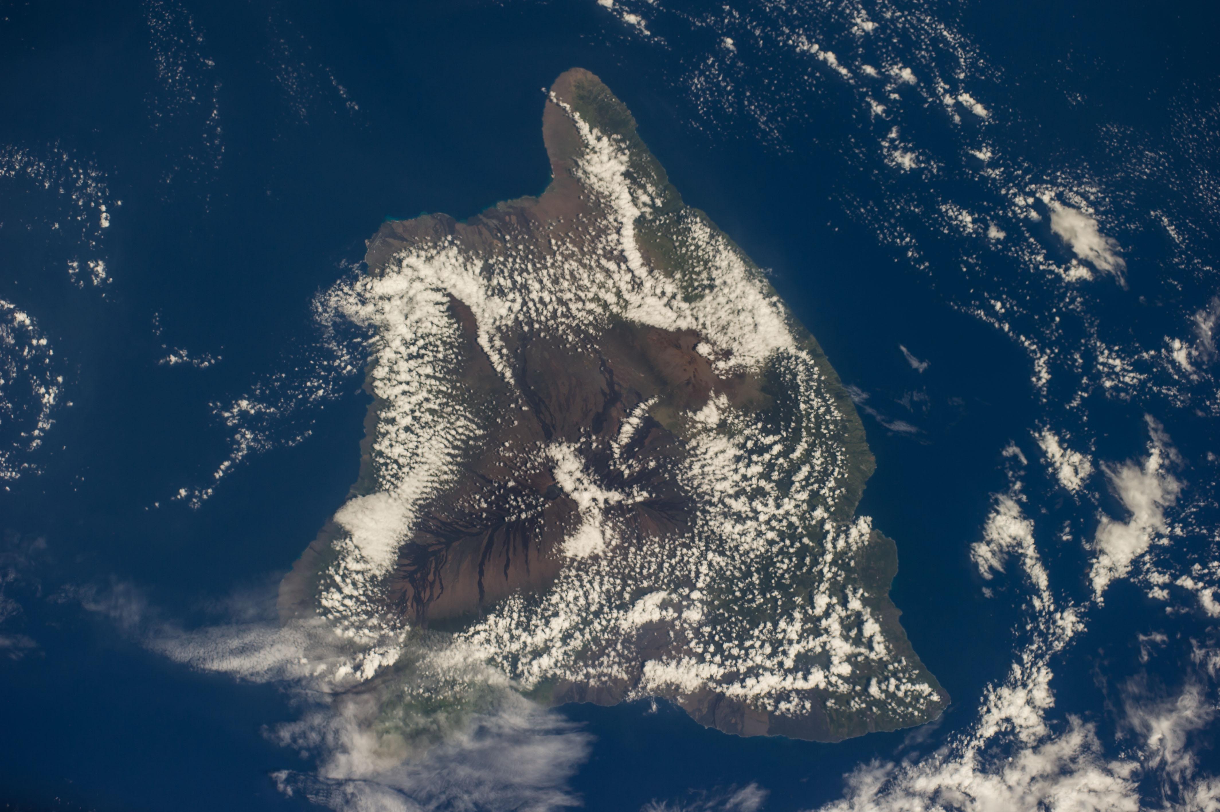

Spacecraft nadir point: 16.1° N, 155.2° W
Photo center point: 19.5° N, 155.5° W
Photo center point by machine learning:
Photo center point: 19.5° N, 155.5° W
Photo center point by machine learning:
Nadir to Photo Center: North
Spacecraft Altitude: 223 nautical miles (413km)
Country or Geographic Name: | USA-HAWAII |
Features: | HAWAII, MAUNA LOA, MAUNA KEA, PACIFIC O. |
| Features Found Using Machine Learning: | |
Cloud Cover Percentage: | 100 (76-100)% |
Sun Elevation Angle: | 65° |
Sun Azimuth: | 125° |
Camera: | Nikon D3S Electronic Still Camera |
Focal Length: | 80mm |
Camera Tilt: | 42 degrees |
Format: | 4256E: 4256 x 2832 pixel CMOS sensor, 36.0mm x 23.9mm, total pixels: 12.87 million, Nikon FX format |
Film Exposure: | |
| Additional Information | |
| Width | Height | Annotated | Cropped | Purpose | Links |
|---|---|---|---|---|---|
| 4256 pixels | 2832 pixels | No | No | Download Image | |
| 640 pixels | 426 pixels | No | No | Download Image |
Download Packaged File
Download a Google Earth KML for this Image
View photo footprint information
Download a GeoTIFF for this photo
Image Caption: CATALOGED BY TEXAS STATE UNIVERSITY
