ISS041-E-103791

| NASA Photo ID | ISS041-E-103791 |
| Focal Length | 800mm |
| Date taken | 2014.10.28 |
| Time taken | 17:09:06 GMT |
Resolutions offered for this image:
1000 x 819 pixels 540 x 442 pixels 4928 x 3280 pixels 720 x 480 pixels 720 x 480 pixels 3280 x 4928 pixels 426 x 640 pixels
1000 x 819 pixels 540 x 442 pixels 4928 x 3280 pixels 720 x 480 pixels 720 x 480 pixels 3280 x 4928 pixels 426 x 640 pixels


Spacecraft nadir point: 43.8° N, 87.7° W
Photo center point: 41.8° N, 87.9° W
Photo center point by machine learning:
Photo center point: 41.8° N, 87.9° W
Photo center point by machine learning:
Nadir to Photo Center: South
Spacecraft Altitude: 220 nautical miles (407km)
Country or Geographic Name: | USA-ILLINOIS |
Features: | CHICAGO, LOOP, CHICAGO R., L. MICHIGAN |
| Features Found Using Machine Learning: | |
Cloud Cover Percentage: | 10 (1-10)% |
Sun Elevation Angle: | 33° |
Sun Azimuth: | 173° |
Camera: | Nikon D4 Electronic Still Camera |
Focal Length: | 800mm |
Camera Tilt: | 29 degrees |
Format: | 4928E: 4928 x 3280 pixel CMOS sensor, 36.0mm x 23.9mm, total pixels: 16.6 million, Nikon FX format |
Film Exposure: | |
| Additional Information | |
| Width | Height | Annotated | Cropped | Purpose | Links |
|---|---|---|---|---|---|
| 1000 pixels | 819 pixels | No | Yes | Earth From Space collection | Download Image |
| 540 pixels | 442 pixels | Yes | Yes | Earth From Space collection | Download Image |
| 4928 pixels | 3280 pixels | No | No | NASA's Earth Observatory web site | Download Image |
| 720 pixels | 480 pixels | Yes | No | NASA's Earth Observatory web site | Download Image |
| 720 pixels | 480 pixels | Yes | Yes | NASA's Earth Observatory web site | Download Image |
| 3280 pixels | 4928 pixels | No | No | Download Image | |
| 426 pixels | 640 pixels | No | No | Download Image |
Download Packaged File
Download a Google Earth KML for this Image
View photo footprint information
Download a GeoTIFF for this photo
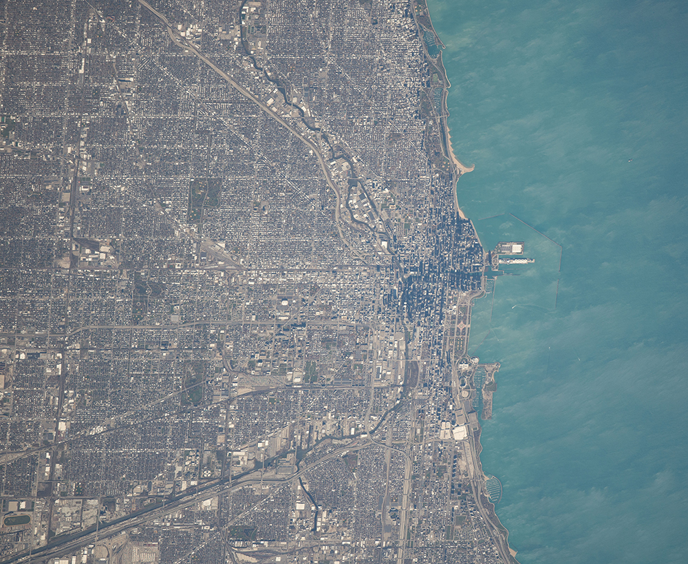
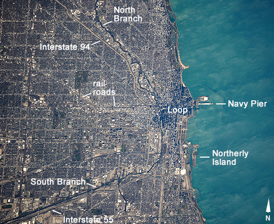
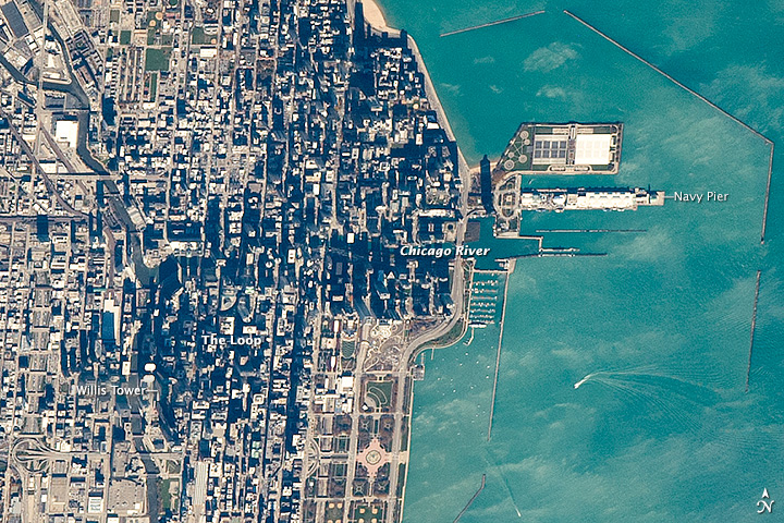
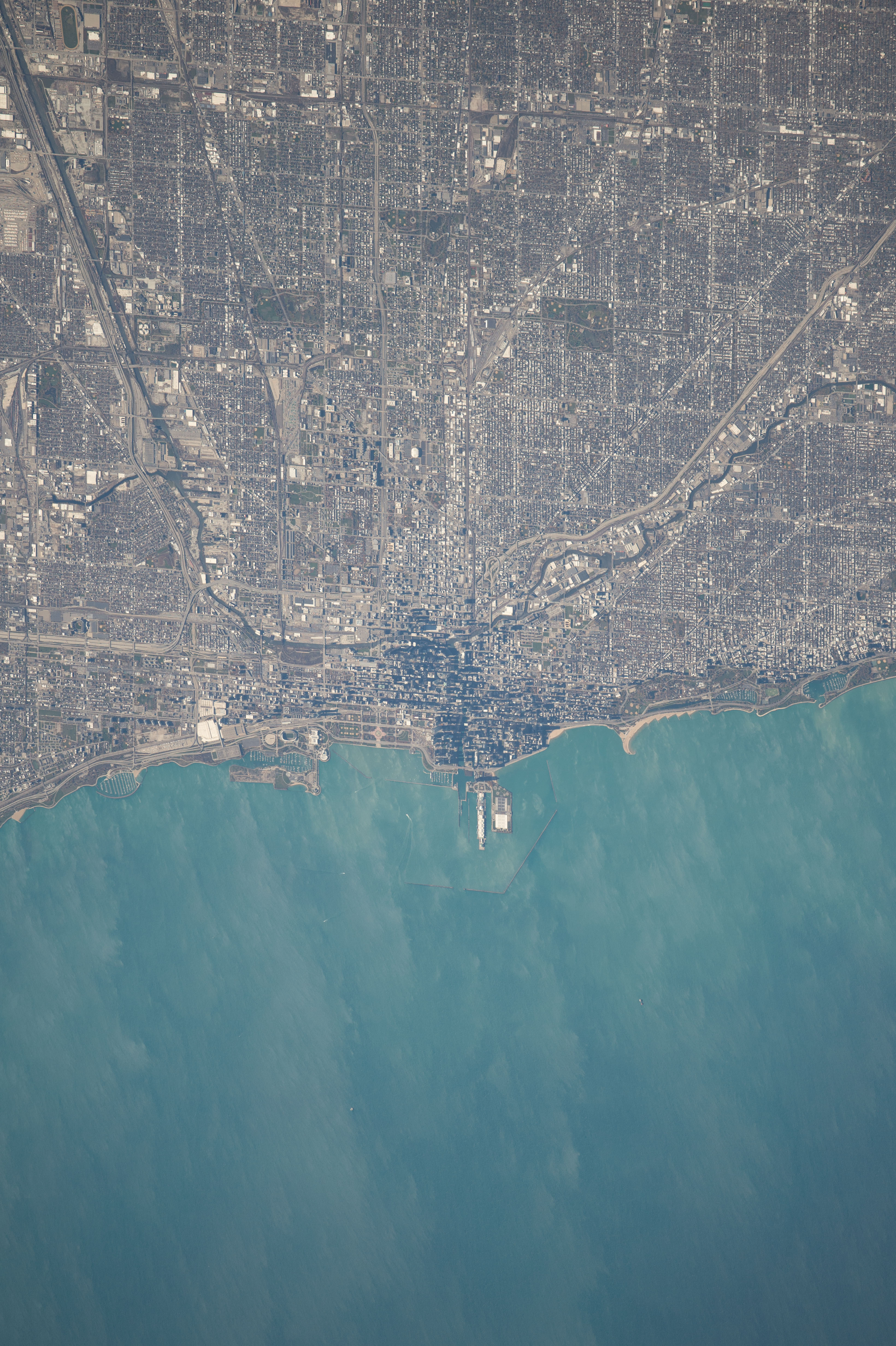
Image Caption: Chicago, Illinois
This image of Chicago and 16 miles (26 km) of the Lake Michigan shoreline was taken from the International Space Station. It shows how natural features control the growth of the city. Chicago's center--known as the Loop--lies at the mouth of the Chicago River, reflecting a time when this was the earliest settlement at a point where lake and river traffic converged. Navy Pier was built in 1916 at this transportation node primarily as a cargo facility for lake freighters. The city center still occupies the same location nearly two hundred years later.
Modern highways (I-94 and I-55) prominently are aligned toward the city center, following older transportation routes that ran along the banks of the North and South Branches of the Chicago River-that are still used by barge traffic. Railroads also converge on the city center. Residential and business land uses are competing with the transport functions. For example, Meigs Field was the small downtown airport located on Northerly Island that was bulldozed in 2003 to make way for a city waterfront park.
The city center is distinctly darker as seen from orbit because high rise buildings in the Loop cast much more shadow than low buildings in the surrounding neighborhoods.
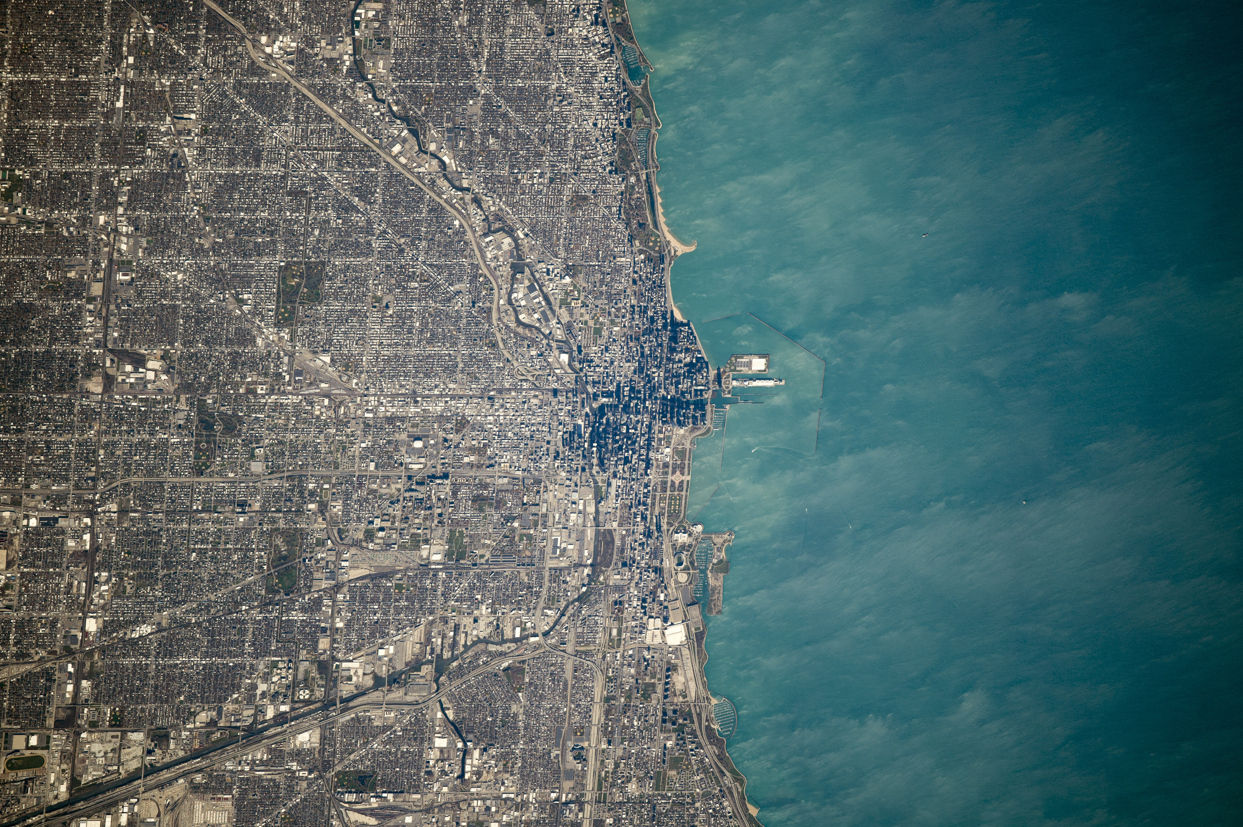
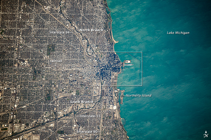
