ISS040-E-91158
| NASA Photo ID | ISS040-E-91158 |
| Focal Length | 145mm |
| Date taken | 2014.08.10 |
| Time taken | 00:41:04 GMT |
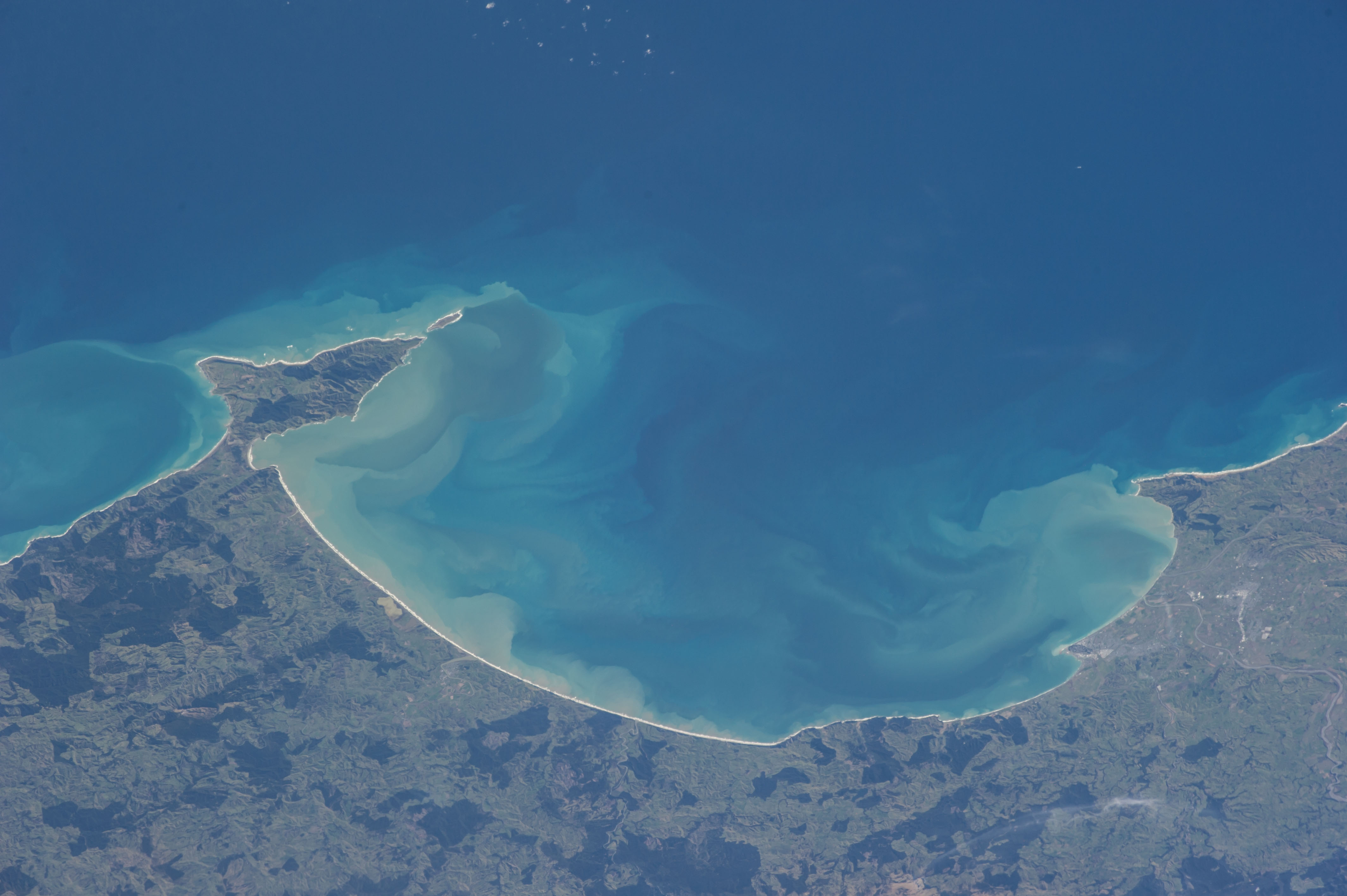


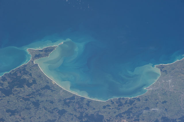
Spacecraft nadir point: 40.3° S, 177.9° W
Photo center point: 39.4° S, 177.5° E
Photo center point by machine learning: 39.39° S, 178.07° E
Photo center point: 39.4° S, 177.5° E
Photo center point by machine learning: 39.39° S, 178.07° E
Nadir to Photo Center: West
Spacecraft Altitude: 225 nautical miles (417km)

Country or Geographic Name: | NEW ZEALAND-NI |
Features: | HAWKE'S B. REGION, HAWKE B., HASTINGS, NAPIER, MAHIA PEN. |
| Features Found Using Machine Learning: | |
Cloud Cover Percentage: | 10 (1-10)% |
Sun Elevation Angle: | 33° |
Sun Azimuth: | 347° |
Camera: | Nikon D3S Electronic Still Camera |
Focal Length: | 145mm |
Camera Tilt: | High Oblique |
Format: | 4256E: 4256 x 2832 pixel CMOS sensor, 36.0mm x 23.9mm, total pixels: 12.87 million, Nikon FX format |
Film Exposure: | |
| Additional Information | |
| Width | Height | Annotated | Cropped | Purpose | Links |
|---|---|---|---|---|---|
| 4256 pixels | 2832 pixels | No | No | Download Image | |
| 640 pixels | 426 pixels | No | No | Download Image |
Download Packaged File
Download a Google Earth KML for this Image
View photo footprint information
Download a GeoTIFF for this photo
Georeferenced by human interaction - exported 2016-08-16-230049-UTCGeoreferenced by human interaction - exported 2016-08-23-234617-UTC
Georeferenced by human interaction - exported 2018-01-16-143458-UTC
An explanation of the georeference file(s) above
Image Caption: ISS040-E-091158 (10 Aug. 2014) --- One of the Expedition 40 crew members 225 nautical miles above Earth onboard the International Space Station used a 200mm lens to record this image of Hawke's Bay, New Zealand on Aug. 10, 2014. Napier and the bay area's most populous area are at bottom center of the frame.
