ISS040-E-74022

| NASA Photo ID | ISS040-E-74022 |
| Focal Length | 85mm |
| Date taken | 2014.07.22 |
| Time taken | 22:25:13 GMT |
Resolutions offered for this image:
1000 x 1503 pixels 540 x 812 pixels 1416 x 2128 pixels 720 x 720 pixels 4256 x 2832 pixels 640 x 426 pixels
1000 x 1503 pixels 540 x 812 pixels 1416 x 2128 pixels 720 x 720 pixels 4256 x 2832 pixels 640 x 426 pixels

Cloud masks available for this image:
Spacecraft nadir point: 29.8° N, 32.3° E
Photo center point: 31.6° N, 34.8° E
Photo center point by machine learning:
Photo center point: 31.6° N, 34.8° E
Photo center point by machine learning:
Nadir to Photo Center: Northeast
Spacecraft Altitude: 223 nautical miles (413km)
Country or Geographic Name: | ISRAEL |
Features: | TEL AVIV-JERUSALEM-AMMAN-BEERSHEBA AREA AT NIGHT |
| Features Found Using Machine Learning: | |
Cloud Cover Percentage: | 0 (no clouds present) |
Sun Elevation Angle: | -40° |
Sun Azimuth: | 9° |
Camera: | Nikon D3S Electronic Still Camera |
Focal Length: | 85mm |
Camera Tilt: | 40 degrees |
Format: | 4256E: 4256 x 2832 pixel CMOS sensor, 36.0mm x 23.9mm, total pixels: 12.87 million, Nikon FX format |
Film Exposure: | |
| Additional Information | |
| Width | Height | Annotated | Cropped | Purpose | Links |
|---|---|---|---|---|---|
| 1000 pixels | 1503 pixels | No | No | Earth From Space collection | Download Image |
| 540 pixels | 812 pixels | Yes | No | Earth From Space collection | Download Image |
| 1416 pixels | 2128 pixels | No | No | NASA's Earth Observatory web site | Download Image |
| 720 pixels | 720 pixels | Yes | Yes | NASA's Earth Observatory web site | Download Image |
| 4256 pixels | 2832 pixels | No | No | Download Image | |
| 640 pixels | 426 pixels | No | No | Download Image |
Download Packaged File
Download a Google Earth KML for this Image
View photo footprint information
Download a GeoTIFF for this photo
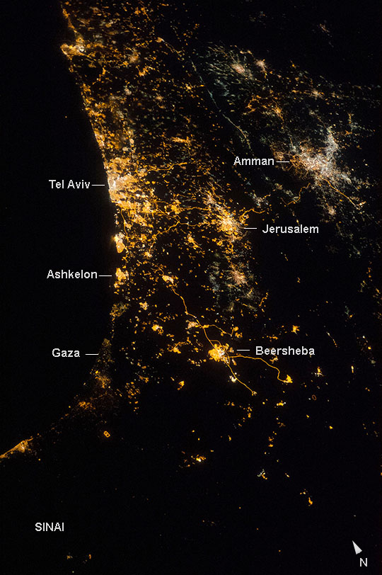
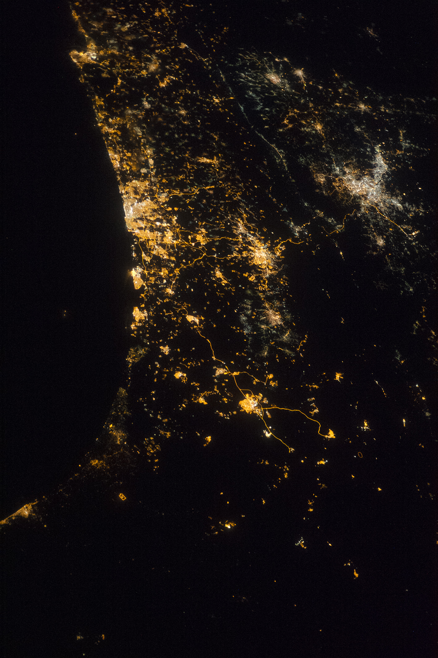
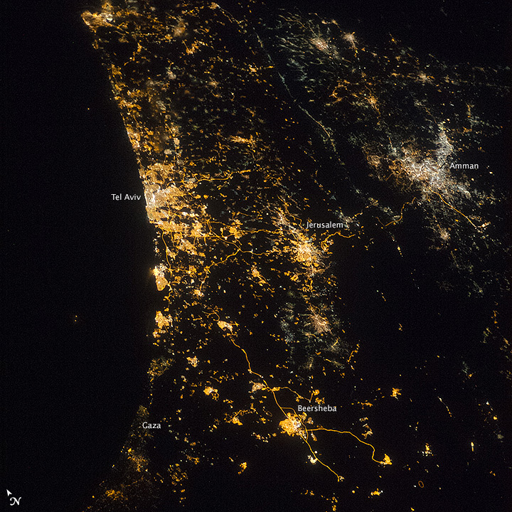
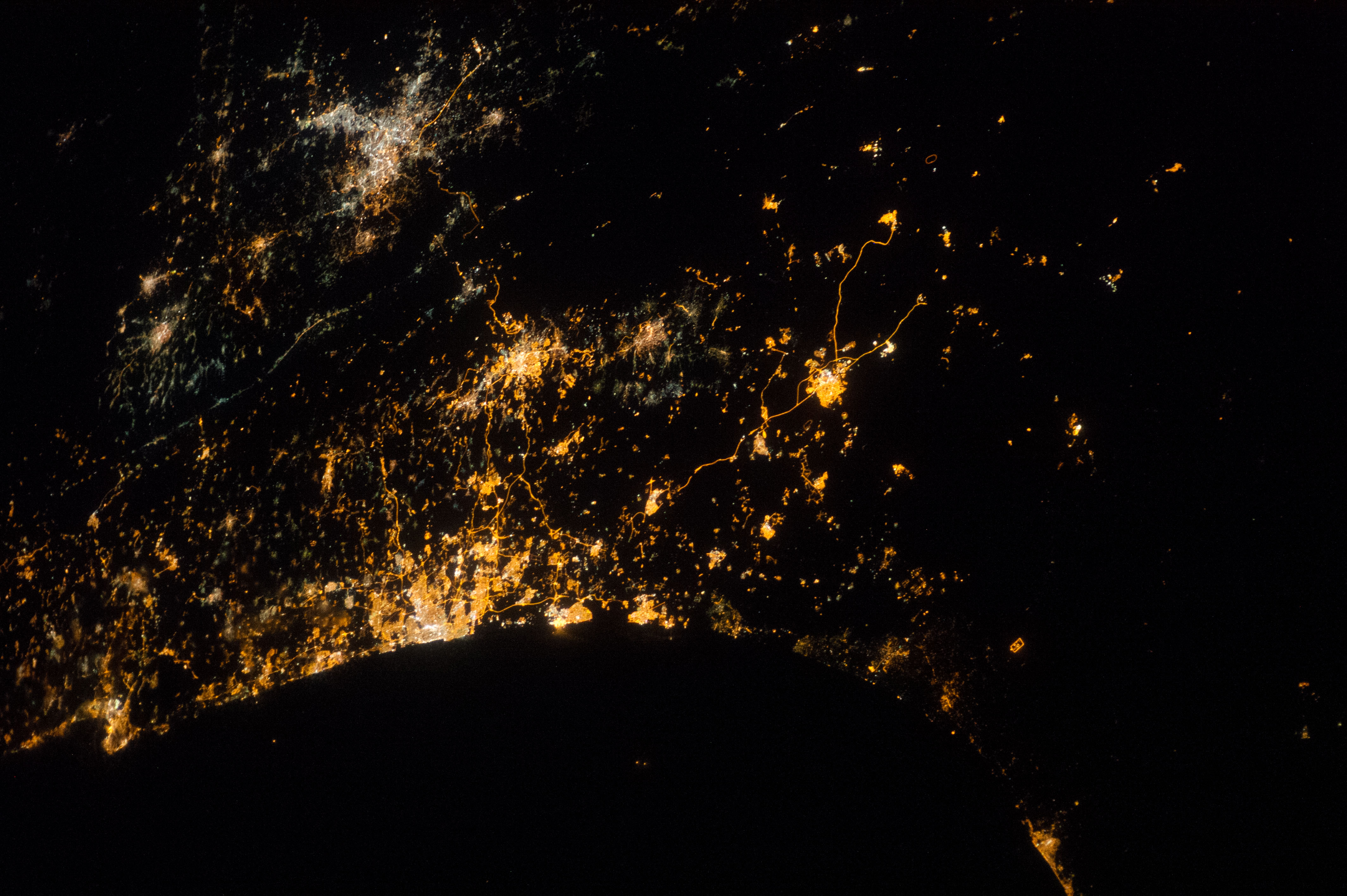
Image Caption: Eastern Mediterranean coastline at night
This night image recently shot by astronauts aboard the International Space Station (ISS) vividly shows the location and size of cities at the east end of the Mediterranean Sea. The largest, brightest cluster is the Israeli city of Tel Aviv (lower center left), a port set against the blackness of the Mediterranean Sea. Jerusalem, Israel's capital city (upper center left), and Amman, Jordan's capital (top left), are the next largest (with Amman's lights a whiter tone), followed by Beersheba. Highway lights mark narrow lines that snake between these cities.
The mainly dark areas with small towns are agricultural and pastoral areas of Israel, Sinai, Gaza, the West Bank and Jordan. The long valley of the Jordan River and the Dead Sea is suggested by the wide almost black zone between Jerusalem and Amman that trends left to right across the entire image.
