ISS040-E-16513
| NASA Photo ID | ISS040-E-16513 |
| Focal Length | 42mm |
| Date taken | 2014.06.21 |
| Time taken | 08:02:32 GMT |
Resolutions offered for this image:
1000 x 747 pixels 540 x 403 pixels 1440 x 960 pixels 720 x 480 pixels 4256 x 2832 pixels 640 x 426 pixels
1000 x 747 pixels 540 x 403 pixels 1440 x 960 pixels 720 x 480 pixels 4256 x 2832 pixels 640 x 426 pixels
Spacecraft nadir point: 30.2° S, 21.7° E
Photo center point: 27.0° S, 16.0° E
Photo center point by machine learning:
Photo center point: 27.0° S, 16.0° E
Photo center point by machine learning:
Nadir to Photo Center: Northwest
Spacecraft Altitude: 227 nautical miles (420km)
Country or Geographic Name: | NAMIBIA |
Features: | PAN-DUST PLUMES, SAND SEA, COASTLINE |
| Features Found Using Machine Learning: | PAN- |
Cloud Cover Percentage: | 10 (1-10)% |
Sun Elevation Angle: | 25° |
Sun Azimuth: | 39° |
Camera: | Nikon D3S Electronic Still Camera |
Focal Length: | 42mm |
Camera Tilt: | High Oblique |
Format: | 4256E: 4256 x 2832 pixel CMOS sensor, 36.0mm x 23.9mm, total pixels: 12.87 million, Nikon FX format |
Film Exposure: | |
| Additional Information | |
| Width | Height | Annotated | Cropped | Purpose | Links |
|---|---|---|---|---|---|
| 1000 pixels | 747 pixels | No | Yes | Earth From Space collection | Download Image |
| 540 pixels | 403 pixels | Yes | Yes | Earth From Space collection | Download Image |
| 1440 pixels | 960 pixels | No | No | Download Image | |
| 720 pixels | 480 pixels | Yes | No | NASA's Earth Observatory web site | Download Image |
| 4256 pixels | 2832 pixels | No | No | Download Image | |
| 640 pixels | 426 pixels | No | No | Download Image |
Download Packaged File
Download a Google Earth KML for this Image
View photo footprint information
Download a GeoTIFF for this photo
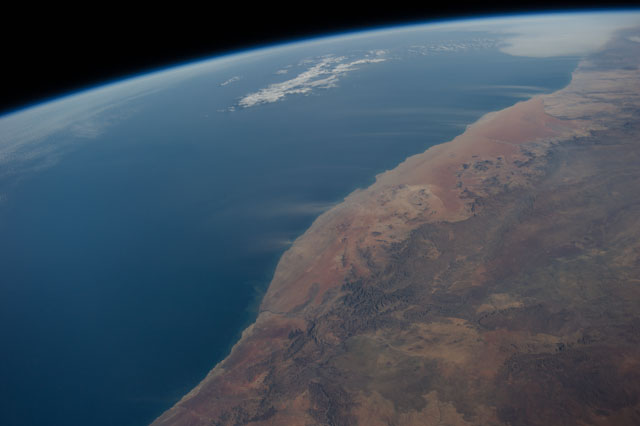
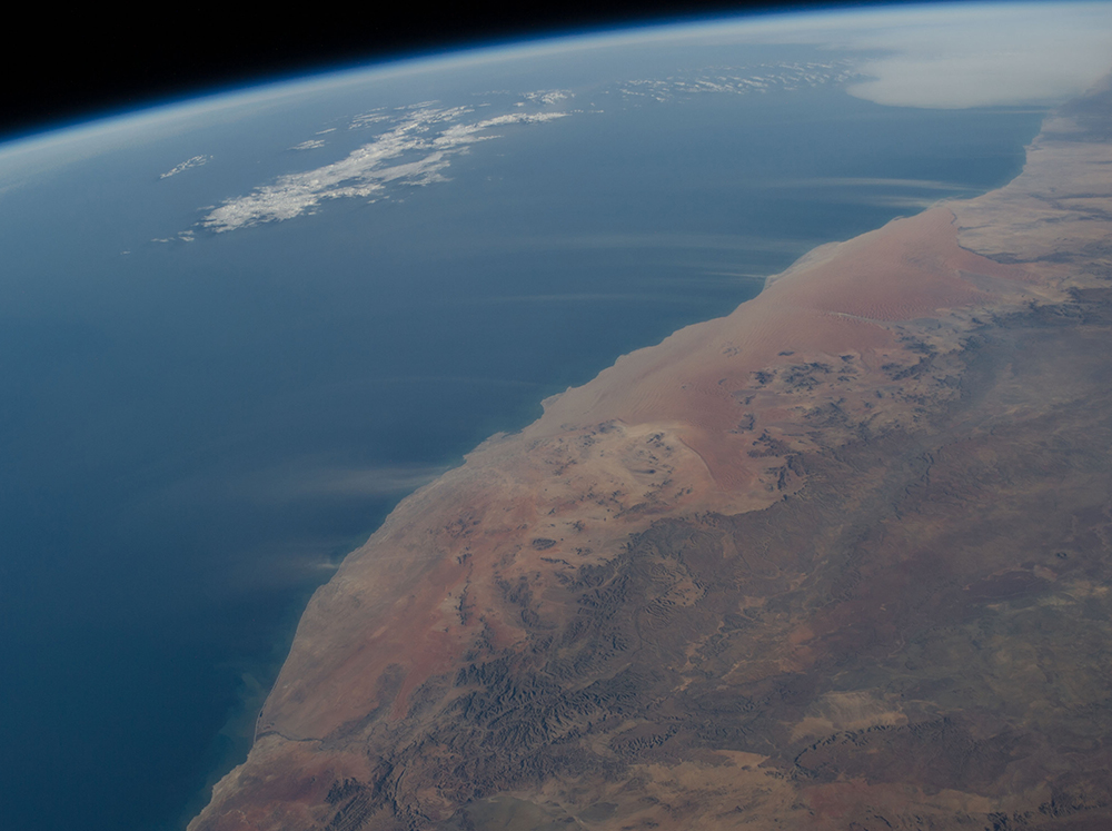
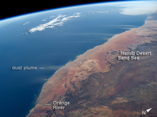
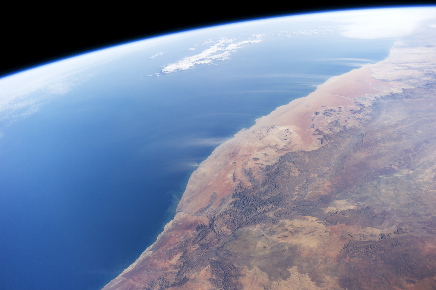
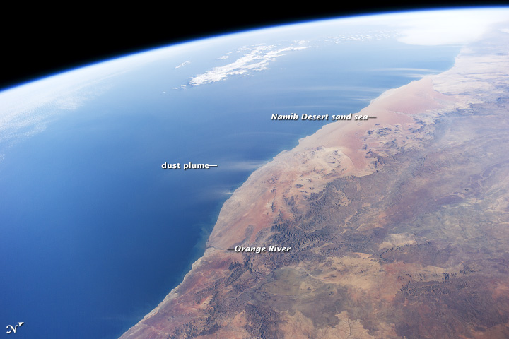
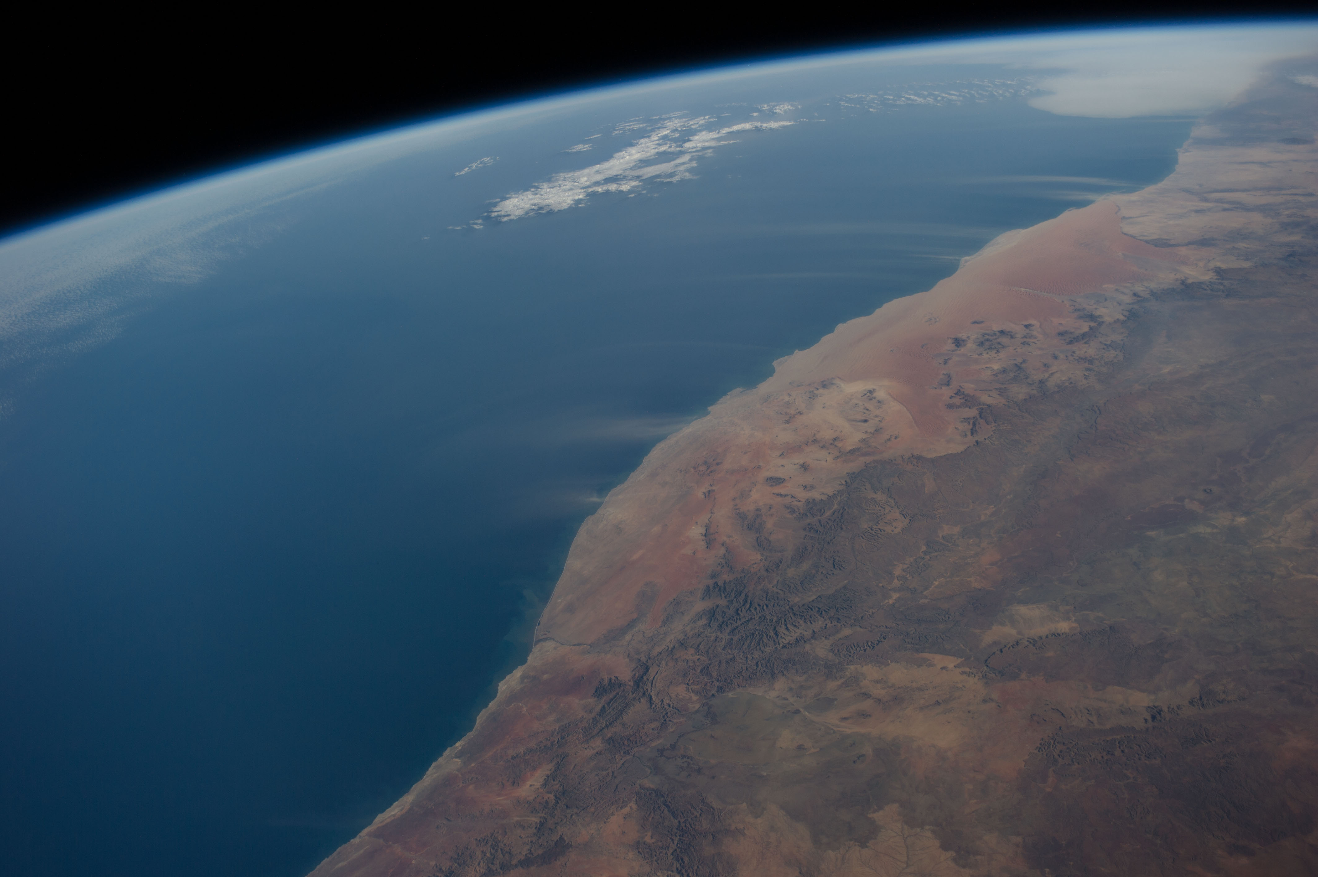
Image Caption: Dust plumes, Namib Desert coast--Namibia
Strong, hot winds known as "berg winds" (mountain winds) are lofting plumes of dust directly out into the Atlantic Ocean in this panoramic image taken from the International Space Station. The southern African equivalent of Santa Ana winds in California, berg winds blow on a few occasions in fall and winter, off all coasts of southern Africa. Other images from ISS have captured these dust plumes.
Namibia's great Sand Sea appears here as a reddish zone along part of the coast (image center). The Sand Sea is more than 350 km long, giving a sense of the length of the visible dust plumes. A light-toned sediment plume enters the sea at the mouth of the Orange River (image lower left), southern Africa's largest river.
